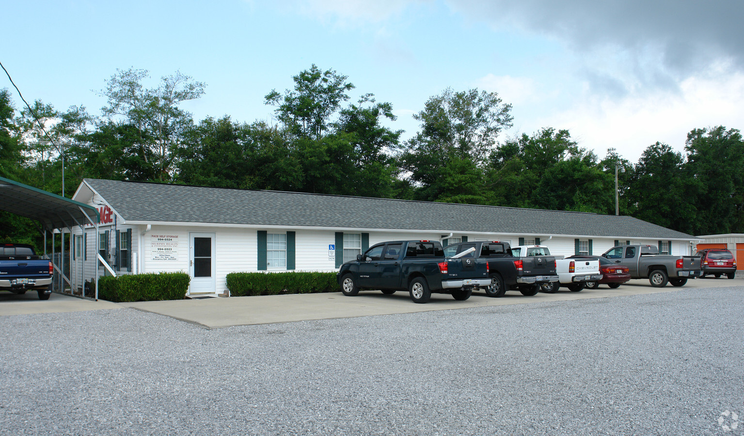
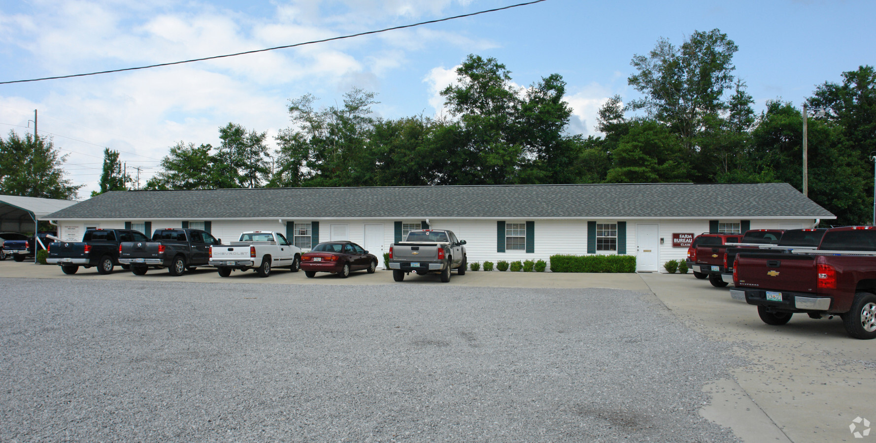
Property Record
4964 Highway 90, Milton, FL 32571
NEARBY LISTINGS FOR SALE OR LEASE
Property Detail
4964 Highway 90
11-1N-29-0000-02604-0000
COM AT SE CORNER OF SECTION 11 TOWNSHP 1 NORTH RANGE 29 WEST THN N0*2047W ON E SEC LN 350 FT THN S89*4729W 25 FT TO W R/W OF PVD CO RD FOR POB THN CONTINUE W 631.65 FT THN N0*03 33W 394.30 FT THN N89*3836 E 276.45 FT THN S2*1038W 246 .14 FT THN S83*4
Publicstorage
Santa Rosa
X
Florida
12113C0426H
3.52 AC
2023
Avalon Beach/Milton
2024
Pensacola
010704
Pensacola-Ferry Pass-Brent, FL
48,285 SF
DEMOGRAPHICS near 4964 Highway 90
1 Mile
3 Mile
5 Mile
2024 Total Population
3,977
29,168
65,942
2029 Population
4,513
33,391
75,563
Pop Growth 2024-2029
+ 13.48%
+ 14.48%
+ 14.59%
Average Age
38
39
40
2024 Total Households
1,465
10,916
24,719
HH Growth 2024-2029
+ 13.79%
+ 14.79%
+ 14.90%
Median Household Inc
$69,405
$75,885
$77,389
Avg Household Size
2.70
2.60
2.60
2024 Avg HH Vehicles
2.00
2.00
2.00
Median Home Value
$232,758
$222,168
$243,726
Median Year Built
1994
1994
1995
Nearby Places
- Restaurants
- Banks
- Shops
- Fitness
- Groceries
PUBLIC TRANSPORTATION
AIRPORT
Pensacola International
DRIVE
WALK
Distance
Pensacola International
27 min
15.2 mi
Freight Ports
Port of Mobile
DRIVE
WALK
Distance
Port of Mobile
78 min
64.1 mi
Nearby Properties
Address
Land Use
TOTAL SIZE
Lot Size
Zoning
Address
Land Use
TOTAL SIZE
Lot Size
Zoning
118,887 SF
19.24 AC
HCD
Address
Land Use
TOTAL SIZE
Lot Size
Zoning
130,379 SF
18.18 AC
HCD
Address
Land Use
TOTAL SIZE
Lot Size
Zoning
79,708 SF
9.62 AC
HCD
Address
Land Use
TOTAL SIZE
Lot Size
Zoning
232,988 SF
24.57 AC
HCD
Address
Land Use
TOTAL SIZE
Lot Size
Zoning
154,042 SF
10.36 AC
HCD
Address
Land Use
TOTAL SIZE
Lot Size
Zoning
47.05 AC
AG-RR
Address
Land Use
TOTAL SIZE
Lot Size
Zoning
151,084 SF
19 AC
HCD
Address
Land Use
TOTAL SIZE
Lot Size
Zoning
130,603 SF
14.30 AC
R2
Address
Land Use
TOTAL SIZE
Lot Size
Zoning
113,652 SF
9.52 AC
C2
Address
Land Use
TOTAL SIZE
Lot Size
Zoning
199,775 SF
8.83 AC
HCD
Address
Land Use
TOTAL SIZE
Lot Size
Zoning
76.81 AC
R1
Address
Land Use
TOTAL SIZE
Lot Size
Zoning
113,899 SF
3.05 AC
HCD
Address
Land Use
TOTAL SIZE
Lot Size
Zoning
81,123 SF
8.78 AC
HCD
Address
Land Use
TOTAL SIZE
Lot Size
Zoning
615,804 SF
32.41 AC
M2
Address
Land Use
TOTAL SIZE
Lot Size
Zoning
98,250 SF
49.63 AC
HCD
Address
Land Use
TOTAL SIZE
Lot Size
Zoning
20.76 AC
AG-RR
Address
Land Use
TOTAL SIZE
Lot Size
Zoning
13.70 AC
HCD
Address
Land Use
TOTAL SIZE
Lot Size
Zoning
81,150 SF
4.86 AC
HCD
Address
Land Use
TOTAL SIZE
Lot Size
Zoning
43,613 SF
3.44 AC
HCD
Address
Land Use
TOTAL SIZE
Lot Size
Zoning
76,674 SF
2.80 AC
HCD
Address
Land Use
TOTAL SIZE
Lot Size
Zoning
115,095 SF
7.44 AC
HCD
Address
Land Use
TOTAL SIZE
Lot Size
Zoning
48,210 SF
8.98 AC
C2
Address
Land Use
TOTAL SIZE
Lot Size
Zoning
9.61 AC
R1
Address
Land Use
TOTAL SIZE
Lot Size
Zoning
50,616 SF
2.56 AC
R3
Address
Land Use
TOTAL SIZE
Lot Size
Zoning
112,196 SF
343.01 AC
HCD
Address
Land Use
TOTAL SIZE
Lot Size
Zoning
30,564 SF
11.12 AC
HCD
Address
Land Use
TOTAL SIZE
Lot Size
Zoning
51,760 SF
5.50 AC
HCD
Address
Land Use
TOTAL SIZE
Lot Size
Zoning
37,820 SF
16.98 AC
HCD
Address
Land Use
TOTAL SIZE
Lot Size
Zoning
23,668 SF
2.30 AC
HCD
Address
Land Use
TOTAL SIZE
Lot Size
Zoning
41,105 SF
8.16 AC
HCD
The World's #1 Commercial Real Estate Marketplace
Connect with us
© 2025 CoStar Group
The information above has been obtained from sources believed reliable. While we do not doubt its accuracy we have not verified it and make no guarantee, warranty or representation about it. It is your responsibility to independently confirm its accuracy and completeness. Any projections, opinions, assumptions, or estimates used are for example only and do not represent the current or future performance of the property. The value of this transaction to you depends on tax and other factors which should be evaluated by your tax, financial, and legal advisors. You and your advisors should conduct a careful, independent investigation of the property to determine to your satisfaction the suitability of the property for your needs.