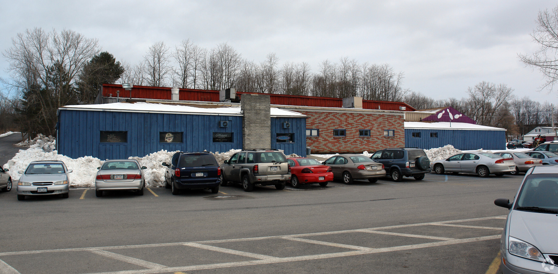
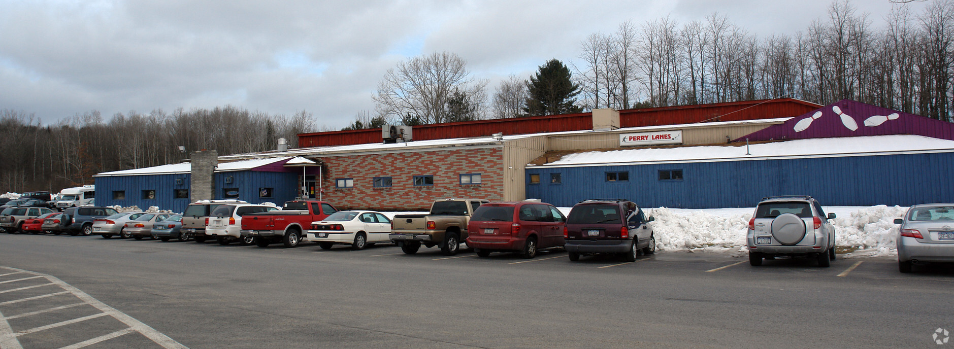
Property Record
497 N Perry St, Johnstown, NY 12095
NEARBY LISTINGS FOR SALE OR LEASE
Property Detail
497 N Perry St
Gloversville, NY
Fulton
170800-162-008-0001-003-000-0000
New York
Bowlingalley
3.000
2024
2.20 AC
2023
Fulton County
971300
Albany/Schenectady/Troy
26,282 SF
DEMOGRAPHICS near 497 N Perry St
1 Mile
3 Mile
5 Mile
2024 Total Population
2,072
22,883
29,255
2029 Population
2,032
22,182
28,456
Pop Growth 2024-2029
(1.93%)
(3.06%)
(2.73%)
Average Age
41
41
42
2024 Total Households
853
9,772
12,289
HH Growth 2024-2029
(2.11%)
(3.10%)
(2.73%)
Median Household Inc
$68,749
$50,488
$52,746
Avg Household Size
2.30
2.20
2.20
2024 Avg HH Vehicles
2.00
2.00
2.00
Median Home Value
$114,286
$104,933
$118,527
Median Year Built
1947
1947
1948
Nearby Places
- Restaurants
- Banks
- Shops
- Fitness
- Groceries
Nearby Properties
Address
Land Use
TOTAL SIZE
Lot Size
Zoning
Address
Land Use
TOTAL SIZE
Lot Size
Zoning
9,040 SF
89.60 AC
RB
Address
Land Use
TOTAL SIZE
Lot Size
Zoning
155,394 SF
83.80 AC
R2
Address
Land Use
TOTAL SIZE
Lot Size
Zoning
67,849 SF
18.80 AC
06 - INDUS
Address
Land Use
TOTAL SIZE
Lot Size
Zoning
124,685 SF
49.10 AC
06 - INDUS
Address
Land Use
TOTAL SIZE
Lot Size
Zoning
65,000 SF
14.35 AC
01 - NOT Z
Address
Land Use
TOTAL SIZE
Lot Size
Zoning
Address
Land Use
TOTAL SIZE
Lot Size
Zoning
151,246 SF
31.20 AC
M
Address
Land Use
TOTAL SIZE
Lot Size
Zoning
198,064 SF
40.70 AC
08 - GOVER
Address
Land Use
TOTAL SIZE
Lot Size
Zoning
166,664 SF
15.20 AC
06 - INDUS
Address
Land Use
TOTAL SIZE
Lot Size
Zoning
207,850 SF
30.50 AC
Address
Land Use
TOTAL SIZE
Lot Size
Zoning
68,106 SF
15.80 AC
08 - GOVER
Address
Land Use
TOTAL SIZE
Lot Size
Zoning
72,560 SF
2.10 AC
C
Address
Land Use
TOTAL SIZE
Lot Size
Zoning
67,650 SF
1.55 AC
C
Address
Land Use
TOTAL SIZE
Lot Size
Zoning
20,030 SF
3.60 AC
C
Address
Land Use
TOTAL SIZE
Lot Size
Zoning
11,456 SF
7.80 AC
RB
Address
Land Use
TOTAL SIZE
Lot Size
Zoning
163,700 SF
8.70 AC
Address
Land Use
TOTAL SIZE
Lot Size
Zoning
51,200 SF
4.60 AC
06 - INDUS
Address
Land Use
TOTAL SIZE
Lot Size
Zoning
36,000 SF
7.10 AC
05 - COMME
Address
Land Use
TOTAL SIZE
Lot Size
Zoning
120,454 SF
14.30 AC
06 - INDUS
Address
Land Use
TOTAL SIZE
Lot Size
Zoning
36,755 SF
1.70 AC
RC
Address
Land Use
TOTAL SIZE
Lot Size
Zoning
Address
Land Use
TOTAL SIZE
Lot Size
Zoning
2.30 AC
M1
Address
Land Use
TOTAL SIZE
Lot Size
Zoning
9,074 SF
30.80 AC
C
Address
Land Use
TOTAL SIZE
Lot Size
Zoning
45,988 SF
1.80 AC
08 - GOVER
Address
Land Use
TOTAL SIZE
Lot Size
Zoning
Address
Land Use
TOTAL SIZE
Lot Size
Zoning
54,164 SF
25 AC
R1
Address
Land Use
TOTAL SIZE
Lot Size
Zoning
Address
Land Use
TOTAL SIZE
Lot Size
Zoning
6,465 SF
8.80 AC
RB
Address
Land Use
TOTAL SIZE
Lot Size
Zoning
43,891 SF
5.63 AC
C
Address
Land Use
TOTAL SIZE
Lot Size
Zoning
29,848 SF
3.30 AC
R1
The World's #1 Commercial Real Estate Marketplace
Connect with us
© 2025 CoStar Group
The information above has been obtained from sources believed reliable. While we do not doubt its accuracy we have not verified it and make no guarantee, warranty or representation about it. It is your responsibility to independently confirm its accuracy and completeness. Any projections, opinions, assumptions, or estimates used are for example only and do not represent the current or future performance of the property. The value of this transaction to you depends on tax and other factors which should be evaluated by your tax, financial, and legal advisors. You and your advisors should conduct a careful, independent investigation of the property to determine to your satisfaction the suitability of the property for your needs.