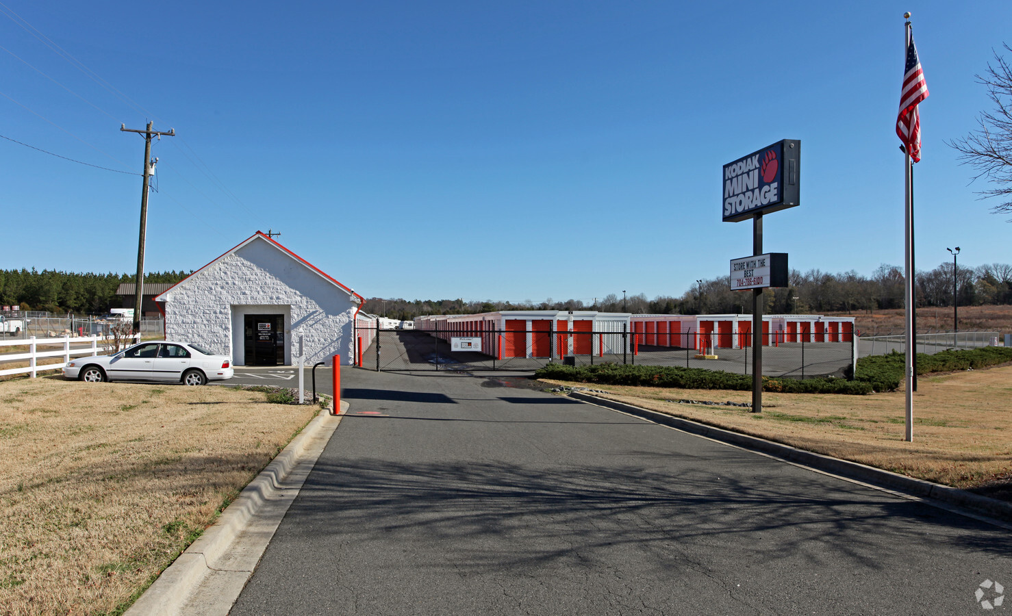
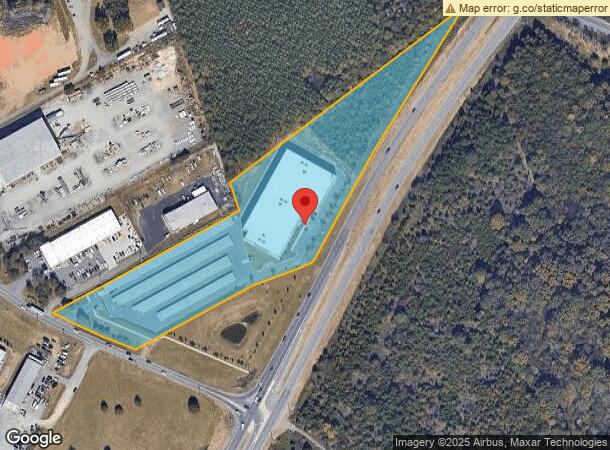
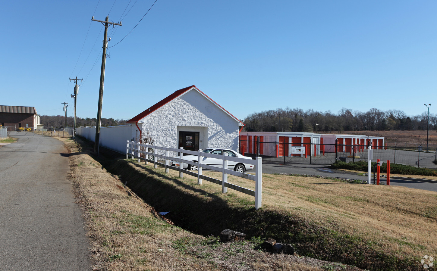
Property Record
4971 Stough Rd Sw, Concord, NC 28027
NEARBY LISTINGS FOR SALE OR LEASE
-
-
View all Concord listings for sale on LoopNet.com
Property Detail
4971 Stough Rd Sw
5528-05-3645-0000
Stough Rd
Publicstorage
NORTH SIDE HWY 49
X
Cabarrus
3710552800K
North Carolina
2024
7.23 AC
2024
Cabarrus County
042000
Charlotte
12,150 SF
Charlotte-Concord-Gastonia, NC-SC
DEMOGRAPHICS near 4971 Stough Rd Sw
1 Mile
3 Mile
5 Mile
2024 Total Population
1,494
38,497
98,001
2029 Population
1,684
43,255
110,247
Pop Growth 2024-2029
+ 12.72%
+ 12.36%
+ 12.50%
Average Age
36
37
38
2024 Total Households
481
13,267
34,374
HH Growth 2024-2029
+ 11.23%
+ 10.93%
+ 11.11%
Median Household Inc
$111,730
$90,179
$85,229
Avg Household Size
3.10
2.80
2.80
2024 Avg HH Vehicles
2.00
2.00
2.00
Median Home Value
$322,727
$273,752
$279,587
Median Year Built
2008
2000
1997
Nearby Places
- Restaurants
- Banks
- Shops
- Fitness
- Groceries
PUBLIC TRANSPORTATION
AIRPORT
Concord-Padgett Regional
DRIVE
WALK
Distance
Concord-Padgett Regional
19 min
11.4 mi
Charlotte/Douglas International
DRIVE
WALK
Distance
Charlotte/Douglas International
39 min
25.4 mi
Freight Ports
Port of Wilmington
DRIVE
WALK
Distance
Port of Wilmington
252 min
196.2 mi
Nearby Properties
Address
Land Use
TOTAL SIZE
Lot Size
Zoning
Address
Land Use
TOTAL SIZE
Lot Size
Zoning
495.38 AC
I-2
Address
Land Use
TOTAL SIZE
Lot Size
Zoning
196,893 SF
43.82 AC
MDR
Address
Land Use
TOTAL SIZE
Lot Size
Zoning
163,494 SF
89.85 AC
I-2
Address
Land Use
TOTAL SIZE
Lot Size
Zoning
21,714 SF
15.02 AC
RC
Address
Land Use
TOTAL SIZE
Lot Size
Zoning
35,268 SF
54 AC
PUD
Address
Land Use
TOTAL SIZE
Lot Size
Zoning
152,554 SF
29.94 AC
O-I
Address
Land Use
TOTAL SIZE
Lot Size
Zoning
160,412 SF
39.97 AC
O-I
Address
Land Use
TOTAL SIZE
Lot Size
Zoning
360,400 SF
20.32 AC
EC
Address
Land Use
TOTAL SIZE
Lot Size
Zoning
116,471 SF
24.39 AC
PUD
Address
Land Use
TOTAL SIZE
Lot Size
Zoning
125,245 SF
21.47 AC
O-I
Address
Land Use
TOTAL SIZE
Lot Size
Zoning
304,000 SF
17.30 AC
EC
Address
Land Use
TOTAL SIZE
Lot Size
Zoning
160,357 SF
26.85 AC
O-I
Address
Land Use
TOTAL SIZE
Lot Size
Zoning
8,640 SF
15.51 AC
RC
Address
Land Use
TOTAL SIZE
Lot Size
Zoning
19,350 SF
173.55 AC
LI
Address
Land Use
TOTAL SIZE
Lot Size
Zoning
48,888 SF
15.29 AC
GC
Address
Land Use
TOTAL SIZE
Lot Size
Zoning
213,698 SF
17.97 AC
C-2
Address
Land Use
TOTAL SIZE
Lot Size
Zoning
7,584 SF
12.63 AC
RC
Address
Land Use
TOTAL SIZE
Lot Size
Zoning
126,214 SF
93.87 AC
O-I
Address
Land Use
TOTAL SIZE
Lot Size
Zoning
12,486 SF
232.04 AC
O-I
Address
Land Use
TOTAL SIZE
Lot Size
Zoning
8,656 SF
10.01 AC
RC
Address
Land Use
TOTAL SIZE
Lot Size
Zoning
60.37 AC
I-2
Address
Land Use
TOTAL SIZE
Lot Size
Zoning
220,121 SF
10.99 AC
I-2
Address
Land Use
TOTAL SIZE
Lot Size
Zoning
21,152 SF
6.03 AC
MDR
Address
Land Use
TOTAL SIZE
Lot Size
Zoning
38,274 SF
15.29 AC
PUD
Address
Land Use
TOTAL SIZE
Lot Size
Zoning
54,503 SF
9.32 AC
EC
Address
Land Use
TOTAL SIZE
Lot Size
Zoning
29,725 SF
100.58 AC
I-1
Address
Land Use
TOTAL SIZE
Lot Size
Zoning
86,460 SF
13.73 AC
I-2
Address
Land Use
TOTAL SIZE
Lot Size
Zoning
71,918 SF
51.27 AC
O-I
Address
Land Use
TOTAL SIZE
Lot Size
Zoning
53,244 SF
9.27 AC
C-2
The World's #1 Commercial Real Estate Marketplace
Connect with us
© 2025 CoStar Group
The information above has been obtained from sources believed reliable. While we do not doubt its accuracy we have not verified it and make no guarantee, warranty or representation about it. It is your responsibility to independently confirm its accuracy and completeness. Any projections, opinions, assumptions, or estimates used are for example only and do not represent the current or future performance of the property. The value of this transaction to you depends on tax and other factors which should be evaluated by your tax, financial, and legal advisors. You and your advisors should conduct a careful, independent investigation of the property to determine to your satisfaction the suitability of the property for your needs.