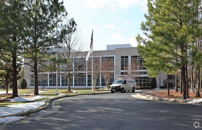
Property Record
5 Laboratory Dr, Durham, NC 27709

Current Lease Availabilities
NEARBY LISTINGS FOR SALE OR LEASE
Property Detail
5 Laboratory Dr
157823
PROP-ARE-NC REGION NO 17 LLC DBA/ARE PL:000202-000321
Manufacturinglight
Durham
AE
North Carolina
3720074800K
1
2025
25.95 AC
2025
Research Triangle
980100
Raleigh/Durham
353,339 SF
Durham-Chapel Hill, NC
DEMOGRAPHICS near 5 Laboratory Dr
1 Mile
3 Mile
5 Mile
2024 Total Population
623
35,862
130,570
2029 Population
647
38,481
138,946
Pop Growth 2024-2029
+ 3.85%
+ 7.30%
+ 6.41%
Average Age
35
37
37
2024 Total Households
318
16,979
56,920
HH Growth 2024-2029
+ 4.09%
+ 7.44%
+ 6.50%
Median Household Inc
$81,423
$85,179
$90,786
Avg Household Size
2.00
2.10
2.30
2024 Avg HH Vehicles
2.00
2.00
2.00
Median Home Value
$416,667
$340,696
$344,679
Median Year Built
2011
2010
2006
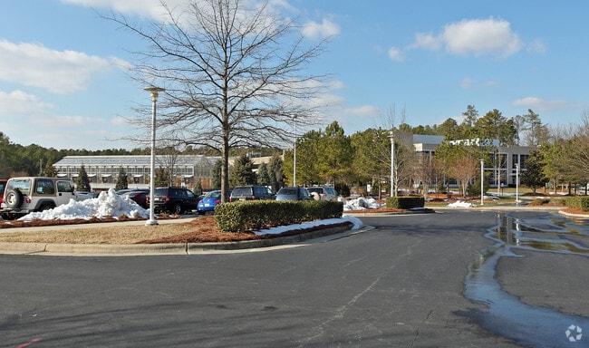
Nearby Places
Map Layers
Map Styles
 Street
 Aerial
- Restaurants
- Banks
- Shops
- Fitness
- Groceries
PUBLIC TRANSPORTATION
AIRPORT
Raleigh-Durham International
DRIVE
WALK
Distance
Raleigh-Durham International
9 min
6.1 mi
Freight Ports
Port of Wilmington
DRIVE
WALK
Distance
Port of Wilmington
1 min
128.6 mi
Nearby Properties
Address
Land Use
TOTAL SIZE
Lot Size
Zoning
Address
Land Use
TOTAL SIZE
Lot Size
Zoning
2,436,024 SF
SRP
Address
Land Use
TOTAL SIZE
Lot Size
Zoning
875,384 SF
111.74 AC
SRP
Address
Land Use
TOTAL SIZE
Lot Size
Zoning
896,802 SF
86.14 AC
RA
Address
Land Use
TOTAL SIZE
Lot Size
Zoning
1,080,486 SF
61.68 AC
SRP
Address
Land Use
TOTAL SIZE
Lot Size
Zoning
677,504 SF
60.32 AC
SRP
Address
Land Use
TOTAL SIZE
Lot Size
Zoning
29.13 AC
CG(D)
Address
Land Use
TOTAL SIZE
Lot Size
Zoning
1,272,163 SF
117.61 AC
OI,SRP
Address
Land Use
TOTAL SIZE
Lot Size
Zoning
1,378,965 SF
183.46 AC
SRP
Address
Land Use
TOTAL SIZE
Lot Size
Zoning
868,283 SF
56.23 AC
SRP
Address
Land Use
TOTAL SIZE
Lot Size
Zoning
491,701 SF
124.48 AC
SRP
Address
Land Use
TOTAL SIZE
Lot Size
Zoning
507,119 SF
118.85 AC
SRP
Address
Land Use
TOTAL SIZE
Lot Size
Zoning
799,818 SF
84.58 AC
IL
Address
Land Use
TOTAL SIZE
Lot Size
Zoning
168,660 SF
15.49 AC
CG(D)
Address
Land Use
TOTAL SIZE
Lot Size
Zoning
444,254 SF
58.71 AC
SRP
Address
Land Use
TOTAL SIZE
Lot Size
Zoning
8,418 SF
22.17 AC
MU(D)
Address
Land Use
TOTAL SIZE
Lot Size
Zoning
122,544 SF
8.04 AC
MU(D)
Address
Land Use
TOTAL SIZE
Lot Size
Zoning
11,670 SF
41.27 AC
RS-M(D)
Address
Land Use
TOTAL SIZE
Lot Size
Zoning
15,252 SF
29.36 AC
RS-M
Address
Land Use
TOTAL SIZE
Lot Size
Zoning
35.03 AC
RS-M(D)
Address
Land Use
TOTAL SIZE
Lot Size
Zoning
449,992 SF
25.16 AC
IP
Address
Land Use
TOTAL SIZE
Lot Size
Zoning
2,922 SF
30.57 AC
PDR 4.840
Address
Land Use
TOTAL SIZE
Lot Size
Zoning
47,376 SF
11.86 AC
OI(D)
Address
Land Use
TOTAL SIZE
Lot Size
Zoning
319,275 SF
50.52 AC
SRP
Address
Land Use
TOTAL SIZE
Lot Size
Zoning
2.82 AC
SRP-C
Address
Land Use
TOTAL SIZE
Lot Size
Zoning
23,889 SF
50.95 AC
OI
Address
Land Use
TOTAL SIZE
Lot Size
Zoning
441,280 SF
48.43 AC
IL
Address
Land Use
TOTAL SIZE
Lot Size
Zoning
529,439 SF
29.84 AC
IL
Address
Land Use
TOTAL SIZE
Lot Size
Zoning
298,457 SF
35.55 AC
RAC
Address
Land Use
TOTAL SIZE
Lot Size
Zoning
300,042 SF
41.03 AC
SRP
The World's #1 Commercial Real Estate Marketplace
Connect with us
© 2026 CoStar Group
The information above has been obtained from sources believed reliable. While we do not doubt its accuracy we have not verified it and make no guarantee, warranty or representation about it. It is your responsibility to independently confirm its accuracy and completeness. Any projections, opinions, assumptions, or estimates used are for example only and do not represent the current or future performance of the property. The value of this transaction to you depends on tax and other factors which should be evaluated by your tax, financial, and legal advisors. You and your advisors should conduct a careful, independent investigation of the property to determine to your satisfaction the suitability of the property for your needs.