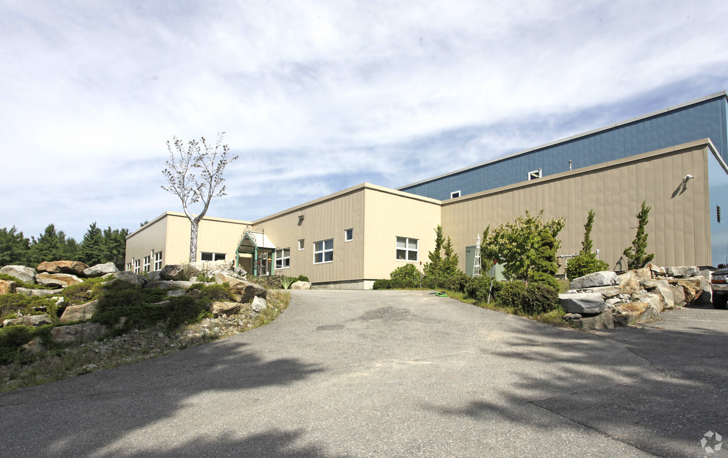
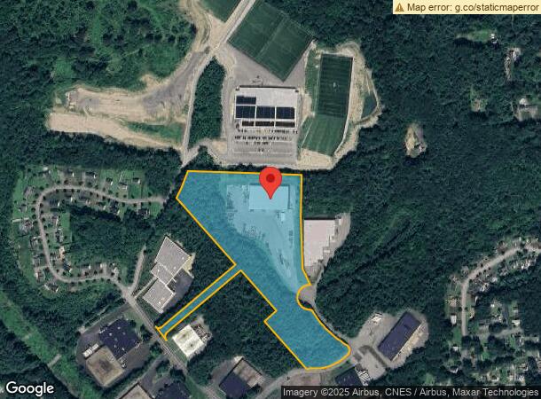
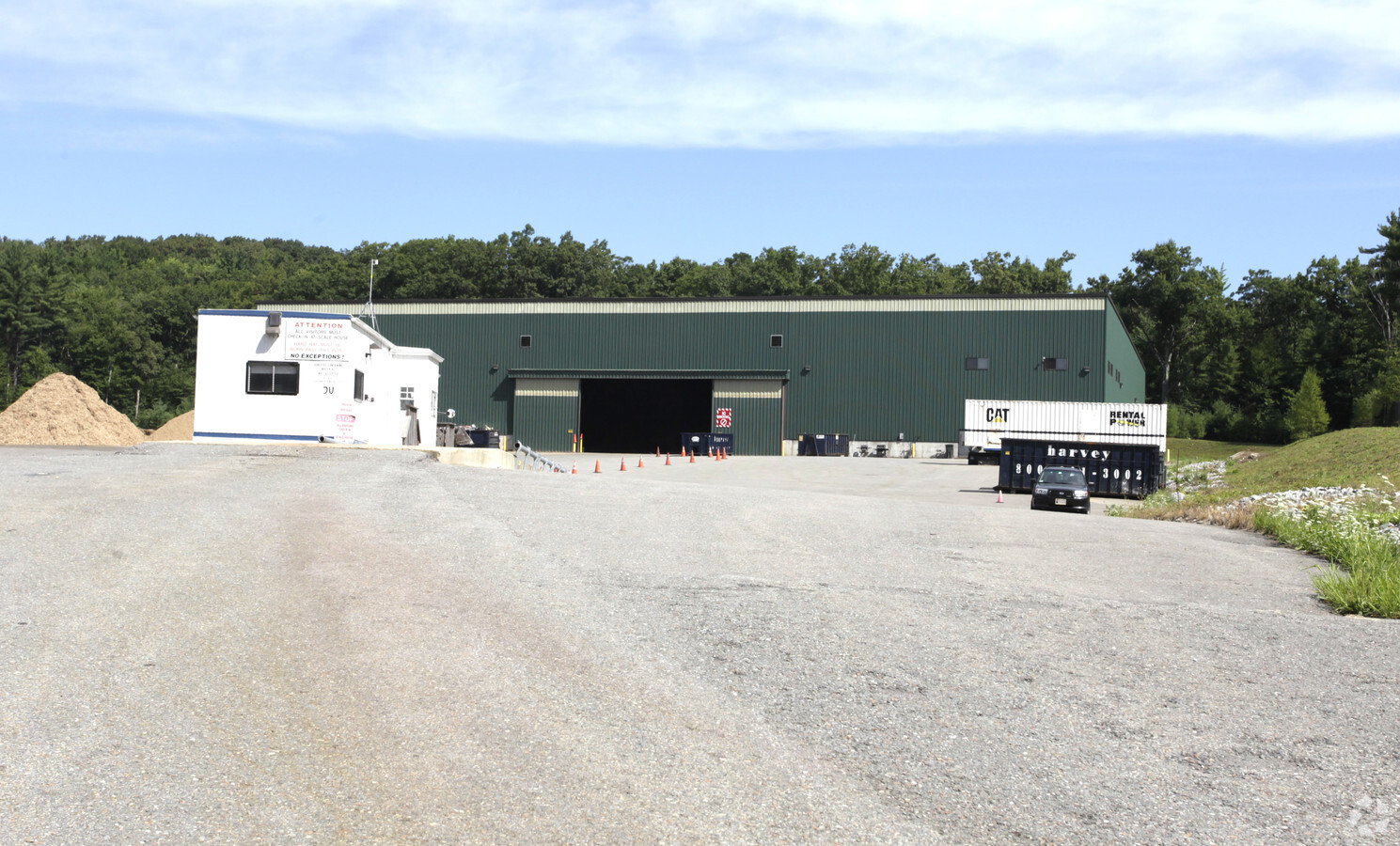
Property Record
50 Arbor Way, Fitchburg, MA 01420
NEARBY LISTINGS FOR SALE OR LEASE
Property Detail
50 Arbor Way
FITC-000110R-000010
Fitchburg Redev Authority
Warehouse
Worcester
ARE
Massachusetts
25027C0253E
14.98 AC
2025
Fitchburg/Leominster
2025
Boston
710300
Worcester, MA-CT
37,500 SF
DEMOGRAPHICS near 50 Arbor Way
1 Mile
3 Mile
5 Mile
2024 Total Population
2,589
23,789
60,338
2029 Population
2,587
23,697
60,206
Pop Growth 2024-2029
(0.08%)
(0.39%)
(0.22%)
Average Age
40
40
40
2024 Total Households
1,003
9,263
23,382
HH Growth 2024-2029
(0.20%)
(0.44%)
(0.21%)
Median Household Inc
$84,782
$78,489
$71,236
Avg Household Size
2.60
2.50
2.40
2024 Avg HH Vehicles
2.00
2.00
2.00
Median Home Value
$277,419
$285,293
$301,922
Median Year Built
1956
1957
1959
Nearby Places
- Restaurants
- Banks
- Shops
- Fitness
- Groceries
PUBLIC TRANSPORTATION
COMMUTER RAIL
Wachusett (Fitchburg Line - MBTA)
DRIVE
WALK
Distance
Wachusett (Fitchburg Line - MBTA)
7 min
2.3 mi
Fitchburg (Fitchburg/South Acton Line - Massachusetts Bay Transportation Authority Commuter Rail (Purple Line))
DRIVE
WALK
Distance
Fitchburg (Fitchburg/South Acton Line - Massachusetts Bay Transportation Authority Commuter Rail (Purple Line))
13 min
4.8 mi
AIRPORT
Worcester Regional
DRIVE
WALK
Distance
Worcester Regional
48 min
28.8 mi
Freight Ports
Port of Boston
DRIVE
WALK
Distance
Port of Boston
81 min
52.8 mi
Nearby Properties
Address
Land Use
TOTAL SIZE
Lot Size
Zoning
Address
Land Use
TOTAL SIZE
Lot Size
Zoning
39.19 AC
CR
Address
Land Use
TOTAL SIZE
Lot Size
Zoning
276,822 SF
26.98 AC
I
Address
Land Use
TOTAL SIZE
Lot Size
Zoning
114,360 SF
6.10 AC
RA
Address
Land Use
TOTAL SIZE
Lot Size
Zoning
281,196 SF
8.70 AC
AI
Address
Land Use
TOTAL SIZE
Lot Size
Zoning
76,396 SF
1.99 AC
DB
Address
Land Use
TOTAL SIZE
Lot Size
Zoning
99,800 SF
20 AC
RA
Address
Land Use
TOTAL SIZE
Lot Size
Zoning
127.30 AC
AI
Address
Land Use
TOTAL SIZE
Lot Size
Zoning
33,000 SF
0.33 AC
DB
Address
Land Use
TOTAL SIZE
Lot Size
Zoning
113,250 SF
34.55 AC
CR
Address
Land Use
TOTAL SIZE
Lot Size
Zoning
3.65 AC
RC
Address
Land Use
TOTAL SIZE
Lot Size
Zoning
178,154 SF
8.50 AC
AI
Address
Land Use
TOTAL SIZE
Lot Size
Zoning
22,803 SF
0.42 AC
DB
Address
Land Use
TOTAL SIZE
Lot Size
Zoning
10.17 AC
AI
Address
Land Use
TOTAL SIZE
Lot Size
Zoning
93,240 SF
0.41 AC
DB
Address
Land Use
TOTAL SIZE
Lot Size
Zoning
56,475 SF
4.26 AC
I
Address
Land Use
TOTAL SIZE
Lot Size
Zoning
87,828 SF
AI
Address
Land Use
TOTAL SIZE
Lot Size
Zoning
6.80 AC
RA
Address
Land Use
TOTAL SIZE
Lot Size
Zoning
72,336 SF
6.42 AC
I
Address
Land Use
TOTAL SIZE
Lot Size
Zoning
91,941 SF
10.55 AC
I
Address
Land Use
TOTAL SIZE
Lot Size
Zoning
630 SF
308.76 AC
RA
Address
Land Use
TOTAL SIZE
Lot Size
Zoning
4.01 AC
Address
Land Use
TOTAL SIZE
Lot Size
Zoning
21,800 SF
16.48 AC
AI
Address
Land Use
TOTAL SIZE
Lot Size
Zoning
99,400 SF
8.58 AC
I
Address
Land Use
TOTAL SIZE
Lot Size
Zoning
4.74 AC
I
Address
Land Use
TOTAL SIZE
Lot Size
Zoning
45.86 AC
Address
Land Use
TOTAL SIZE
Lot Size
Zoning
31,693 SF
4.08 AC
RA
Address
Land Use
TOTAL SIZE
Lot Size
Zoning
83,408 SF
6.18 AC
I
Address
Land Use
TOTAL SIZE
Lot Size
Zoning
57.58 AC
Address
Land Use
TOTAL SIZE
Lot Size
Zoning
32,880 SF
0.76 AC
DB
Address
Land Use
TOTAL SIZE
Lot Size
Zoning
21,758 SF
15.01 AC
The World's #1 Commercial Real Estate Marketplace
Connect with us
© 2025 CoStar Group
The information above has been obtained from sources believed reliable. While we do not doubt its accuracy we have not verified it and make no guarantee, warranty or representation about it. It is your responsibility to independently confirm its accuracy and completeness. Any projections, opinions, assumptions, or estimates used are for example only and do not represent the current or future performance of the property. The value of this transaction to you depends on tax and other factors which should be evaluated by your tax, financial, and legal advisors. You and your advisors should conduct a careful, independent investigation of the property to determine to your satisfaction the suitability of the property for your needs.