Property Record
50 E Wynnewood Ct, Narberth, PA 19072


NEARBY LISTINGS FOR SALE OR LEASE
Property Detail
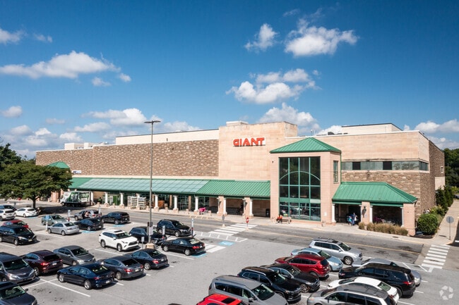
50 E Wynnewood Ct
40-00-68016-002
B 3C-U 111 & B 3D-U 222
Regionalshoppingcenterormallwithanchorstore
Montgomery
X
Pennsylvania
42091C0369G
16
2024
14 AC
2025
Bala Cynwyd/Narberth
205600
Philadelphia
321,744 SF
Philadelphia-Camden-Wilmington, PA-NJ-DE-MD
DEMOGRAPHICS near 50 E Wynnewood Ct
1 Mile
3 Mile
5 Mile
2024 Total Population
17,398
174,634
519,890
2029 Population
17,780
173,328
513,346
Pop Growth 2024-2029
+ 2.20%
(0.75%)
(1.26%)
Average Age
41
40
39
2024 Total Households
6,930
66,242
209,830
HH Growth 2024-2029
+ 2.27%
(0.84%)
(1.44%)
Median Household Inc
$152,107
$85,007
$63,747
Avg Household Size
2.40
2.50
2.30
2024 Avg HH Vehicles
2.00
1.00
1.00
Median Home Value
$701,133
$343,962
$272,082
Median Year Built
1949
1948
1949
Nearby Places
Map Layers
Map Styles
 Street
 Aerial
- Restaurants
- Banks
- Shops
- Fitness
- Groceries
PUBLIC TRANSPORTATION
TRANSIT/SUBWAY
Wynnewood (R5 - Southeastern Pennsylvania Transportation Authority Regional Rail (SEPTA Regional Rail))
DRIVE
WALK
Distance
Wynnewood (R5 - Southeastern Pennsylvania Transportation Authority Regional Rail (SEPTA Regional Rail))
1 min
3 min
0.2 mi
Narberth (R5 - Southeastern Pennsylvania Transportation Authority Regional Rail (SEPTA Regional Rail))
DRIVE
WALK
Distance
Narberth (R5 - Southeastern Pennsylvania Transportation Authority Regional Rail (SEPTA Regional Rail))
4 min
17 min
0.9 mi
COMMUTER RAIL
Wynnewood (R5 - Southeastern Pennsylvania Transportation Authority Regional Rail (SEPTA Regional Rail))
DRIVE
WALK
Distance
Wynnewood (R5 - Southeastern Pennsylvania Transportation Authority Regional Rail (SEPTA Regional Rail))
1 min
3 min
0.2 mi
Narberth (R5 - Southeastern Pennsylvania Transportation Authority Regional Rail (SEPTA Regional Rail))
DRIVE
WALK
Distance
Narberth (R5 - Southeastern Pennsylvania Transportation Authority Regional Rail (SEPTA Regional Rail))
3 min
16 min
0.8 mi
AIRPORT
Philadelphia International
DRIVE
WALK
Distance
Philadelphia International
30 min
11.9 mi
Trenton Mercer
DRIVE
WALK
Distance
Trenton Mercer
64 min
41.3 mi
Freight Ports
South Jersey Port
DRIVE
WALK
Distance
South Jersey Port
25 min
11.9 mi
SALE & LEASE HISTORY
LISTING DATE
SALE/LEASE

Mar 26, 2024
For Lease
Apr 24, 2025
For Lease
Nearby Properties
Address
Land Use
TOTAL SIZE
Lot Size
Zoning
Address
Land Use
TOTAL SIZE
Lot Size
Zoning
2,178,860 SF
48.65 AC
R3
Address
Land Use
TOTAL SIZE
Lot Size
Zoning
1,455,130 SF
6.80 AC
RSD3
Address
Land Use
TOTAL SIZE
Lot Size
Zoning
1,600 SF
177.07 AC
SPPOA
Address
Land Use
TOTAL SIZE
Lot Size
Zoning
1,174,127 SF
2 AC
C1
Address
Land Use
TOTAL SIZE
Lot Size
Zoning
1,037,806 SF
73.69 AC
R2
Address
Land Use
TOTAL SIZE
Lot Size
Zoning
511,806 SF
1.70 AC
RM4
Address
Land Use
TOTAL SIZE
Lot Size
Zoning
409,386 SF
33.36 AC
R2
Address
Land Use
TOTAL SIZE
Lot Size
Zoning
479,520 SF
21.26 AC
R1
Address
Land Use
TOTAL SIZE
Lot Size
Zoning
377,851 SF
19.18 AC
R4
Address
Land Use
TOTAL SIZE
Lot Size
Zoning
112,268 SF
28.27 AC
Address
Land Use
TOTAL SIZE
Lot Size
Zoning
281,508 SF
18.93 AC
SPINS
Address
Land Use
TOTAL SIZE
Lot Size
Zoning
299,678 SF
14.06 AC
R4
Address
Land Use
TOTAL SIZE
Lot Size
Zoning
530,525 SF
36.29 AC
R3
Address
Land Use
TOTAL SIZE
Lot Size
Zoning
258,000 SF
1.90 AC
CMX2
Address
Land Use
TOTAL SIZE
Lot Size
Zoning
394,649 SF
27.93 AC
C0
Address
Land Use
TOTAL SIZE
Lot Size
Zoning
197,925 SF
1.96 AC
RM4
Address
Land Use
TOTAL SIZE
Lot Size
Zoning
73,193 SF
37.01 AC
Address
Land Use
TOTAL SIZE
Lot Size
Zoning
475,984 SF
5.74 AC
ICMX
Address
Land Use
TOTAL SIZE
Lot Size
Zoning
82,153 SF
13.97 AC
Address
Land Use
TOTAL SIZE
Lot Size
Zoning
257,405 SF
4.26 AC
C2
Address
Land Use
TOTAL SIZE
Lot Size
Zoning
408,216 SF
16.62 AC
C0
Address
Land Use
TOTAL SIZE
Lot Size
Zoning
7.96 AC
Address
Land Use
TOTAL SIZE
Lot Size
Zoning
363,359 SF
5.11 AC
R6A
Address
Land Use
TOTAL SIZE
Lot Size
Zoning
144,500 SF
0.77 AC
CA2
Address
Land Use
TOTAL SIZE
Lot Size
Zoning
521,041 SF
28.14 AC
I2
Address
Land Use
TOTAL SIZE
Lot Size
Zoning
93,353 SF
1.03 AC
CMX2.5
Address
Land Use
TOTAL SIZE
Lot Size
Zoning
78,250 SF
34.50 AC
Address
Land Use
TOTAL SIZE
Lot Size
Zoning
252,350 SF
0.91 AC
SPINS
Address
Land Use
TOTAL SIZE
Lot Size
Zoning
452,148 SF
19.22 AC
C1
The World's #1 Commercial Real Estate Marketplace
Connect with us
© 2026 CoStar Group
The information above has been obtained from sources believed reliable. While we do not doubt its accuracy we have not verified it and make no guarantee, warranty or representation about it. It is your responsibility to independently confirm its accuracy and completeness. Any projections, opinions, assumptions, or estimates used are for example only and do not represent the current or future performance of the property. The value of this transaction to you depends on tax and other factors which should be evaluated by your tax, financial, and legal advisors. You and your advisors should conduct a careful, independent investigation of the property to determine to your satisfaction the suitability of the property for your needs.