Property Record
50 Foxtree Dr, Martinsville, VA 24112
NEARBY LISTINGS FOR SALE OR LEASE
-
-
View all Martinsville listings for sale on LoopNet.com
Property Detail
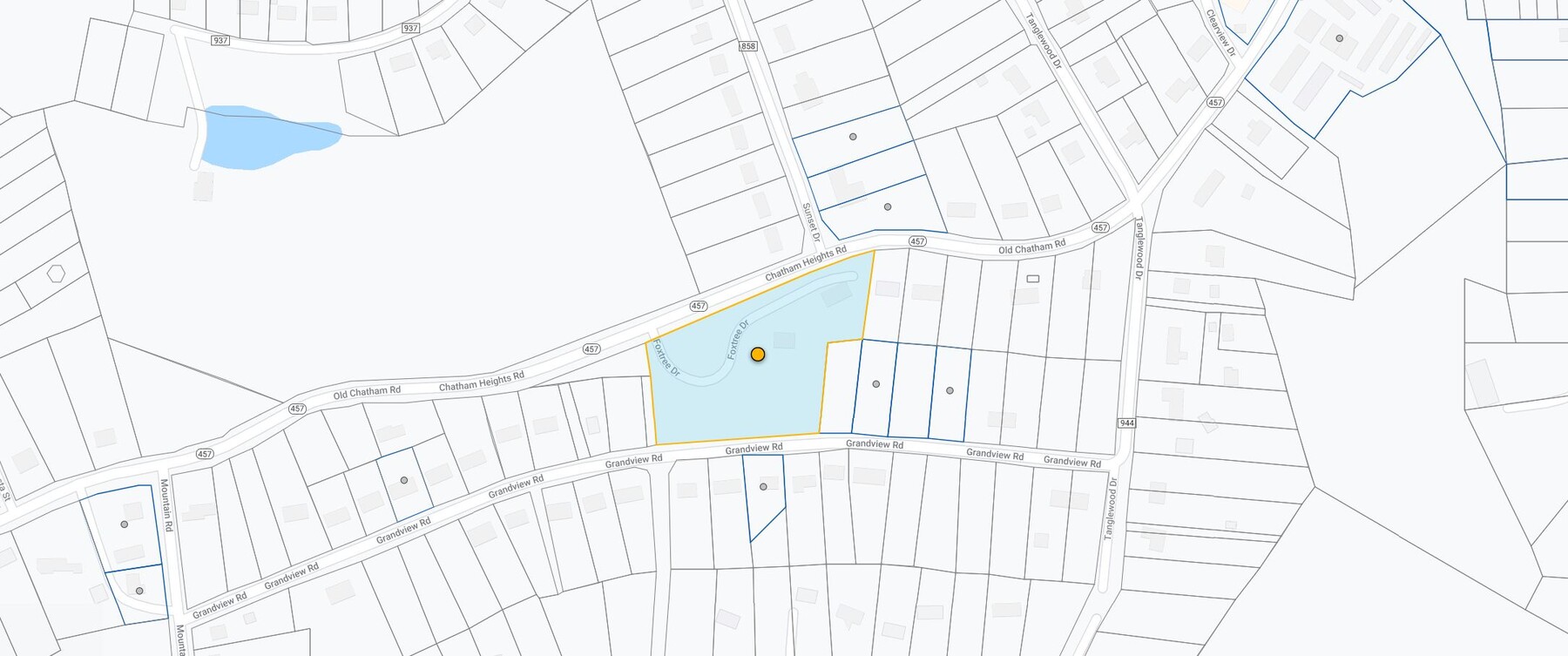
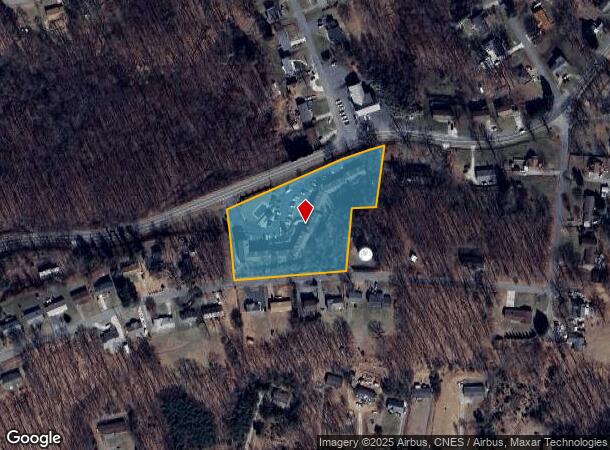
50 Foxtree Dr
059690000
42.3(004 )000D/019; D H PANNILL SUB FOX TREE APT TRACT A
Multifamilydwelling
Henry
X
Virginia
51089C0154C
2.95 AC
2024
Virginia South Central
2024
Other Market Areas
010300
Martinsville, VA
DEMOGRAPHICS near 50 Foxtree Dr
1 Mile
3 Mile
5 Mile
2024 Total Population
2,245
14,019
29,717
2029 Population
2,232
14,237
29,805
Pop Growth 2024-2029
(0.58%)
+ 1.56%
+ 0.30%
Average Age
47
44
44
2024 Total Households
999
6,233
13,004
HH Growth 2024-2029
(0.90%)
+ 1.57%
+ 0.37%
Median Household Inc
$31,346
$42,305
$41,698
Avg Household Size
2.10
2.10
2.20
2024 Avg HH Vehicles
2.00
2.00
2.00
Median Home Value
$73,606
$90,433
$99,235
Median Year Built
1971
1966
1970
Nearby Places
- Restaurants
- Banks
- Shops
- Fitness
- Groceries
Nearby Properties
Address
Land Use
TOTAL SIZE
Lot Size
Zoning
Address
Land Use
TOTAL SIZE
Lot Size
Zoning
42.45 AC
I1
Address
Land Use
TOTAL SIZE
Lot Size
Zoning
31.90 AC
I1
Address
Land Use
TOTAL SIZE
Lot Size
Zoning
46.18 AC
I1
Address
Land Use
TOTAL SIZE
Lot Size
Zoning
137 AC
GS
Address
Land Use
TOTAL SIZE
Lot Size
Zoning
60.14 AC
I1
Address
Land Use
TOTAL SIZE
Lot Size
Zoning
66,787 SF
3.69 AC
R-T
Address
Land Use
TOTAL SIZE
Lot Size
Zoning
49.62 AC
I1
Address
Land Use
TOTAL SIZE
Lot Size
Zoning
389.42 AC
I1
Address
Land Use
TOTAL SIZE
Lot Size
Zoning
123,300 SF
9.62 AC
R-T
Address
Land Use
TOTAL SIZE
Lot Size
Zoning
Address
Land Use
TOTAL SIZE
Lot Size
Zoning
52,259 SF
5.10 AC
C-N
Address
Land Use
TOTAL SIZE
Lot Size
Zoning
13.76 AC
I1
Address
Land Use
TOTAL SIZE
Lot Size
Zoning
9.65 AC
I1
Address
Land Use
TOTAL SIZE
Lot Size
Zoning
65,344 SF
6 AC
R-T
Address
Land Use
TOTAL SIZE
Lot Size
Zoning
22.10 AC
ED-I
Address
Land Use
TOTAL SIZE
Lot Size
Zoning
16.04 AC
I1
Address
Land Use
TOTAL SIZE
Lot Size
Zoning
18.39 AC
GS
Address
Land Use
TOTAL SIZE
Lot Size
Zoning
29.60 AC
I1
Address
Land Use
TOTAL SIZE
Lot Size
Zoning
59,560 SF
3.01 AC
R-T
Address
Land Use
TOTAL SIZE
Lot Size
Zoning
48,070 SF
8.31 AC
C-N
Address
Land Use
TOTAL SIZE
Lot Size
Zoning
32.37 AC
I1
Address
Land Use
TOTAL SIZE
Lot Size
Zoning
23,957 SF
8.27 AC
R-T
Address
Land Use
TOTAL SIZE
Lot Size
Zoning
38,605 SF
8.09 AC
C-N
Address
Land Use
TOTAL SIZE
Lot Size
Zoning
39.94 AC
C-C
Address
Land Use
TOTAL SIZE
Lot Size
Zoning
37,970 SF
18.32 AC
ED-G
Address
Land Use
TOTAL SIZE
Lot Size
Zoning
9.01 AC
B1
Address
Land Use
TOTAL SIZE
Lot Size
Zoning
1,188.66 AC
A1
Address
Land Use
TOTAL SIZE
Lot Size
Zoning
6.25 AC
R-N
The World's #1 Commercial Real Estate Marketplace
Connect with us
© 2025 CoStar Group
The information above has been obtained from sources believed reliable. While we do not doubt its accuracy we have not verified it and make no guarantee, warranty or representation about it. It is your responsibility to independently confirm its accuracy and completeness. Any projections, opinions, assumptions, or estimates used are for example only and do not represent the current or future performance of the property. The value of this transaction to you depends on tax and other factors which should be evaluated by your tax, financial, and legal advisors. You and your advisors should conduct a careful, independent investigation of the property to determine to your satisfaction the suitability of the property for your needs.