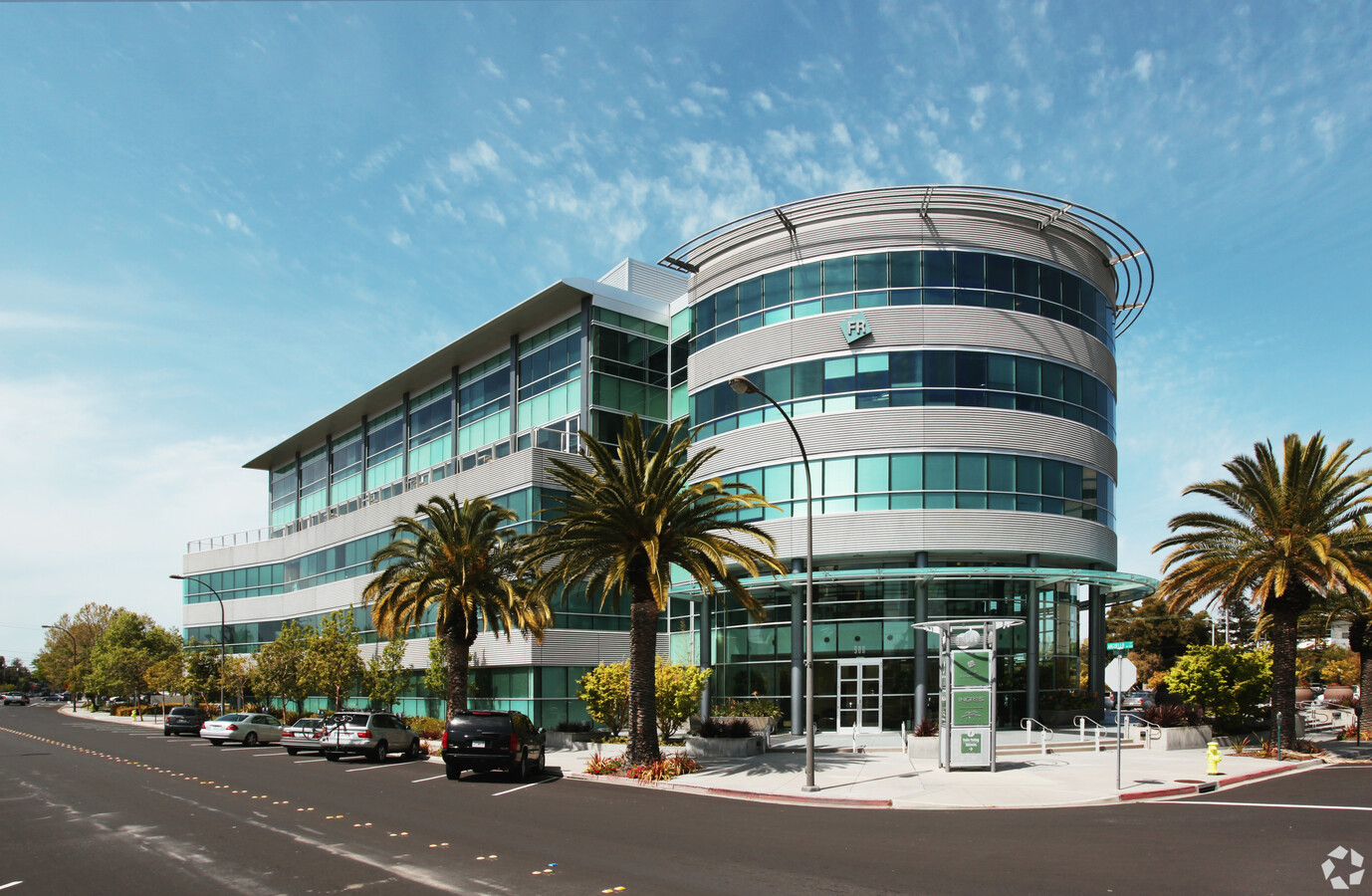
Property Record
500 Arguello St, Redwood City, CA 94063


Current Lease Availabilities
NEARBY LISTINGS FOR SALE OR LEASE
Property Detail
500 Arguello St
San Francisco-Redwood City-South San Francisco, CA
Technology Station
052-325-180
1.586 AC MOL LOT 1 RWC TECHNOLOGY STATION RSM 130/97-98
Officebuilding
San Mateo
X
California
06081C0301F
1
2024
1.59 AC
2023
Redwood City
610202
San Francisco
96,298 SF
DEMOGRAPHICS near 500 Arguello St
1 Mile
3 Mile
5 Mile
2024 Total Population
28,475
127,945
257,161
2029 Population
27,411
122,396
245,847
Pop Growth 2024-2029
(3.74%)
(4.34%)
(4.40%)
Average Age
38
41
41
2024 Total Households
11,017
45,787
94,333
HH Growth 2024-2029
(3.61%)
(4.39%)
(4.50%)
Median Household Inc
$124,091
$146,536
$158,744
Avg Household Size
2.50
2.70
2.60
2024 Avg HH Vehicles
2.00
2.00
2.00
Median Home Value
$1,119,005
$1,130,972
$1,132,626
Median Year Built
1969
1963
1967
Nearby Places
- Restaurants
- Banks
- Shops
- Fitness
- Groceries
PUBLIC TRANSPORTATION
COMMUTER RAIL
Redwood City (Caltrain - Caltrain (Caltrain))
DRIVE
WALK
Distance
Redwood City (Caltrain - Caltrain (Caltrain))
0 min
4 min
0.2 mi
San Carlos (Caltrain - Caltrain (Caltrain))
DRIVE
WALK
Distance
San Carlos (Caltrain - Caltrain (Caltrain))
5 min
2.2 mi
AIRPORT
San Francisco International
DRIVE
WALK
Distance
San Francisco International
20 min
14.2 mi
Norman Y Mineta San Jose International
DRIVE
WALK
Distance
Norman Y Mineta San Jose International
27 min
20.1 mi
Metro Oakland International
DRIVE
WALK
Distance
Metro Oakland International
38 min
29.9 mi
Freight Ports
Port of Redwood City
DRIVE
WALK
Distance
Port of Redwood City
6 min
2.8 mi
Nearby Properties
Address
Land Use
TOTAL SIZE
Lot Size
Zoning
Address
Land Use
TOTAL SIZE
Lot Size
Zoning
373,238 SF
7.94 AC
Address
Land Use
TOTAL SIZE
Lot Size
Zoning
330,071 SF
1.64 AC
Address
Land Use
TOTAL SIZE
Lot Size
Zoning
8.31 AC
EA00CA
Address
Land Use
TOTAL SIZE
Lot Size
Zoning
491,030 SF
2.74 AC
Address
Land Use
TOTAL SIZE
Lot Size
Zoning
458,111 SF
2.26 AC
Address
Land Use
TOTAL SIZE
Lot Size
Zoning
Address
Land Use
TOTAL SIZE
Lot Size
Zoning
283,015 SF
8.76 AC
Address
Land Use
TOTAL SIZE
Lot Size
Zoning
283,015 SF
7.66 AC
Address
Land Use
TOTAL SIZE
Lot Size
Zoning
Address
Land Use
TOTAL SIZE
Lot Size
Zoning
378,534 SF
2.24 AC
Address
Land Use
TOTAL SIZE
Lot Size
Zoning
395,625 SF
5.08 AC
Address
Land Use
TOTAL SIZE
Lot Size
Zoning
190,245 SF
16.88 AC
M10000
Address
Land Use
TOTAL SIZE
Lot Size
Zoning
223,321 SF
8.39 AC
M10000
Address
Land Use
TOTAL SIZE
Lot Size
Zoning
368,000 SF
11.32 AC
Address
Land Use
TOTAL SIZE
Lot Size
Zoning
262,189 SF
1.16 AC
Address
Land Use
TOTAL SIZE
Lot Size
Zoning
366,384 SF
3.25 AC
Address
Land Use
TOTAL SIZE
Lot Size
Zoning
249,198 SF
1.14 AC
Address
Land Use
TOTAL SIZE
Lot Size
Zoning
209,967 SF
8.28 AC
CP0000
Address
Land Use
TOTAL SIZE
Lot Size
Zoning
141,180 SF
2.41 AC
Address
Land Use
TOTAL SIZE
Lot Size
Zoning
Address
Land Use
TOTAL SIZE
Lot Size
Zoning
164,732 SF
4.58 AC
Address
Land Use
TOTAL SIZE
Lot Size
Zoning
170,495 SF
7.15 AC
Address
Land Use
TOTAL SIZE
Lot Size
Zoning
204,006 SF
8.58 AC
TP0000
Address
Land Use
TOTAL SIZE
Lot Size
Zoning
164,732 SF
7.02 AC
Address
Land Use
TOTAL SIZE
Lot Size
Zoning
135,070 SF
5.27 AC
Address
Land Use
TOTAL SIZE
Lot Size
Zoning
147,022 SF
7.18 AC
Address
Land Use
TOTAL SIZE
Lot Size
Zoning
221,200 SF
0.77 AC
Address
Land Use
TOTAL SIZE
Lot Size
Zoning
282,273 SF
6.15 AC
CB0000
Address
Land Use
TOTAL SIZE
Lot Size
Zoning
176,956 SF
4 AC
M10000
Address
Land Use
TOTAL SIZE
Lot Size
Zoning
185,285 SF
7.80 AC
CB0000
The World's #1 Commercial Real Estate Marketplace
Connect with us
© 2025 CoStar Group
The information above has been obtained from sources believed reliable. While we do not doubt its accuracy we have not verified it and make no guarantee, warranty or representation about it. It is your responsibility to independently confirm its accuracy and completeness. Any projections, opinions, assumptions, or estimates used are for example only and do not represent the current or future performance of the property. The value of this transaction to you depends on tax and other factors which should be evaluated by your tax, financial, and legal advisors. You and your advisors should conduct a careful, independent investigation of the property to determine to your satisfaction the suitability of the property for your needs.