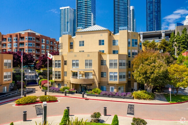
Property Record
500 Beale St, San Francisco, CA 94105


Property Detail
500 Beale St
San Francisco-San Mateo-Redwood City, CA
MAP 53 PG 206 UNIT 402 LOT 146
3773-200A
SAN FRANCISCO
Apartment
California
M2
146
2024
2.61 AC
2025
South Beach
061508
San Francisco
243,570 SF
NEARBY LISTINGS FOR SALE OR LEASE
DEMOGRAPHICS near 500 Beale St
1 mile
3 mile
5 mile
2025 Total Population
49,758
368,773
627,007
2030 Population
51,800
377,451
637,837
Pop Growth 2025-2030
+ 4.10%
+ 2.35%
+ 1.73%
Average Age
40
42
42
2025 Total Households
25,870
181,129
280,893
HH Growth 2025-2030
+ 4.01%
+ 2.25%
+ 1.78%
Median Household Inc
$173,706
$121,642
$132,585
Avg Household Size
1.80
1.90
2.10
2025 Avg HH Vehicles
1.00
1.00
1.00
Median Home Value
$1,079,725
$1,087,458
$1,095,671
Median Year Built
2005
1957
1949
Nearby Places
Map Layers
Map Styles
 Street
 Aerial
Layers
 Traffic
 Biking
Places
Listings with unknown addresses are not visible on the map
- Restaurants
- Banks
- Shops
- Fitness
- Groceries
PUBLIC TRANSPORTATION
TRANSIT/SUBWAY
Brannan And The Embarcadero (JUDAH - San Francisco Municipal Railway (MUNI Metro), N Judah - San Francisco Municipal Railway (MUNI Metro), T Third Street - San Francisco Municipal Railway (MUNI Metro))
Drive
Walk
Distance
Brannan And The Embarcadero (JUDAH - San Francisco Municipal Railway (MUNI Metro), N Judah - San Francisco Municipal Railway (MUNI Metro), T Third Street - San Francisco Municipal Railway (MUNI Metro))
2 min
2 min
0.1 mi
The Embarcadero & Folsom St (INGLESIDE - San Francisco Municipal Transportation Agency, JUDAH - San Francisco Municipal Transportation Agency, OCEAN VIEW - San Francisco Municipal Transportation Agency, TARAVAL - San Francisco Municipal Transportation Agency)
Drive
Walk
Distance
The Embarcadero & Folsom St (INGLESIDE - San Francisco Municipal Transportation Agency, JUDAH - San Francisco Municipal Transportation Agency, OCEAN VIEW - San Francisco Municipal Transportation Agency, TARAVAL - San Francisco Municipal Transportation Agency)
1 min
8 min
0.4 mi
2Nd And King (N Judah - San Francisco Municipal Railway (MUNI Metro), T Third Street - San Francisco Municipal Railway (MUNI Metro))
Drive
Walk
Distance
2Nd And King (N Judah - San Francisco Municipal Railway (MUNI Metro), T Third Street - San Francisco Municipal Railway (MUNI Metro))
3 min
8 min
0.5 mi
Main St & Mission St (MARKET & WHARVES - San Francisco Municipal Transportation Agency)
Drive
Walk
Distance
Main St & Mission St (MARKET & WHARVES - San Francisco Municipal Transportation Agency)
2 min
12 min
0.6 mi
Fourth Street & Brannan Northbound (THIRD - San Francisco Municipal Transportation Agency)
Drive
Walk
Distance
Fourth Street & Brannan Northbound (THIRD - San Francisco Municipal Transportation Agency)
3 min
13 min
0.7 mi
COMMUTER RAIL
San Francisco Caltrain Station Southbound (Express - Caltrain (Caltrain), Limited - Caltrain (Caltrain), Local Weekday - Caltrain (Caltrain), Local Weekend - Caltrain (Caltrain))
Drive
Walk
Distance
San Francisco Caltrain Station Southbound (Express - Caltrain (Caltrain), Limited - Caltrain (Caltrain), Local Weekday - Caltrain (Caltrain), Local Weekend - Caltrain (Caltrain))
3 min
15 min
0.8 mi
Bayshore Caltrain Station Southbound (Local Weekday - Caltrain (Caltrain), Local Weekend - Caltrain (Caltrain))
Drive
Walk
Distance
Bayshore Caltrain Station Southbound (Local Weekday - Caltrain (Caltrain), Local Weekend - Caltrain (Caltrain))
11 min
6.3 mi
AIRPORT
San Francisco International
Drive
Walk
Distance
San Francisco International
22 min
14.0 mi
Metro Oakland International
Drive
Walk
Distance
Metro Oakland International
28 min
18.6 mi
Freight Ports
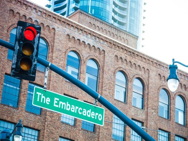
Port of San Francisco
Drive
Walk
Distance
Port of San Francisco
3 min
1.0 mi
SALE & LEASE HISTORY
LISTING DATE
SALE/LEASE

Mar 18, 2024
For Lease
Nearby Properties
Address
Land Use
TOTAL SIZE
Lot Size
Zoning
Address
Land Use
TOTAL SIZE
Lot Size
Zoning
1,015,000 SF
2.43 AC
RC4
Address
Land Use
TOTAL SIZE
Lot Size
Zoning
764,661 SF
0.67 AC
C3OSD
Address
Land Use
TOTAL SIZE
Lot Size
Zoning
750,370 SF
3.25 AC
MBR3
Address
Land Use
TOTAL SIZE
Lot Size
Zoning
1,471,929 SF
1.93 AC
C3O
Address
Land Use
TOTAL SIZE
Lot Size
Zoning
1,300,000 SF
1.74 AC
C3O
Address
Land Use
TOTAL SIZE
Lot Size
Zoning
1,420,430 SF
1.16 AC
C3OSD
Address
Land Use
TOTAL SIZE
Lot Size
Zoning
1,534,312 SF
2.60 AC
C3O
Address
Land Use
TOTAL SIZE
Lot Size
Zoning
914,037 SF
1.36 AC
C3O
Address
Land Use
TOTAL SIZE
Lot Size
Zoning
717,234 SF
3.47 AC
UMU
Address
Land Use
TOTAL SIZE
Lot Size
Zoning
605,459 SF
0.63 AC
C3O
Address
Land Use
TOTAL SIZE
Lot Size
Zoning
475,791 SF
0.55 AC
C3OSD
Address
Land Use
TOTAL SIZE
Lot Size
Zoning
690,442 SF
0.79 AC
C3O
Address
Land Use
TOTAL SIZE
Lot Size
Zoning
10.92 AC
Address
Land Use
TOTAL SIZE
Lot Size
Zoning
750,491 SF
0.51 AC
C3O
Address
Land Use
TOTAL SIZE
Lot Size
Zoning
432,000 SF
0.35 AC
C3OSD
Address
Land Use
TOTAL SIZE
Lot Size
Zoning
266,143 SF
4 AC
C-3-R
Address
Land Use
TOTAL SIZE
Lot Size
Zoning
885,581 SF
5.20 AC
M2
Address
Land Use
TOTAL SIZE
Lot Size
Zoning
512,395 SF
1.24 AC
C3O
Address
Land Use
TOTAL SIZE
Lot Size
Zoning
508,714 SF
1.29 AC
C3R
Address
Land Use
TOTAL SIZE
Lot Size
Zoning
1,084,662 SF
1.67 AC
C3O
Address
Land Use
TOTAL SIZE
Lot Size
Zoning
505,120 SF
0.41 AC
C3O
Address
Land Use
TOTAL SIZE
Lot Size
Zoning
694,334 SF
1.01 AC
C3O
Address
Land Use
TOTAL SIZE
Lot Size
Zoning
696,431 SF
0.97 AC
C3G
Address
Land Use
TOTAL SIZE
Lot Size
Zoning
139,070 SF
0.64 AC
C3O
Address
Land Use
TOTAL SIZE
Lot Size
Zoning
1.52 AC
C3G
Address
Land Use
TOTAL SIZE
Lot Size
Zoning
1,424,230 SF
2.60 AC
C3G
Address
Land Use
TOTAL SIZE
Lot Size
Zoning
614,740 SF
1.74 AC
C3OSD
Address
Land Use
TOTAL SIZE
Lot Size
Zoning
615,957 SF
0.63 AC
C3O
Address
Land Use
TOTAL SIZE
Lot Size
Zoning
492,980 SF
0.43 AC
C3O
Address
Land Use
TOTAL SIZE
Lot Size
Zoning
385,000 SF
0.81 AC
C3O
The World's #1 Commercial Real Estate Marketplace
Connect with us
© 2026 CoStar Group
The information above has been obtained from sources believed reliable. While we do not doubt its accuracy we have not verified it and make no guarantee, warranty or representation about it. It is your responsibility to independently confirm its accuracy and completeness. Any projections, opinions, assumptions, or estimates used are for example only and do not represent the current or future performance of the property. The value of this transaction to you depends on tax and other factors which should be evaluated by your tax, financial, and legal advisors. You and your advisors should conduct a careful, independent investigation of the property to determine to your satisfaction the suitability of the property for your needs.