Property Record
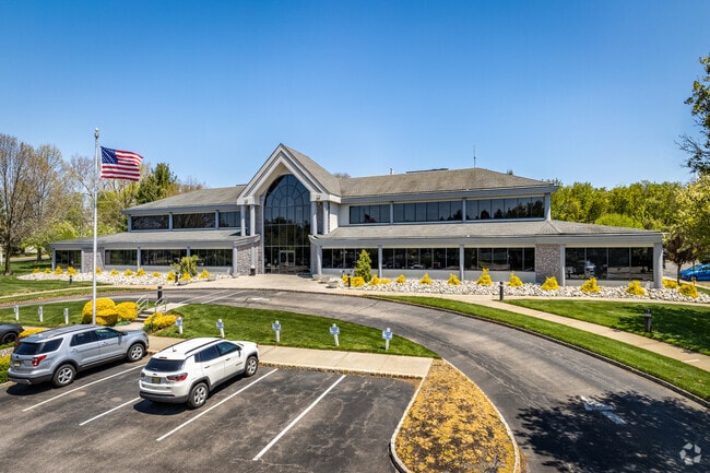
500 Craig Rd, Manalapan, NJ 07726


Current Lease Availabilities
NEARBY LISTINGS FOR SALE OR LEASE
Property Detail
500 Craig Rd
28-02503-0000-00026-01
Monmouth
Officebuilding
New Jersey
X
26.1
34025C0141F
3.45 AC
2024
Western Monmouth
2025
Northern New Jersey
810102
New York-Jersey City-White Plains, NY-NJ
DEMOGRAPHICS near 500 Craig Rd
1 Mile
3 Mile
5 Mile
2024 Total Population
4,752
52,668
111,282
2029 Population
4,712
51,996
110,005
Pop Growth 2024-2029
(0.84%)
(1.28%)
(1.15%)
Average Age
43
42
42
2024 Total Households
1,548
17,966
38,352
HH Growth 2024-2029
(1.10%)
(1.46%)
(1.27%)
Median Household Inc
$161,666
$124,143
$136,475
Avg Household Size
2.80
2.80
2.80
2024 Avg HH Vehicles
2.00
2.00
2.00
Median Home Value
$534,180
$515,224
$575,948
Median Year Built
1985
1981
1982
Nearby Places
Map Layers
Map Styles
 Street
 Aerial
- Restaurants
- Banks
- Shops
- Fitness
- Groceries
PUBLIC TRANSPORTATION
AIRPORT
Trenton Mercer
DRIVE
WALK
Distance
Trenton Mercer
55 min
36.2 mi
Newark Liberty International
DRIVE
WALK
Distance
Newark Liberty International
47 min
38.6 mi
Freight Ports
New York Container Terminal
DRIVE
WALK
Distance
New York Container Terminal
40 min
30.8 mi
Nearby Properties
Address
Land Use
TOTAL SIZE
Lot Size
Zoning
Address
Land Use
TOTAL SIZE
Lot Size
Zoning
825,686 SF
151.47 AC
575
Address
Land Use
TOTAL SIZE
Lot Size
Zoning
67.30 AC
PB
Address
Land Use
TOTAL SIZE
Lot Size
Zoning
56.99 AC
C1
Address
Land Use
TOTAL SIZE
Lot Size
Zoning
285,037 SF
40.82 AC
H-1
Address
Land Use
TOTAL SIZE
Lot Size
Zoning
25.27 AC
C1
Address
Land Use
TOTAL SIZE
Lot Size
Zoning
2.91 AC
RCR
Address
Land Use
TOTAL SIZE
Lot Size
Zoning
278,199 SF
6.92 AC
R-10
Address
Land Use
TOTAL SIZE
Lot Size
Zoning
81,690 SF
42.46 AC
RMZ-
Address
Land Use
TOTAL SIZE
Lot Size
Zoning
13,730 SF
19.29 AC
CM-3
Address
Land Use
TOTAL SIZE
Lot Size
Zoning
19.02 AC
HD
Address
Land Use
TOTAL SIZE
Lot Size
Zoning
138.38 AC
R-E
Address
Land Use
TOTAL SIZE
Lot Size
Zoning
82,872 SF
25.58 AC
B-10
Address
Land Use
TOTAL SIZE
Lot Size
Zoning
21 AC
R-40
Address
Land Use
TOTAL SIZE
Lot Size
Zoning
48,451 SF
12.17 AC
B-10
Address
Land Use
TOTAL SIZE
Lot Size
Zoning
23.08 AC
PB
Address
Land Use
TOTAL SIZE
Lot Size
Zoning
200,294 SF
12 AC
R10
Address
Land Use
TOTAL SIZE
Lot Size
Zoning
13.21 AC
OB01
Address
Land Use
TOTAL SIZE
Lot Size
Zoning
185,237 SF
20.18 AC
VC
Address
Land Use
TOTAL SIZE
Lot Size
Zoning
54,065 SF
19.07 AC
CM3A
Address
Land Use
TOTAL SIZE
Lot Size
Zoning
6.97 AC
C2
Address
Land Use
TOTAL SIZE
Lot Size
Zoning
1,800 SF
83.93 AC
R120
Address
Land Use
TOTAL SIZE
Lot Size
Zoning
134,977 SF
2.30 AC
A
Address
Land Use
TOTAL SIZE
Lot Size
Zoning
88,303 SF
39.55 AC
R-40
Address
Land Use
TOTAL SIZE
Lot Size
Zoning
189,210 SF
8.07 AC
0
Address
Land Use
TOTAL SIZE
Lot Size
Zoning
448,934 SF
24.24 AC
C-M
Address
Land Use
TOTAL SIZE
Lot Size
Zoning
8.32 AC
R-40
Address
Land Use
TOTAL SIZE
Lot Size
Zoning
244,275 SF
2.50 AC
RM-1
Address
Land Use
TOTAL SIZE
Lot Size
Zoning
8.15 AC
C2-M
Address
Land Use
TOTAL SIZE
Lot Size
Zoning
27,535 SF
7.03 AC
CM3A
Address
Land Use
TOTAL SIZE
Lot Size
Zoning
16,496 SF
10.87 AC
CM3A
The World's #1 Commercial Real Estate Marketplace
Connect with us
© 2026 CoStar Group
The information above has been obtained from sources believed reliable. While we do not doubt its accuracy we have not verified it and make no guarantee, warranty or representation about it. It is your responsibility to independently confirm its accuracy and completeness. Any projections, opinions, assumptions, or estimates used are for example only and do not represent the current or future performance of the property. The value of this transaction to you depends on tax and other factors which should be evaluated by your tax, financial, and legal advisors. You and your advisors should conduct a careful, independent investigation of the property to determine to your satisfaction the suitability of the property for your needs.