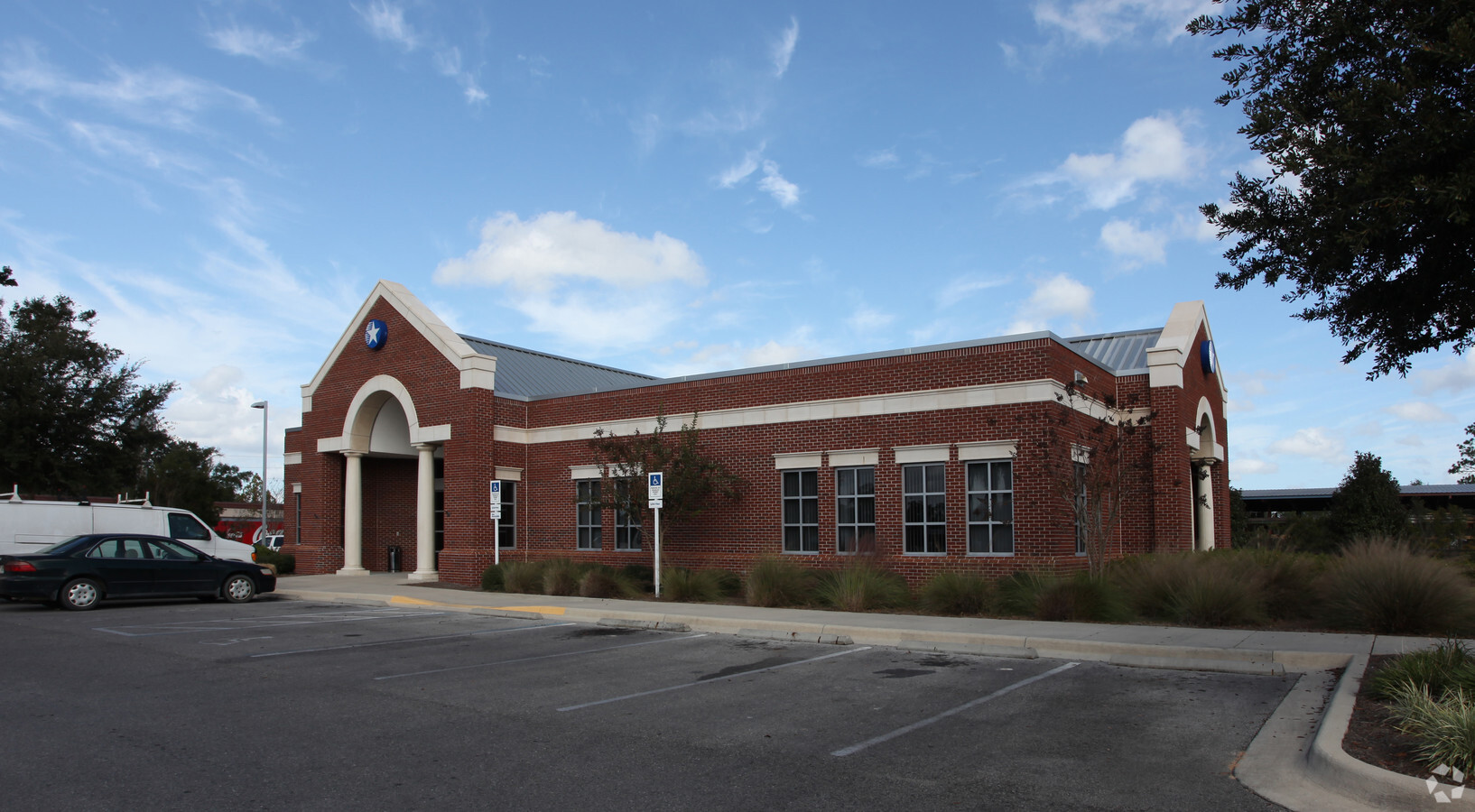
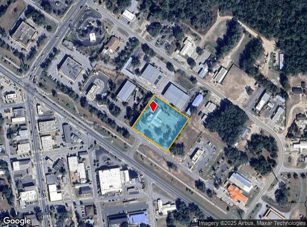
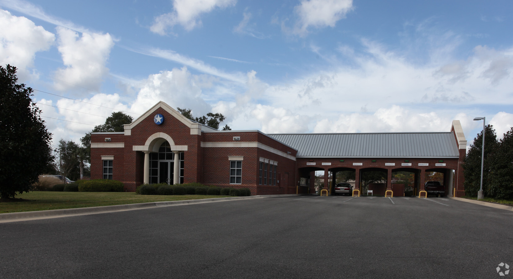
Property Record
500 Green Way, Keystone Heights, FL 32656
NEARBY LISTINGS FOR SALE OR LEASE
Property Detail
500 Green Way
20-08-23-002188-005-00
Keystone Square
Financialbuilding
PT OF W1/2 S20T8R23 A/K/A PRCL S 17 & 18 KEYSTONE SQUARE AS REC OR 2437 PG 214 EX PT REC O
X
Clay
12001C0220E
Florida
2023
1.84 AC
2024
Orange Park/Clay County
031109
Jacksonville (Florida)
4,625 SF
Jacksonville, FL
DEMOGRAPHICS near 500 Green Way
1 Mile
3 Mile
5 Mile
2024 Total Population
3,191
11,797
18,385
2029 Population
3,506
12,883
20,067
Pop Growth 2024-2029
+ 9.87%
+ 9.21%
+ 9.15%
Average Age
42
43
44
2024 Total Households
1,229
4,705
7,396
HH Growth 2024-2029
+ 10.09%
+ 9.01%
+ 8.91%
Median Household Inc
$49,482
$53,761
$57,389
Avg Household Size
2.60
2.50
2.50
2024 Avg HH Vehicles
2.00
2.00
2.00
Median Home Value
$211,952
$196,832
$195,084
Median Year Built
1979
1981
1984
Nearby Places
- Restaurants
- Banks
- Shops
- Fitness
- Groceries
PUBLIC TRANSPORTATION
AIRPORT
Gainesville Regional
DRIVE
WALK
Distance
Gainesville Regional
38 min
22.9 mi
Freight Ports
Jacksonville Port
DRIVE
WALK
Distance
Jacksonville Port
84 min
56.0 mi
Nearby Properties
Address
Land Use
TOTAL SIZE
Lot Size
Zoning
Address
Land Use
TOTAL SIZE
Lot Size
Zoning
8,645.38 AC
Address
Land Use
TOTAL SIZE
Lot Size
Zoning
23,953 SF
228.32 AC
Address
Land Use
TOTAL SIZE
Lot Size
Zoning
56,278 SF
39.66 AC
Address
Land Use
TOTAL SIZE
Lot Size
Zoning
68,670 SF
10 AC
Address
Land Use
TOTAL SIZE
Lot Size
Zoning
116,370 SF
23.88 AC
PS-5
Address
Land Use
TOTAL SIZE
Lot Size
Zoning
52,626 SF
28.21 AC
Address
Land Use
TOTAL SIZE
Lot Size
Zoning
61,803 SF
18.29 AC
Address
Land Use
TOTAL SIZE
Lot Size
Zoning
60,351 SF
11.58 AC
Address
Land Use
TOTAL SIZE
Lot Size
Zoning
123,219 SF
121 AC
Address
Land Use
TOTAL SIZE
Lot Size
Zoning
42,928 SF
4.69 AC
Address
Land Use
TOTAL SIZE
Lot Size
Zoning
26,203 SF
0.80 AC
Address
Land Use
TOTAL SIZE
Lot Size
Zoning
43,696 SF
14.90 AC
Address
Land Use
TOTAL SIZE
Lot Size
Zoning
22,485 SF
110 AC
Address
Land Use
TOTAL SIZE
Lot Size
Zoning
21,704 SF
8.45 AC
Address
Land Use
TOTAL SIZE
Lot Size
Zoning
14,736 SF
2.12 AC
Address
Land Use
TOTAL SIZE
Lot Size
Zoning
8,266 SF
1.20 AC
Address
Land Use
TOTAL SIZE
Lot Size
Zoning
13,000 SF
2.24 AC
RB
Address
Land Use
TOTAL SIZE
Lot Size
Zoning
33,258 SF
5.34 AC
Address
Land Use
TOTAL SIZE
Lot Size
Zoning
Address
Land Use
TOTAL SIZE
Lot Size
Zoning
10,115 SF
0.92 AC
PO-1
Address
Land Use
TOTAL SIZE
Lot Size
Zoning
Address
Land Use
TOTAL SIZE
Lot Size
Zoning
Address
Land Use
TOTAL SIZE
Lot Size
Zoning
Address
Land Use
TOTAL SIZE
Lot Size
Zoning
Address
Land Use
TOTAL SIZE
Lot Size
Zoning
Address
Land Use
TOTAL SIZE
Lot Size
Zoning
Address
Land Use
TOTAL SIZE
Lot Size
Zoning
Address
Land Use
TOTAL SIZE
Lot Size
Zoning
Address
Land Use
TOTAL SIZE
Lot Size
Zoning
Address
Land Use
TOTAL SIZE
Lot Size
Zoning
The World's #1 Commercial Real Estate Marketplace
Connect with us
© 2025 CoStar Group
The information above has been obtained from sources believed reliable. While we do not doubt its accuracy we have not verified it and make no guarantee, warranty or representation about it. It is your responsibility to independently confirm its accuracy and completeness. Any projections, opinions, assumptions, or estimates used are for example only and do not represent the current or future performance of the property. The value of this transaction to you depends on tax and other factors which should be evaluated by your tax, financial, and legal advisors. You and your advisors should conduct a careful, independent investigation of the property to determine to your satisfaction the suitability of the property for your needs.