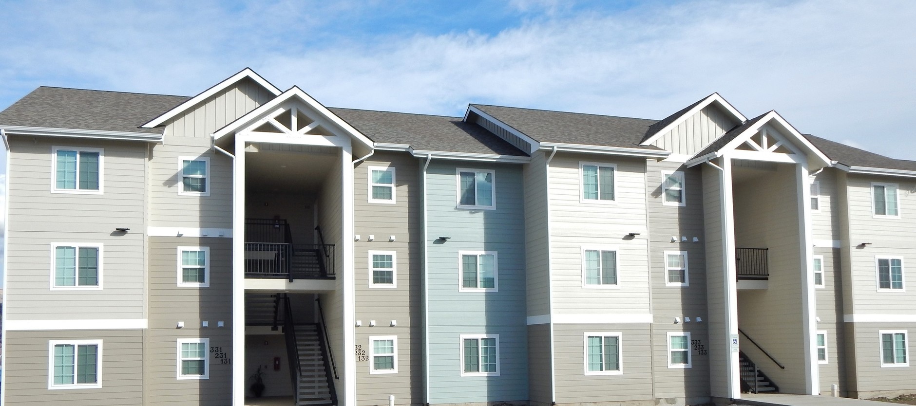
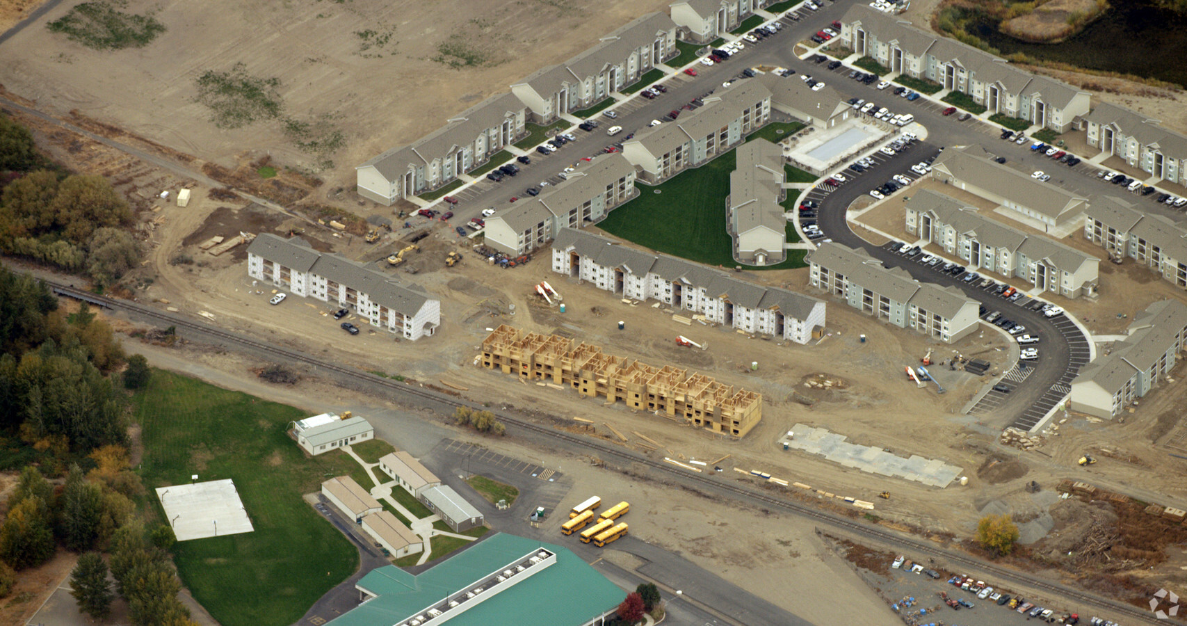
Property Record
500 University Pky, Yakima, WA 98901
NEARBY LISTINGS FOR SALE OR LEASE
Property Detail
500 University Pky
Yakima, WA
Short Plat Af 7931323
191321-42422
SECTION 21 TOWNSHIP 13 RANGE 19 QUARTER SE: SHORT PLAT AF 7931323 LOT 2
Multifamilydwelling
Yakima
X
Washington
53077C1052D
2
2024
5.80 AC
2023
East Yakima County
001602
Yakima
34,144 SF
DEMOGRAPHICS near 500 University Pky
1 Mile
3 Mile
5 Mile
2024 Total Population
4,460
36,281
91,978
2029 Population
4,525
36,430
92,304
Pop Growth 2024-2029
+ 1.46%
+ 0.41%
+ 0.35%
Average Age
39
35
36
2024 Total Households
1,871
12,363
32,295
HH Growth 2024-2029
+ 1.50%
+ 0.38%
+ 0.38%
Median Household Inc
$62,524
$47,209
$51,341
Avg Household Size
2.30
2.80
2.70
2024 Avg HH Vehicles
2.00
2.00
2.00
Median Home Value
$313,198
$209,334
$220,942
Median Year Built
2003
1972
1970
Nearby Places
- Restaurants
- Banks
- Shops
- Fitness
- Groceries
PUBLIC TRANSPORTATION
AIRPORT
Yakima Air Trml/McAllister Field
DRIVE
WALK
Distance
Yakima Air Trml/McAllister Field
16 min
7.2 mi
Freight Ports
Port of Tacoma
DRIVE
WALK
Distance
Port of Tacoma
187 min
157.4 mi
Nearby Properties
Address
Land Use
TOTAL SIZE
Lot Size
Zoning
Address
Land Use
TOTAL SIZE
Lot Size
Zoning
390,527 SF
11.86 AC
R3
Address
Land Use
TOTAL SIZE
Lot Size
Zoning
287,403 SF
32.20 AC
R1
Address
Land Use
TOTAL SIZE
Lot Size
Zoning
345,698 SF
3.52 AC
COM
Address
Land Use
TOTAL SIZE
Lot Size
Zoning
120,370 SF
15.75 AC
GC
Address
Land Use
TOTAL SIZE
Lot Size
Zoning
87,068 SF
2.89 AC
CBD
Address
Land Use
TOTAL SIZE
Lot Size
Zoning
176,098 SF
1.67 AC
CBD
Address
Land Use
TOTAL SIZE
Lot Size
Zoning
129,042 SF
6.53 AC
R3
Address
Land Use
TOTAL SIZE
Lot Size
Zoning
106,878 SF
3.46 AC
RD
Address
Land Use
TOTAL SIZE
Lot Size
Zoning
121,488 SF
5.97 AC
R3
Address
Land Use
TOTAL SIZE
Lot Size
Zoning
91,856 SF
92.29 AC
RD
Address
Land Use
TOTAL SIZE
Lot Size
Zoning
135,634 SF
9.84 AC
COM
Address
Land Use
TOTAL SIZE
Lot Size
Zoning
82,436 SF
11 AC
RD
Address
Land Use
TOTAL SIZE
Lot Size
Zoning
100,992 SF
9.15 AC
RD
Address
Land Use
TOTAL SIZE
Lot Size
Zoning
194,451 SF
18.08 AC
COM
Address
Land Use
TOTAL SIZE
Lot Size
Zoning
56,505 SF
2.75 AC
GC
Address
Land Use
TOTAL SIZE
Lot Size
Zoning
84,714 SF
4.40 AC
R3
Address
Land Use
TOTAL SIZE
Lot Size
Zoning
73,917 SF
1.01 AC
CBD
Address
Land Use
TOTAL SIZE
Lot Size
Zoning
69.53 AC
SR
Address
Land Use
TOTAL SIZE
Lot Size
Zoning
77,472 SF
33.76 AC
R1
Address
Land Use
TOTAL SIZE
Lot Size
Zoning
325,959 SF
11.95 AC
M2
Address
Land Use
TOTAL SIZE
Lot Size
Zoning
83,856 SF
4.23 AC
R3
Address
Land Use
TOTAL SIZE
Lot Size
Zoning
82,422 SF
4.58 AC
COM
Address
Land Use
TOTAL SIZE
Lot Size
Zoning
94,724 SF
0.79 AC
CBD
Address
Land Use
TOTAL SIZE
Lot Size
Zoning
204,600 SF
12.54 AC
W/W
Address
Land Use
TOTAL SIZE
Lot Size
Zoning
43,687 SF
3.33 AC
C2
Address
Land Use
TOTAL SIZE
Lot Size
Zoning
110,526 SF
9.70 AC
GC
Address
Land Use
TOTAL SIZE
Lot Size
Zoning
76,160 SF
39.51 AC
M1
Address
Land Use
TOTAL SIZE
Lot Size
Zoning
163,130 SF
1.95 AC
CBD
Address
Land Use
TOTAL SIZE
Lot Size
Zoning
64,593 SF
10.02 AC
R1
The World's #1 Commercial Real Estate Marketplace
Connect with us
© 2025 CoStar Group
The information above has been obtained from sources believed reliable. While we do not doubt its accuracy we have not verified it and make no guarantee, warranty or representation about it. It is your responsibility to independently confirm its accuracy and completeness. Any projections, opinions, assumptions, or estimates used are for example only and do not represent the current or future performance of the property. The value of this transaction to you depends on tax and other factors which should be evaluated by your tax, financial, and legal advisors. You and your advisors should conduct a careful, independent investigation of the property to determine to your satisfaction the suitability of the property for your needs.