Property Record
500 Water St, Jacksonville, FL 32202
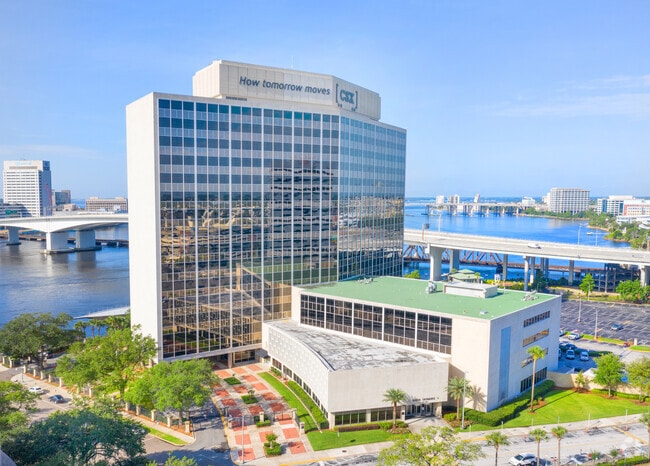

Property Detail
500 Water St
088958-0010
56-2S-26E FRANCIS J ROSS GRANT PT FAIRBANKS MILL PROPERTY N & E OF LOT 1 OF FAIRBANKS S/D BROOKLYN, PT UNSURVEYED SEC 14-2S-26E RECD O/R BK 3214-1109, JAX & LAVILLA HARTS MAP PT WATER LOTS 33,34 RECD O/R BK 4231-1168,PT CL ST RECD O/R 4231-1181(EX R/
Officebuilding
Duval
CCBD
Florida
AE The base floodplain where base flood elevations are provided. AE Zones are now used on new format FIRMs instead of A1-A30 Zones.
1
2025
5.97 AC
2026
Downtown Northbank
017200
Jacksonville (Florida)
125,571 SF
Jacksonville, FL
NEARBY LISTINGS FOR SALE OR LEASE
DEMOGRAPHICS near 500 Water St
1 mile
3 mile
5 mile
2025 Total Population
10,706
95,069
223,081
2030 Population
11,543
102,741
238,669
Pop Growth 2025-2030
+ 7.82%
+ 8.07%
+ 6.99%
Average Age
44
39
39
2025 Total Households
4,949
41,286
93,505
HH Growth 2025-2030
+ 9.70%
+ 8.58%
+ 7.39%
Median Household Inc
$46,514
$43,294
$48,232
Avg Household Size
1.40
2.10
2.30
2025 Avg HH Vehicles
1.00
1.00
1.00
Median Home Value
$446,470
$274,579
$248,910
Median Year Built
1990
1960
1961
Nearby Places
Map Layers
Map Styles
 Street
 Aerial
Layers
 Traffic
 Biking
Places
Listings with unknown addresses are not visible on the map
- Restaurants
- Banks
- Shops
- Fitness
- Groceries
PUBLIC TRANSPORTATION
COMMUTER RAIL
Drive
Walk
Distance
13 min
6.5 mi
AIRPORT
Jacksonville International
Drive
Walk
Distance
Jacksonville International
24 min
15.1 mi
Nearby Properties
Address
Land Use
TOTAL SIZE
Lot Size
Zoning
Address
Land Use
TOTAL SIZE
Lot Size
Zoning
1,086,885 SF
16.34 AC
CCBD
Address
Land Use
TOTAL SIZE
Lot Size
Zoning
543,383 SF
7.87 AC
CCBD
Address
Land Use
TOTAL SIZE
Lot Size
Zoning
1,150,143 SF
43.90 AC
CCBD
Address
Land Use
TOTAL SIZE
Lot Size
Zoning
629,459 SF
10.33 AC
PUD
Address
Land Use
TOTAL SIZE
Lot Size
Zoning
705,940 SF
25.12 AC
PBF-1
Address
Land Use
TOTAL SIZE
Lot Size
Zoning
442,972 SF
5.33 AC
PUD
Address
Land Use
TOTAL SIZE
Lot Size
Zoning
165,408 SF
2.45 AC
CCBD
Address
Land Use
TOTAL SIZE
Lot Size
Zoning
407,122 SF
4.50 AC
CCBD
Address
Land Use
TOTAL SIZE
Lot Size
Zoning
521,850 SF
10.06 AC
CCBD
Address
Land Use
TOTAL SIZE
Lot Size
Zoning
831,560 SF
1.16 AC
PUD
Address
Land Use
TOTAL SIZE
Lot Size
Zoning
187,278 SF
1.71 AC
CCBD
Address
Land Use
TOTAL SIZE
Lot Size
Zoning
257,667 SF
3.91 AC
CCBD
Address
Land Use
TOTAL SIZE
Lot Size
Zoning
127,732 SF
1.44 AC
CCBD
Address
Land Use
TOTAL SIZE
Lot Size
Zoning
224,600 SF
3.41 AC
PUD
Address
Land Use
TOTAL SIZE
Lot Size
Zoning
313,472 SF
35.44 AC
CCBD
Address
Land Use
TOTAL SIZE
Lot Size
Zoning
355,967 SF
8.98 AC
PUD
Address
Land Use
TOTAL SIZE
Lot Size
Zoning
700,443 SF
8 AC
CCBD
Address
Land Use
TOTAL SIZE
Lot Size
Zoning
264,277 SF
2.07 AC
CCBD
Address
Land Use
TOTAL SIZE
Lot Size
Zoning
503,858 SF
1.32 AC
CCBD
Address
Land Use
TOTAL SIZE
Lot Size
Zoning
369,638 SF
6.30 AC
CCBD
Address
Land Use
TOTAL SIZE
Lot Size
Zoning
448,709 SF
2.97 AC
CCBD
Address
Land Use
TOTAL SIZE
Lot Size
Zoning
326,485 SF
1.56 AC
CCBD
Address
Land Use
TOTAL SIZE
Lot Size
Zoning
453,728 SF
8.20 AC
CCBD
Address
Land Use
TOTAL SIZE
Lot Size
Zoning
194,877 SF
11.64 AC
CCBD
Address
Land Use
TOTAL SIZE
Lot Size
Zoning
299,055 SF
18.93 AC
CCBD
Address
Land Use
TOTAL SIZE
Lot Size
Zoning
336,623 SF
2.06 AC
CCBD
Address
Land Use
TOTAL SIZE
Lot Size
Zoning
290,975 SF
4.49 AC
PUD
Address
Land Use
TOTAL SIZE
Lot Size
Zoning
253,858 SF
4.93 AC
PUD
Address
Land Use
TOTAL SIZE
Lot Size
Zoning
212,152 SF
8.17 AC
CCBD
Address
Land Use
TOTAL SIZE
Lot Size
Zoning
146,636 SF
2.88 AC
CCBD
The World's #1 Commercial Real Estate Marketplace
Connect with us
© 2026 CoStar Group
The information above has been obtained from sources believed reliable. While we do not doubt its accuracy we have not verified it and make no guarantee, warranty or representation about it. It is your responsibility to independently confirm its accuracy and completeness. Any projections, opinions, assumptions, or estimates used are for example only and do not represent the current or future performance of the property. The value of this transaction to you depends on tax and other factors which should be evaluated by your tax, financial, and legal advisors. You and your advisors should conduct a careful, independent investigation of the property to determine to your satisfaction the suitability of the property for your needs.