Property Record
5000 Long Prairie Rd, Flower Mound, TX 75028
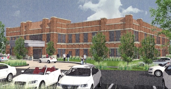

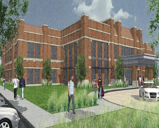
Property Detail
5000 Long Prairie Rd
Dallas-Fort Worth-Arlington, TX
ORTHOPEDIC ASSOCIATES OF FLOWER MOUND ADDN BLK A LOT 1
R199388
Denton
Commercialnec
Texas
B and X Area of moderate flood hazard, usually the area between the limits of the 100-year and 500-year floods.
1
2024
5 AC
2025
Lewisville
021759
Dallas/Ft Worth
46,602 SF
NEARBY LISTINGS FOR SALE OR LEASE
DEMOGRAPHICS near 5000 Long Prairie Rd
1 mile
3 mile
5 mile
2025 Total Population
10,883
98,003
192,532
2030 Population
12,232
108,923
214,698
Pop Growth 2025-2030
+ 12.40%
+ 11.14%
+ 11.51%
Average Age
42
41
40
2025 Total Households
3,876
34,262
66,807
HH Growth 2025-2030
+ 12.64%
+ 11.43%
+ 11.80%
Median Household Inc
$158,279
$146,636
$129,366
Avg Household Size
2.70
2.80
2.80
2025 Avg HH Vehicles
2.00
2.00
2.00
Median Home Value
$610,885
$532,472
$496,456
Median Year Built
1996
1995
1995
Nearby Places
Map Layers
Map Styles
 Street
 Aerial
Layers
 Traffic
 Biking
Places
Listings with unknown addresses are not visible on the map
- Restaurants
- Banks
- Shops
- Fitness
- Groceries
PUBLIC TRANSPORTATION
COMMUTER RAIL
Drive
Walk
Distance
11 min
5.5 mi
Drive
Walk
Distance
13 min
6.0 mi
AIRPORT
Dallas-Fort Worth International
Drive
Walk
Distance
Dallas-Fort Worth International
21 min
12.7 mi
Dallas Love Field
Drive
Walk
Distance
Dallas Love Field
38 min
25.5 mi
SALE & LEASE HISTORY
LISTING DATE
SALE/LEASE

Feb 02, 2021
For Lease
Nearby Properties
Address
Land Use
TOTAL SIZE
Lot Size
Zoning
Address
Land Use
TOTAL SIZE
Lot Size
Zoning
478,148 SF
57.44 AC
Address
Land Use
TOTAL SIZE
Lot Size
Zoning
428,117 SF
67.02 AC
Address
Land Use
TOTAL SIZE
Lot Size
Zoning
397,866 SF
43.19 AC
Address
Land Use
TOTAL SIZE
Lot Size
Zoning
309,498 SF
9.57 AC
Address
Land Use
TOTAL SIZE
Lot Size
Zoning
282,766 SF
9 AC
Address
Land Use
TOTAL SIZE
Lot Size
Zoning
231,043 SF
11.89 AC
Address
Land Use
TOTAL SIZE
Lot Size
Zoning
340,081 SF
18.06 AC
6
Address
Land Use
TOTAL SIZE
Lot Size
Zoning
226,888 SF
5.62 AC
Address
Land Use
TOTAL SIZE
Lot Size
Zoning
302,183 SF
15.50 AC
7G
Address
Land Use
TOTAL SIZE
Lot Size
Zoning
262,035 SF
10.88 AC
Address
Land Use
TOTAL SIZE
Lot Size
Zoning
212,454 SF
13 AC
6B
Address
Land Use
TOTAL SIZE
Lot Size
Zoning
244,310 SF
6.24 AC
Address
Land Use
TOTAL SIZE
Lot Size
Zoning
199,049 SF
28.96 AC
Address
Land Use
TOTAL SIZE
Lot Size
Zoning
241,095 SF
13.02 AC
Address
Land Use
TOTAL SIZE
Lot Size
Zoning
221,320 SF
12.79 AC
6B
Address
Land Use
TOTAL SIZE
Lot Size
Zoning
240,886 SF
6.65 AC
Address
Land Use
TOTAL SIZE
Lot Size
Zoning
208,268 SF
11.23 AC
6G
Address
Land Use
TOTAL SIZE
Lot Size
Zoning
87,600 SF
12.12 AC
Address
Land Use
TOTAL SIZE
Lot Size
Zoning
154,756 SF
15.12 AC
7G
Address
Land Use
TOTAL SIZE
Lot Size
Zoning
148,458 SF
14.69 AC
Address
Land Use
TOTAL SIZE
Lot Size
Zoning
135,394 SF
14.48 AC
Address
Land Use
TOTAL SIZE
Lot Size
Zoning
179,120 SF
7.66 AC
6G
Address
Land Use
TOTAL SIZE
Lot Size
Zoning
168,897 SF
11.62 AC
7G
Address
Land Use
TOTAL SIZE
Lot Size
Zoning
145,758 SF
17.25 AC
Address
Land Use
TOTAL SIZE
Lot Size
Zoning
80,396 SF
8.72 AC
Address
Land Use
TOTAL SIZE
Lot Size
Zoning
169,188 SF
10.17 AC
Address
Land Use
TOTAL SIZE
Lot Size
Zoning
130,986 SF
7.32 AC
6A
Address
Land Use
TOTAL SIZE
Lot Size
Zoning
166,437 SF
4.38 AC
Address
Land Use
TOTAL SIZE
Lot Size
Zoning
89,332 SF
11.57 AC
Address
Land Use
TOTAL SIZE
Lot Size
Zoning
90,007 SF
14.13 AC
The World's #1 Commercial Real Estate Marketplace
Connect with us
© 2026 CoStar Group
The information above has been obtained from sources believed reliable. While we do not doubt its accuracy we have not verified it and make no guarantee, warranty or representation about it. It is your responsibility to independently confirm its accuracy and completeness. Any projections, opinions, assumptions, or estimates used are for example only and do not represent the current or future performance of the property. The value of this transaction to you depends on tax and other factors which should be evaluated by your tax, financial, and legal advisors. You and your advisors should conduct a careful, independent investigation of the property to determine to your satisfaction the suitability of the property for your needs.