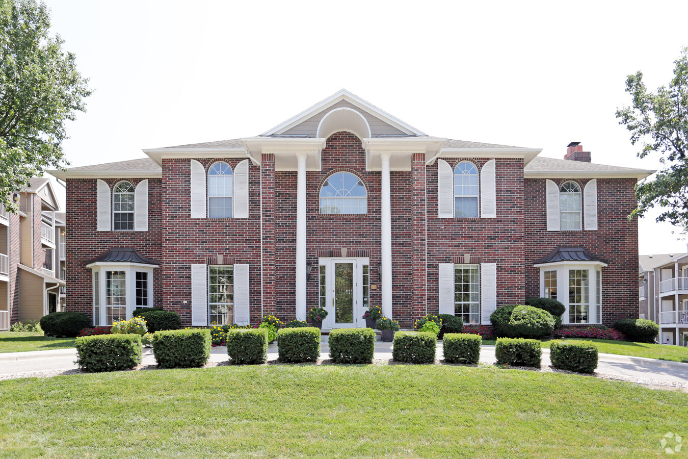
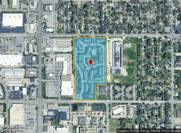
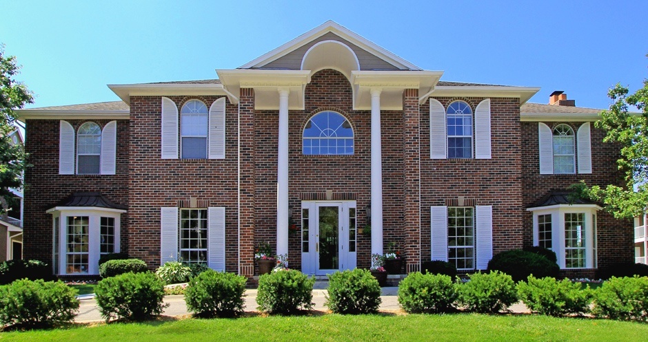
Property Record
5000 R St, Lincoln, NE 68504
NEARBY LISTINGS FOR SALE OR LEASE
Property Detail
5000 R St
Lincoln, NE
Millers
17-20-401-002-000
MILLERS (J G) SUBDIVISION - S1/2 20-10-7, LOT 3, & LOT 14 EX W36 & EX TRACT IN SE CORNER (BEING S315.06 & BEING 223.70 ON N & 224.97 ON S)
Commercialnec
Lancaster
X
Nebraska
31109C0310F
3,14
2023
17.06 AC
2023
Culler
001002
Lincoln
37,240 SF
DEMOGRAPHICS near 5000 R St
1 Mile
3 Mile
5 Mile
2024 Total Population
14,200
121,663
221,608
2029 Population
14,798
126,235
229,808
Pop Growth 2024-2029
+ 4.21%
+ 3.76%
+ 3.70%
Average Age
37
38
38
2024 Total Households
6,387
52,105
93,983
HH Growth 2024-2029
+ 4.34%
+ 3.98%
+ 3.86%
Median Household Inc
$52,016
$54,305
$57,781
Avg Household Size
2.10
2.20
2.20
2024 Avg HH Vehicles
2.00
2.00
2.00
Median Home Value
$158,555
$183,320
$209,507
Median Year Built
1969
1966
1974
Nearby Places
- Restaurants
- Banks
- Shops
- Fitness
- Groceries
PUBLIC TRANSPORTATION
COMMUTER RAIL
Lincoln Amtrak Station (California Zephyr - Amtrak)
DRIVE
WALK
Distance
Lincoln Amtrak Station (California Zephyr - Amtrak)
8 min
3.8 mi
AIRPORT
Lincoln
DRIVE
WALK
Distance
Lincoln
15 min
7.9 mi
Freight Ports
Tulsa Port Of Catoosa
DRIVE
WALK
Distance
Tulsa Port Of Catoosa
469 min
391.2 mi
Nearby Properties
Address
Land Use
TOTAL SIZE
Lot Size
Zoning
Address
Land Use
TOTAL SIZE
Lot Size
Zoning
604,749 SF
20.55 AC
R2
Address
Land Use
TOTAL SIZE
Lot Size
Zoning
364,797 SF
25.06 AC
R1
Address
Land Use
TOTAL SIZE
Lot Size
Zoning
413,484 SF
44.25 AC
R6
Address
Land Use
TOTAL SIZE
Lot Size
Zoning
131,328 SF
2.07 AC
P
Address
Land Use
TOTAL SIZE
Lot Size
Zoning
148,760 SF
4.99 AC
R4
Address
Land Use
TOTAL SIZE
Lot Size
Zoning
182,668 SF
2.07 AC
B4
Address
Land Use
TOTAL SIZE
Lot Size
Zoning
92,054 SF
6.22 AC
R5
Address
Land Use
TOTAL SIZE
Lot Size
Zoning
47,866 SF
10.39 AC
R3
Address
Land Use
TOTAL SIZE
Lot Size
Zoning
63,393 SF
11.10 AC
R5
Address
Land Use
TOTAL SIZE
Lot Size
Zoning
179,447 SF
7.85 AC
R6
Address
Land Use
TOTAL SIZE
Lot Size
Zoning
287,193 SF
6.62 AC
B4
Address
Land Use
TOTAL SIZE
Lot Size
Zoning
71,046 SF
23.72 AC
R5
Address
Land Use
TOTAL SIZE
Lot Size
Zoning
217,115 SF
0.89 AC
B4
Address
Land Use
TOTAL SIZE
Lot Size
Zoning
36,751 SF
1.80 AC
B5
Address
Land Use
TOTAL SIZE
Lot Size
Zoning
189,854 SF
2.07 AC
P
Address
Land Use
TOTAL SIZE
Lot Size
Zoning
189,948 SF
13.56 AC
R2
Address
Land Use
TOTAL SIZE
Lot Size
Zoning
43,276 SF
4.60 AC
R2
Address
Land Use
TOTAL SIZE
Lot Size
Zoning
225,199 SF
31.18 AC
O3
Address
Land Use
TOTAL SIZE
Lot Size
Zoning
62,499 SF
5.77 AC
R4
Address
Land Use
TOTAL SIZE
Lot Size
Zoning
53,419 SF
0.43 AC
B4
Address
Land Use
TOTAL SIZE
Lot Size
Zoning
119,655 SF
2.28 AC
B4
Address
Land Use
TOTAL SIZE
Lot Size
Zoning
65,064 SF
1.39 AC
R6
Address
Land Use
TOTAL SIZE
Lot Size
Zoning
23,881 SF
0.80 AC
B4
Address
Land Use
TOTAL SIZE
Lot Size
Zoning
63,003 SF
1.22 AC
O3
Address
Land Use
TOTAL SIZE
Lot Size
Zoning
214,823 SF
19.37 AC
B5
Address
Land Use
TOTAL SIZE
Lot Size
Zoning
192,751 SF
18.49 AC
B5
Address
Land Use
TOTAL SIZE
Lot Size
Zoning
92,505 SF
2.96 AC
B4
Address
Land Use
TOTAL SIZE
Lot Size
Zoning
73,737 SF
5.98 AC
B2
Address
Land Use
TOTAL SIZE
Lot Size
Zoning
182,451 SF
2.07 AC
B4
The World's #1 Commercial Real Estate Marketplace
Connect with us
© 2025 CoStar Group
The information above has been obtained from sources believed reliable. While we do not doubt its accuracy we have not verified it and make no guarantee, warranty or representation about it. It is your responsibility to independently confirm its accuracy and completeness. Any projections, opinions, assumptions, or estimates used are for example only and do not represent the current or future performance of the property. The value of this transaction to you depends on tax and other factors which should be evaluated by your tax, financial, and legal advisors. You and your advisors should conduct a careful, independent investigation of the property to determine to your satisfaction the suitability of the property for your needs.