Property Record
5000L S Broad St, Philadelphia, PA 19112


NEARBY LISTINGS FOR SALE OR LEASE
Property Detail
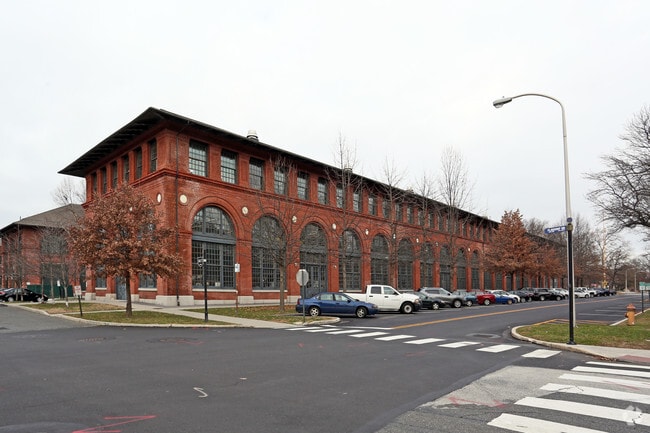
5000L S Broad St
788008310
SWC S BROAD ST
Warehouse
Philadelphia
AE
Pennsylvania
34015C0018F
1.50 AC
0
Navy Yard
2026
Philadelphia
989200
Philadelphia-Camden-Wilmington, PA-NJ-DE-MD
49,600 SF
DEMOGRAPHICS near 5000L S Broad St
1 Mile
3 Mile
5 Mile
2024 Total Population
41
113,251
508,033
2029 Population
43
109,679
499,225
Pop Growth 2024-2029
+ 4.88%
(3.15%)
(1.73%)
Average Age
43
39
38
2024 Total Households
15
45,642
218,917
HH Growth 2024-2029
+ 6.67%
(3.44%)
(2.09%)
Median Household Inc
$120,833
$66,686
$66,165
Avg Household Size
2.60
2.40
2.20
2024 Avg HH Vehicles
2.00
1.00
1.00
Median Home Value
$199,999
$258,338
$263,506
Median Year Built
1958
1947
1949
Nearby Places
Map Layers
Map Styles
 Street
 Aerial
- Restaurants
- Banks
- Shops
- Fitness
- Groceries
PUBLIC TRANSPORTATION
COMMUTER RAIL
DRIVE
WALK
Distance
11 min
5.4 mi
Eastwick (R1 - Southeastern Pennsylvania Transportation Authority Regional Rail (SEPTA Regional Rail))
DRIVE
WALK
Distance
Eastwick (R1 - Southeastern Pennsylvania Transportation Authority Regional Rail (SEPTA Regional Rail))
12 min
5.5 mi
AIRPORT
Philadelphia International
DRIVE
WALK
Distance
Philadelphia International
16 min
7.6 mi
Trenton Mercer
DRIVE
WALK
Distance
Trenton Mercer
56 min
38.0 mi
Freight Ports
Broadway Terminal - Pier 5
DRIVE
WALK
Distance
Broadway Terminal - Pier 5
13 min
6.7 mi
Nearby Properties
Address
Land Use
TOTAL SIZE
Lot Size
Zoning
Address
Land Use
TOTAL SIZE
Lot Size
Zoning
608,400 SF
43.23 AC
SPSTA
Address
Land Use
TOTAL SIZE
Lot Size
Zoning
11,513 SF
19.92 AC
SPSTA
Address
Land Use
TOTAL SIZE
Lot Size
Zoning
159,630 SF
9.15 AC
SPENT
Address
Land Use
TOTAL SIZE
Lot Size
Zoning
678,227 SF
850.40 AC
SPAIR
Address
Land Use
TOTAL SIZE
Lot Size
Zoning
217,168 SF
54.93 AC
SPSTA
Address
Land Use
TOTAL SIZE
Lot Size
Zoning
28,089 SF
90.46 AC
SPPOA
Address
Land Use
TOTAL SIZE
Lot Size
Zoning
685,000 SF
47.69 AC
CMX3
Address
Land Use
TOTAL SIZE
Lot Size
Zoning
80,064 SF
51.52 AC
I3
Address
Land Use
TOTAL SIZE
Lot Size
Zoning
387,472 SF
4.61 AC
I3
Address
Land Use
TOTAL SIZE
Lot Size
Zoning
727,272 SF
16.70 AC
I3
Address
Land Use
TOTAL SIZE
Lot Size
Zoning
338,277 SF
114.75 AC
I3
Address
Land Use
TOTAL SIZE
Lot Size
Zoning
257.31 AC
I3
Address
Land Use
TOTAL SIZE
Lot Size
Zoning
10,080 SF
3.10 AC
I3
Address
Land Use
TOTAL SIZE
Lot Size
Zoning
141.90 AC
I3
Address
Land Use
TOTAL SIZE
Lot Size
Zoning
236,800 SF
5.04 AC
CMX3
Address
Land Use
TOTAL SIZE
Lot Size
Zoning
513,963 SF
3.41 AC
CMX3
Address
Land Use
TOTAL SIZE
Lot Size
Zoning
810.21 AC
0108
Address
Land Use
TOTAL SIZE
Lot Size
Zoning
124.50 AC
I3
Address
Land Use
TOTAL SIZE
Lot Size
Zoning
335,340 SF
23.83 AC
I2
Address
Land Use
TOTAL SIZE
Lot Size
Zoning
3.85 AC
CMX3
Address
Land Use
TOTAL SIZE
Lot Size
Zoning
83.63 AC
I3
Address
Land Use
TOTAL SIZE
Lot Size
Zoning
47.20 AC
I3
Address
Land Use
TOTAL SIZE
Lot Size
Zoning
44.20 AC
I1
Address
Land Use
TOTAL SIZE
Lot Size
Zoning
272,918 SF
23.03 AC
CA2
Address
Land Use
TOTAL SIZE
Lot Size
Zoning
Address
Land Use
TOTAL SIZE
Lot Size
Zoning
79,400 SF
3.05 AC
CMX3
Address
Land Use
TOTAL SIZE
Lot Size
Zoning
106,200 SF
3.87 AC
CMX3
Address
Land Use
TOTAL SIZE
Lot Size
Zoning
315,375 SF
20.41 AC
CMX3
Address
Land Use
TOTAL SIZE
Lot Size
Zoning
80,052 SF
4.41 AC
CMX3
Address
Land Use
TOTAL SIZE
Lot Size
Zoning
383,255 SF
4.36 AC
IRMX
The World's #1 Commercial Real Estate Marketplace
Connect with us
© 2025 CoStar Group
The information above has been obtained from sources believed reliable. While we do not doubt its accuracy we have not verified it and make no guarantee, warranty or representation about it. It is your responsibility to independently confirm its accuracy and completeness. Any projections, opinions, assumptions, or estimates used are for example only and do not represent the current or future performance of the property. The value of this transaction to you depends on tax and other factors which should be evaluated by your tax, financial, and legal advisors. You and your advisors should conduct a careful, independent investigation of the property to determine to your satisfaction the suitability of the property for your needs.