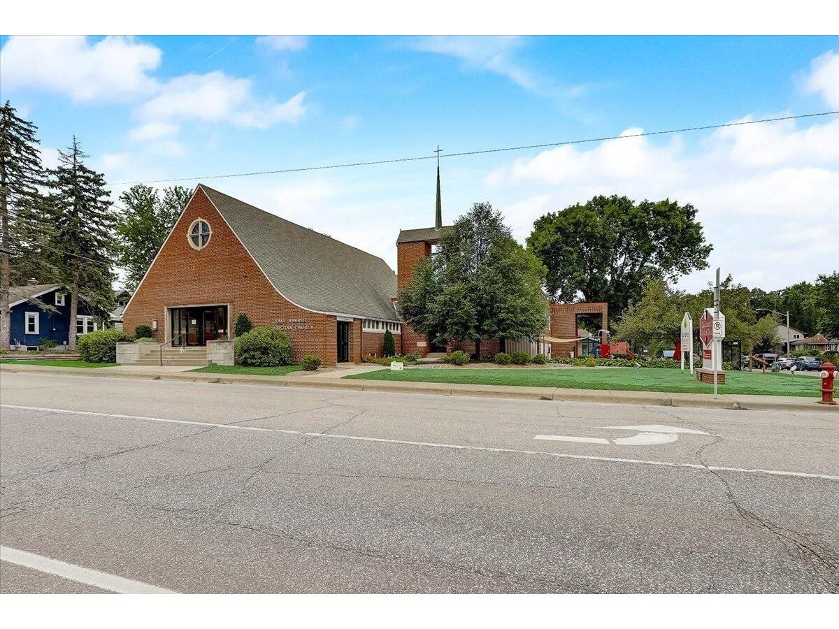
Property Record
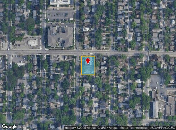
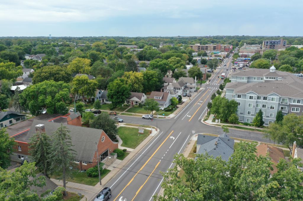
5009 Beard Ave S, Minneapolis, MN 55410

NEARBY LISTINGS FOR SALE OR LEASE
Property Detail
5009 Beard Ave S
Minneapolis-St. Paul-Bloomington, MN-WI
Steeles Lake Harriet Park Add To Mpls
17-028-24-31-0204
BLOCK 009 A STEELES LAKE HARRIET PARK ADD TO MPLS LOTS 25 THRU 28 INCL 177.90 X 127.10
Apartment
Hennepin
X
Minnesota
27053C0362F
25-28
2024
0.52 AC
2023
I-494 Corridor
111200
Minneapolis/St Paul
7,958 SF
DEMOGRAPHICS near 5009 Beard Ave S
1 Mile
3 Mile
5 Mile
2024 Total Population
19,204
145,108
396,667
2029 Population
18,843
142,712
390,715
Pop Growth 2024-2029
(1.88%)
(1.65%)
(1.50%)
Average Age
41
40
39
2024 Total Households
7,493
64,922
179,128
HH Growth 2024-2029
(2.04%)
(1.61%)
(1.48%)
Median Household Inc
$156,678
$102,306
$80,493
Avg Household Size
2.50
2.20
2.10
2024 Avg HH Vehicles
2.00
2.00
2.00
Median Home Value
$671,964
$453,579
$367,130
Median Year Built
1947
1955
1958
Nearby Places
- Restaurants
- Banks
- Shops
- Fitness
- Groceries
PUBLIC TRANSPORTATION
COMMUTER RAIL
Target Field Station (Northstar Corridor - Northstar Commuter Rail)
DRIVE
WALK
Distance
Target Field Station (Northstar Corridor - Northstar Commuter Rail)
15 min
9.3 mi
AIRPORT
Minneapolis-St Paul International/Wold-Chamberlain
DRIVE
WALK
Distance
Minneapolis-St Paul International/Wold-Chamberlain
18 min
10.3 mi
Freight Ports
Port Milwaukee
DRIVE
WALK
Distance
Port Milwaukee
384 min
344.4 mi
SALE & LEASE HISTORY
LISTING DATE
SALE/LEASE

Sep 25, 2024
For Sale
Nov 13, 2023
For Lease
Mar 06, 2023
For Lease
Nearby Properties
Address
Land Use
TOTAL SIZE
Lot Size
Zoning
Address
Land Use
TOTAL SIZE
Lot Size
Zoning
364,730 SF
13.40 AC
PCD3
Address
Land Use
TOTAL SIZE
Lot Size
Zoning
45.77 AC
Address
Land Use
TOTAL SIZE
Lot Size
Zoning
12,308 SF
1.25 AC
PCD3
Address
Land Use
TOTAL SIZE
Lot Size
Zoning
451,860 SF
2.40 AC
C3A
Address
Land Use
TOTAL SIZE
Lot Size
Zoning
659,076 SF
1.45 AC
C3A
Address
Land Use
TOTAL SIZE
Lot Size
Zoning
79,717 SF
4.62 AC
Address
Land Use
TOTAL SIZE
Lot Size
Zoning
1.50 AC
Address
Land Use
TOTAL SIZE
Lot Size
Zoning
313,009 SF
1.61 AC
OR2
Address
Land Use
TOTAL SIZE
Lot Size
Zoning
3.51 AC
Address
Land Use
TOTAL SIZE
Lot Size
Zoning
1.74 AC
Address
Land Use
TOTAL SIZE
Lot Size
Zoning
50,484 SF
5.12 AC
Address
Land Use
TOTAL SIZE
Lot Size
Zoning
94,827 SF
5.86 AC
RMD
Address
Land Use
TOTAL SIZE
Lot Size
Zoning
4,497,396 SF
11.05 AC
Address
Land Use
TOTAL SIZE
Lot Size
Zoning
7,614 SF
2.01 AC
PCD3
Address
Land Use
TOTAL SIZE
Lot Size
Zoning
31,646 SF
5.85 AC
Address
Land Use
TOTAL SIZE
Lot Size
Zoning
8.80 AC
Address
Land Use
TOTAL SIZE
Lot Size
Zoning
390,060 SF
3.11 AC
Address
Land Use
TOTAL SIZE
Lot Size
Zoning
398,595 SF
1.91 AC
Address
Land Use
TOTAL SIZE
Lot Size
Zoning
288,096 SF
10.19 AC
Address
Land Use
TOTAL SIZE
Lot Size
Zoning
406,842 SF
1.59 AC
Address
Land Use
TOTAL SIZE
Lot Size
Zoning
295,036 SF
1.82 AC
R6
Address
Land Use
TOTAL SIZE
Lot Size
Zoning
524,556 SF
4.56 AC
Address
Land Use
TOTAL SIZE
Lot Size
Zoning
379,488 SF
2.68 AC
Address
Land Use
TOTAL SIZE
Lot Size
Zoning
21.69 AC
Address
Land Use
TOTAL SIZE
Lot Size
Zoning
263,948 SF
2.73 AC
R6
Address
Land Use
TOTAL SIZE
Lot Size
Zoning
340,330 SF
2.22 AC
Address
Land Use
TOTAL SIZE
Lot Size
Zoning
244,941 SF
5.24 AC
Address
Land Use
TOTAL SIZE
Lot Size
Zoning
21,740 SF
3.60 AC
Address
Land Use
TOTAL SIZE
Lot Size
Zoning
239,539 SF
1.29 AC
OR2
Address
Land Use
TOTAL SIZE
Lot Size
Zoning
127,084 SF
17.21 AC
The World's #1 Commercial Real Estate Marketplace
Connect with us
© 2025 CoStar Group
The information above has been obtained from sources believed reliable. While we do not doubt its accuracy we have not verified it and make no guarantee, warranty or representation about it. It is your responsibility to independently confirm its accuracy and completeness. Any projections, opinions, assumptions, or estimates used are for example only and do not represent the current or future performance of the property. The value of this transaction to you depends on tax and other factors which should be evaluated by your tax, financial, and legal advisors. You and your advisors should conduct a careful, independent investigation of the property to determine to your satisfaction the suitability of the property for your needs.