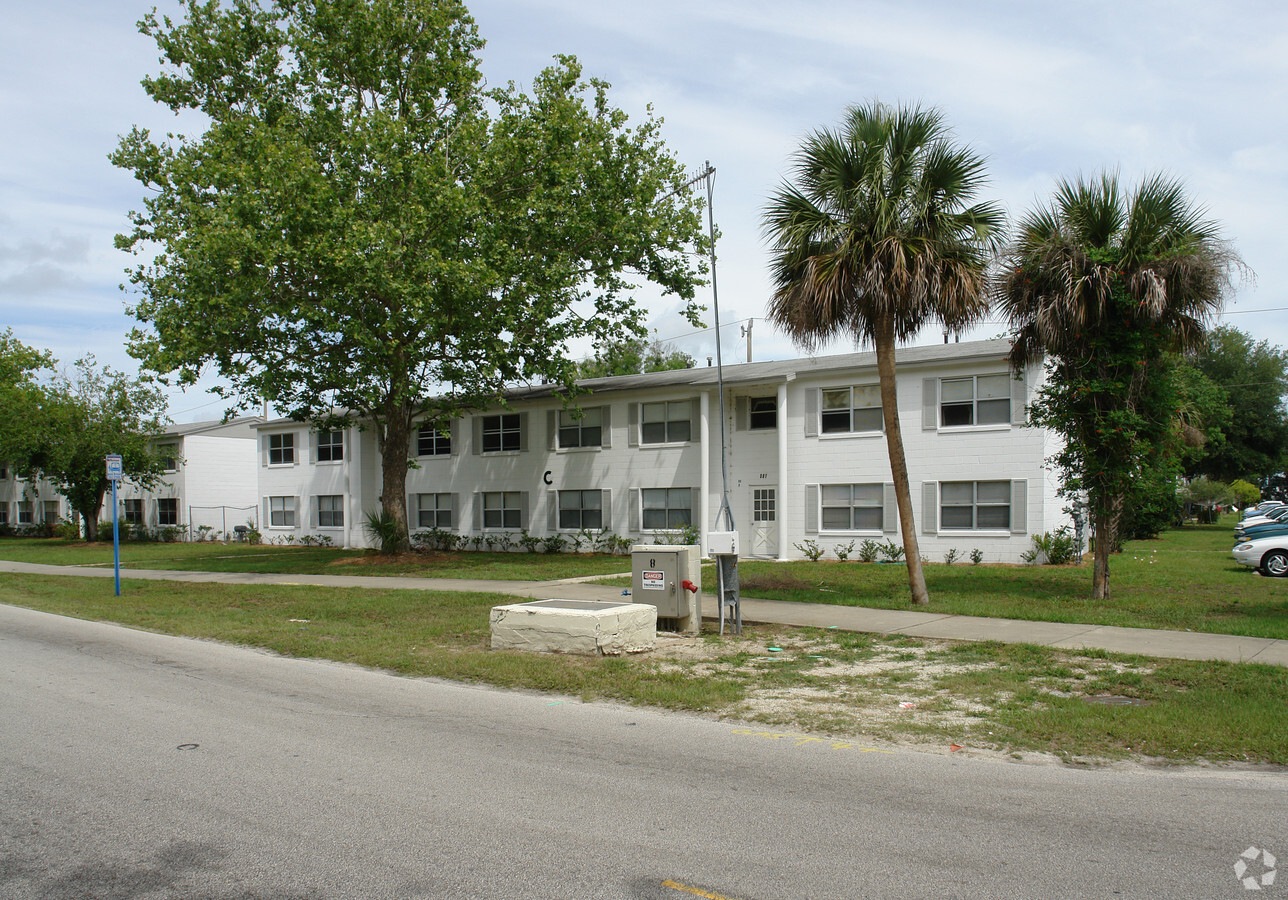
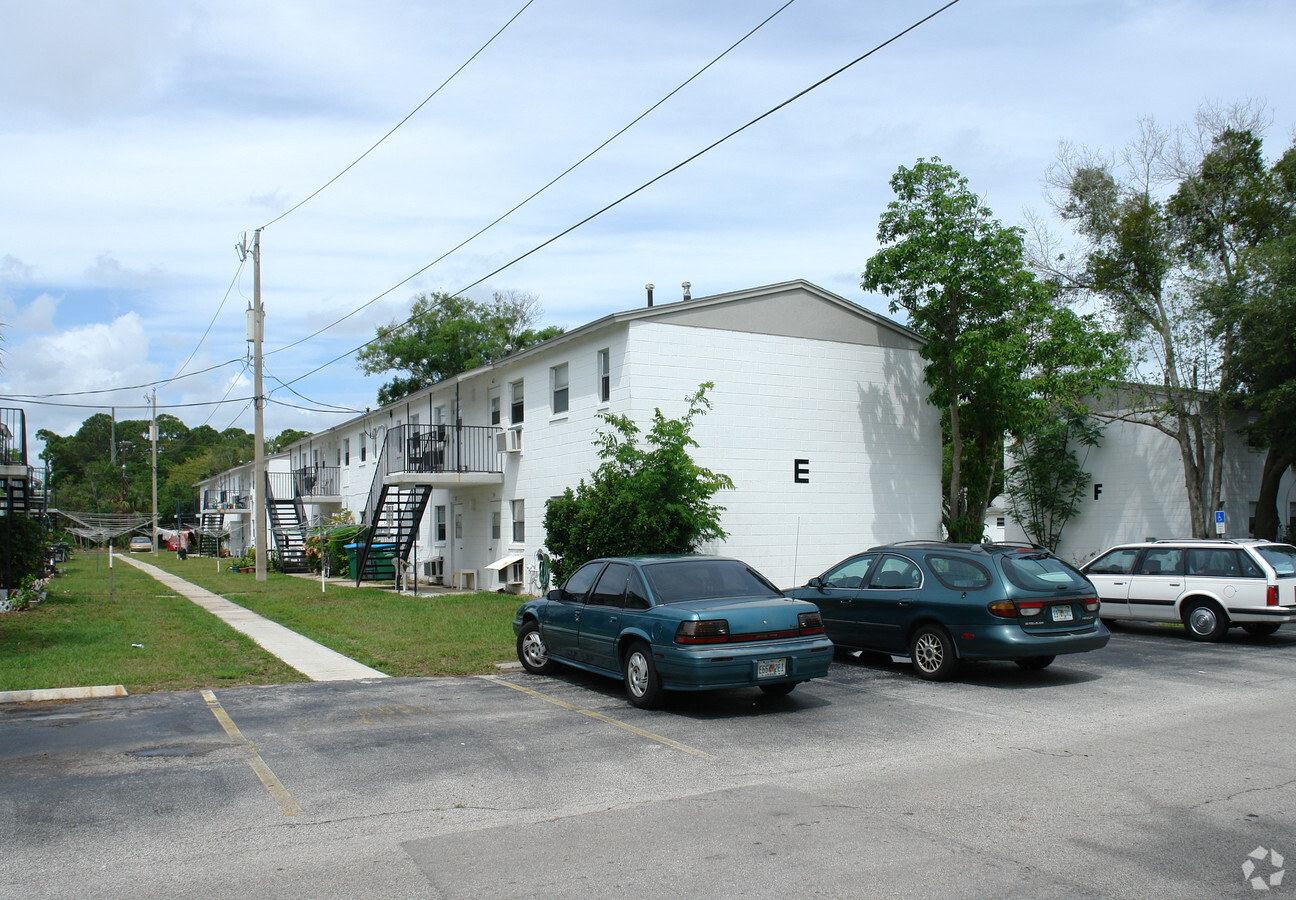
Property Record
501 10Th St, New Smyrna Beach, FL 32168
NEARBY LISTINGS FOR SALE OR LEASE
Property Detail
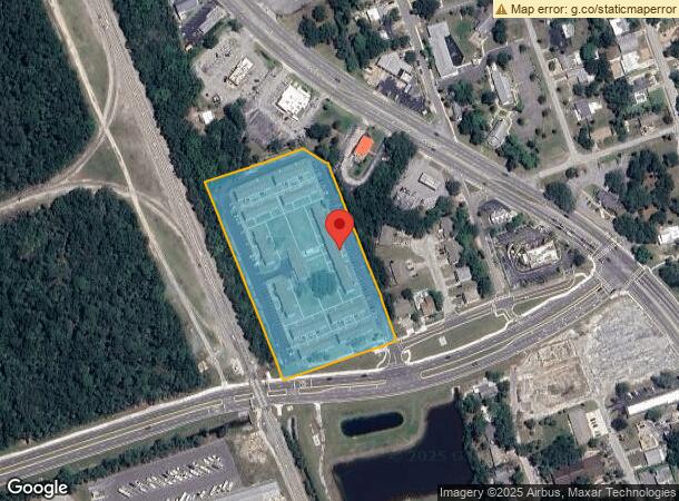
501 10Th St
Deltona-Daytona Beach-Ormond Beach, FL
Edson Ridge Sub
7449-04-07-0010
LOTS 1 THRU 10 INC BLK 7 & LOTS 1 THRU 10 INC BLK 8 EDSON RIDGE SUB NO 2 MB 19 PG 96 & VACATED ORANGE ST & CYPRESS ST S OF 8TH ST & THAT PART OF 8TH ST W OF ORANGE ST PER OR 271 PG 188 PER OR 2467 PG 1149
Multifamilydwelling
Volusia
AE
Florida
12127C0543J
1-10
2023
2.01 AC
2024
Outer SE Volusia County
082802
Deltona/Daytona Beach
70,283 SF
DEMOGRAPHICS near 501 10Th St
1 Mile
3 Mile
5 Mile
2024 Total Population
3,619
35,913
63,598
2029 Population
3,994
40,681
72,039
Pop Growth 2024-2029
+ 10.36%
+ 13.28%
+ 13.27%
Average Age
45
50
50
2024 Total Households
1,369
16,921
29,488
HH Growth 2024-2029
+ 10.52%
+ 13.75%
+ 13.72%
Median Household Inc
$45,618
$57,487
$59,970
Avg Household Size
2.10
2.00
2.10
2024 Avg HH Vehicles
2.00
2.00
2.00
Median Home Value
$280,593
$278,949
$274,776
Median Year Built
1959
1982
1985
Nearby Places
- Restaurants
- Banks
- Shops
- Fitness
- Groceries
PUBLIC TRANSPORTATION
AIRPORT
Daytona Beach International
DRIVE
WALK
Distance
Daytona Beach International
30 min
19.9 mi
Orlando Sanford International
DRIVE
WALK
Distance
Orlando Sanford International
51 min
33.7 mi
Freight Ports
Port Canaveral
DRIVE
WALK
Distance
Port Canaveral
72 min
58.5 mi
Nearby Properties
Address
Land Use
TOTAL SIZE
Lot Size
Zoning
Address
Land Use
TOTAL SIZE
Lot Size
Zoning
360,394 SF
65.63 AC
01R4
Address
Land Use
TOTAL SIZE
Lot Size
Zoning
177,619 SF
6.91 AC
10R2
Address
Land Use
TOTAL SIZE
Lot Size
Zoning
108,577 SF
20 AC
10R2
Address
Land Use
TOTAL SIZE
Lot Size
Zoning
209,027 SF
29.13 AC
10R2A
Address
Land Use
TOTAL SIZE
Lot Size
Zoning
115,562 SF
1.40 AC
10B4
Address
Land Use
TOTAL SIZE
Lot Size
Zoning
68,493 SF
1.89 AC
10B6
Address
Land Use
TOTAL SIZE
Lot Size
Zoning
70,564 SF
2.09 AC
10B1
Address
Land Use
TOTAL SIZE
Lot Size
Zoning
150,044 SF
19.80 AC
R4
Address
Land Use
TOTAL SIZE
Lot Size
Zoning
134,246 SF
13.58 AC
10B5
Address
Land Use
TOTAL SIZE
Lot Size
Zoning
0.20 AC
B46
Address
Land Use
TOTAL SIZE
Lot Size
Zoning
94,001 SF
1.49 AC
10B4
Address
Land Use
TOTAL SIZE
Lot Size
Zoning
23,142 SF
7.98 AC
R
Address
Land Use
TOTAL SIZE
Lot Size
Zoning
7,345 SF
0.43 AC
MH1
Address
Land Use
TOTAL SIZE
Lot Size
Zoning
Address
Land Use
TOTAL SIZE
Lot Size
Zoning
160.14 AC
CW
Address
Land Use
TOTAL SIZE
Lot Size
Zoning
91,509 SF
4.06 AC
I1
Address
Land Use
TOTAL SIZE
Lot Size
Zoning
87,154 SF
1.08 AC
10R5
Address
Land Use
TOTAL SIZE
Lot Size
Zoning
94,251 SF
18.51 AC
Address
Land Use
TOTAL SIZE
Lot Size
Zoning
111,686 SF
10.03 AC
10B5
Address
Land Use
TOTAL SIZE
Lot Size
Zoning
115,028 SF
16.51 AC
R4
Address
Land Use
TOTAL SIZE
Lot Size
Zoning
229,941 SF
0.57 AC
10R2A
Address
Land Use
TOTAL SIZE
Lot Size
Zoning
74,609 SF
12.67 AC
10B3
Address
Land Use
TOTAL SIZE
Lot Size
Zoning
119,537 SF
12.06 AC
PUD
Address
Land Use
TOTAL SIZE
Lot Size
Zoning
55,587 SF
85.39 AC
R4
Address
Land Use
TOTAL SIZE
Lot Size
Zoning
91,759 SF
10.15 AC
10B2
Address
Land Use
TOTAL SIZE
Lot Size
Zoning
40,796 SF
10.61 AC
B3C
Address
Land Use
TOTAL SIZE
Lot Size
Zoning
44,239 SF
2.31 AC
10B1
Address
Land Use
TOTAL SIZE
Lot Size
Zoning
2,628 SF
3.04 AC
Address
Land Use
TOTAL SIZE
Lot Size
Zoning
108,762 SF
11.60 AC
RA
Address
Land Use
TOTAL SIZE
Lot Size
Zoning
64,123 SF
6.94 AC
07B5
The World's #1 Commercial Real Estate Marketplace
Connect with us
© 2025 CoStar Group
The information above has been obtained from sources believed reliable. While we do not doubt its accuracy we have not verified it and make no guarantee, warranty or representation about it. It is your responsibility to independently confirm its accuracy and completeness. Any projections, opinions, assumptions, or estimates used are for example only and do not represent the current or future performance of the property. The value of this transaction to you depends on tax and other factors which should be evaluated by your tax, financial, and legal advisors. You and your advisors should conduct a careful, independent investigation of the property to determine to your satisfaction the suitability of the property for your needs.