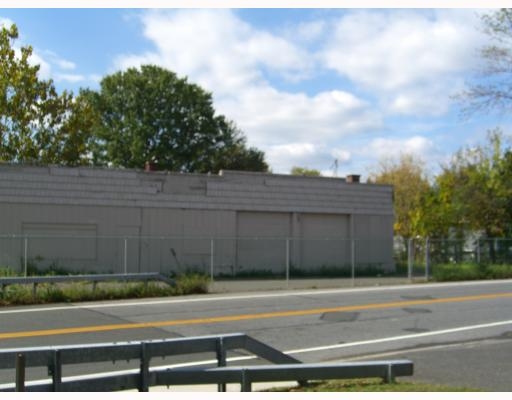
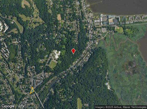
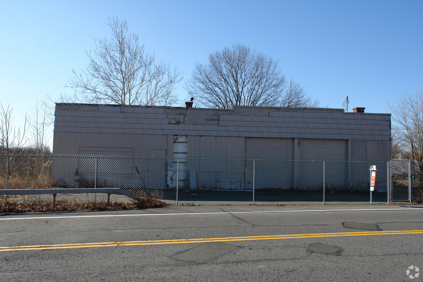
Property Record
501 S Highland Ave, Piermont, NY 10968
NEARBY LISTINGS FOR SALE OR LEASE
Property Detail
501 S Highland Ave
392405-075-077-0001-031-000-0000
5/109/914/1
Servicestation
Rockland
X
New York
36087C0191G
31.000
2023
0.51 AC
2023
Rockland County
013300
Northern New Jersey
1,984 SF
New York-Jersey City-White Plains, NY-NJ
DEMOGRAPHICS near 501 S Highland Ave
1 Mile
3 Mile
5 Mile
2024 Total Population
5,743
35,513
145,248
2029 Population
5,712
35,399
144,083
Pop Growth 2024-2029
(0.54%)
(0.32%)
(0.80%)
Average Age
43
43
43
2024 Total Households
2,183
12,463
52,715
HH Growth 2024-2029
(0.41%)
(0.41%)
(0.97%)
Median Household Inc
$105,635
$128,519
$135,860
Avg Household Size
2.30
2.60
2.60
2024 Avg HH Vehicles
2.00
2.00
2.00
Median Home Value
$682,783
$674,021
$699,674
Median Year Built
1970
1964
1961
Nearby Places
- Restaurants
- Banks
- Shops
- Fitness
- Groceries
PUBLIC TRANSPORTATION
AIRPORT
Westchester County
DRIVE
WALK
Distance
Westchester County
32 min
21.2 mi
Laguardia
DRIVE
WALK
Distance
Laguardia
44 min
25.5 mi
Newark Liberty International
DRIVE
WALK
Distance
Newark Liberty International
41 min
29.7 mi
Freight Ports
NY - Red Hook Container Terminal
DRIVE
WALK
Distance
NY - Red Hook Container Terminal
55 min
32.0 mi
Nearby Properties
Address
Land Use
TOTAL SIZE
Lot Size
Zoning
Address
Land Use
TOTAL SIZE
Lot Size
Zoning
2,736 SF
25.26 AC
Address
Land Use
TOTAL SIZE
Lot Size
Zoning
61.28 AC
Address
Land Use
TOTAL SIZE
Lot Size
Zoning
69,289 SF
136.28 AC
R-40
Address
Land Use
TOTAL SIZE
Lot Size
Zoning
11.68 AC
Address
Land Use
TOTAL SIZE
Lot Size
Zoning
1,562 SF
22.30 AC
R-40
Address
Land Use
TOTAL SIZE
Lot Size
Zoning
237,408 SF
14.97 AC
R-40
Address
Land Use
TOTAL SIZE
Lot Size
Zoning
14.31 AC
Address
Land Use
TOTAL SIZE
Lot Size
Zoning
220,000 SF
2.01 AC
Address
Land Use
TOTAL SIZE
Lot Size
Zoning
4,564 SF
8.60 AC
LI
Address
Land Use
TOTAL SIZE
Lot Size
Zoning
6.72 AC
C
Address
Land Use
TOTAL SIZE
Lot Size
Zoning
48.19 AC
P
Address
Land Use
TOTAL SIZE
Lot Size
Zoning
15.23 AC
C
Address
Land Use
TOTAL SIZE
Lot Size
Zoning
9.75 AC
Address
Land Use
TOTAL SIZE
Lot Size
Zoning
2.80 AC
R10
Address
Land Use
TOTAL SIZE
Lot Size
Zoning
8 AC
AH1CC
Address
Land Use
TOTAL SIZE
Lot Size
Zoning
5.96 AC
Address
Land Use
TOTAL SIZE
Lot Size
Zoning
125,000 SF
1.62 AC
Address
Land Use
TOTAL SIZE
Lot Size
Zoning
32,374 SF
48.30 AC
R-40
Address
Land Use
TOTAL SIZE
Lot Size
Zoning
123,027 SF
32.26 AC
R-40
Address
Land Use
TOTAL SIZE
Lot Size
Zoning
114,520 SF
24.87 AC
R4
Address
Land Use
TOTAL SIZE
Lot Size
Zoning
47,432 SF
9.81 AC
RG
Address
Land Use
TOTAL SIZE
Lot Size
Zoning
75,000 SF
3.58 AC
Address
Land Use
TOTAL SIZE
Lot Size
Zoning
11.09 AC
Address
Land Use
TOTAL SIZE
Lot Size
Zoning
161.33 AC
P
Address
Land Use
TOTAL SIZE
Lot Size
Zoning
6.80 AC
Address
Land Use
TOTAL SIZE
Lot Size
Zoning
23.13 AC
Address
Land Use
TOTAL SIZE
Lot Size
Zoning
11.80 AC
Address
Land Use
TOTAL SIZE
Lot Size
Zoning
395,296 SF
106 AC
LO
Address
Land Use
TOTAL SIZE
Lot Size
Zoning
9.54 AC
Address
Land Use
TOTAL SIZE
Lot Size
Zoning
16.30 AC
LI
The World's #1 Commercial Real Estate Marketplace
Connect with us
© 2025 CoStar Group
The information above has been obtained from sources believed reliable. While we do not doubt its accuracy we have not verified it and make no guarantee, warranty or representation about it. It is your responsibility to independently confirm its accuracy and completeness. Any projections, opinions, assumptions, or estimates used are for example only and do not represent the current or future performance of the property. The value of this transaction to you depends on tax and other factors which should be evaluated by your tax, financial, and legal advisors. You and your advisors should conduct a careful, independent investigation of the property to determine to your satisfaction the suitability of the property for your needs.