Property Record
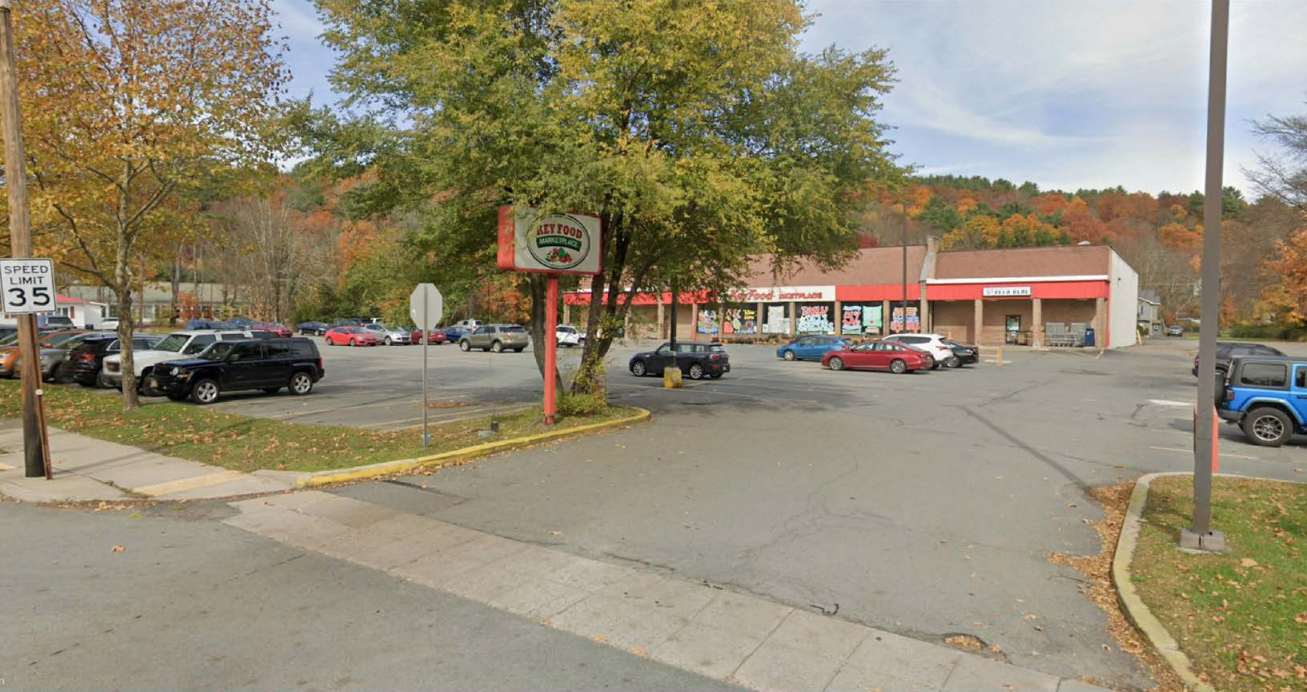
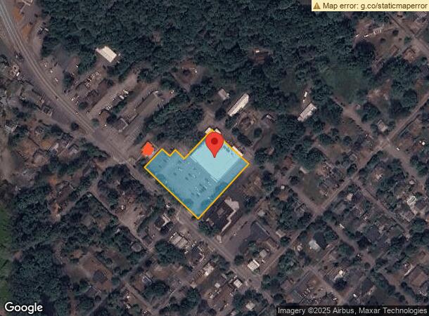
501 W Harford St, Milford, PA 18337
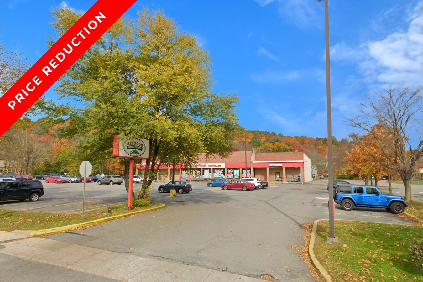

This Property Is For Sale
NEARBY LISTINGS FOR SALE OR LEASE
Property Detail
501 W Harford St
000998
1.94 AC KEY FOOD
Storesoffices
Pike
X
Pennsylvania
34037C0008E
1.94 AC
2024
Pike County
2024
Northern New Jersey
950601
Newark, NJ-PA
22,581 SF
DEMOGRAPHICS near 501 W Harford St
1 Mile
3 Mile
5 Mile
2024 Total Population
1,822
4,165
10,432
2029 Population
1,907
4,324
10,735
Pop Growth 2024-2029
+ 4.67%
+ 3.82%
+ 2.90%
Average Age
47
47
45
2024 Total Households
842
1,806
4,294
HH Growth 2024-2029
+ 4.75%
+ 3.88%
+ 2.86%
Median Household Inc
$65,119
$70,937
$84,616
Avg Household Size
2.10
2.20
2.30
2024 Avg HH Vehicles
2.00
2.00
2.00
Median Home Value
$294,607
$278,600
$265,441
Median Year Built
1973
1979
1983
Nearby Places
- Restaurants
- Banks
- Shops
- Fitness
- Groceries
PUBLIC TRANSPORTATION
COMMUTER RAIL
Port Jervis (Bergen County/Port Jervis Line - NJ Transit Commuter Rail (NJ Transit), Main/Port Jervis Line - NJ Transit Commuter Rail (NJ Transit))
DRIVE
WALK
Distance
Port Jervis (Bergen County/Port Jervis Line - NJ Transit Commuter Rail (NJ Transit), Main/Port Jervis Line - NJ Transit Commuter Rail (NJ Transit))
19 min
7.8 mi
Freight Ports
Maher Terminal
DRIVE
WALK
Distance
Maher Terminal
97 min
67.1 mi
Nearby Properties
Address
Land Use
TOTAL SIZE
Lot Size
Zoning
Address
Land Use
TOTAL SIZE
Lot Size
Zoning
1.69 AC
R-1
Address
Land Use
TOTAL SIZE
Lot Size
Zoning
9 AC
C2
Address
Land Use
TOTAL SIZE
Lot Size
Zoning
668.30 AC
R-1
Address
Land Use
TOTAL SIZE
Lot Size
Zoning
657.40 AC
R-1
Address
Land Use
TOTAL SIZE
Lot Size
Zoning
77.56 AC
W
Address
Land Use
TOTAL SIZE
Lot Size
Zoning
155.98 AC
W
Address
Land Use
TOTAL SIZE
Lot Size
Zoning
632 AC
CD
Address
Land Use
TOTAL SIZE
Lot Size
Zoning
577 AC
C-2
Address
Land Use
TOTAL SIZE
Lot Size
Zoning
3,884 SF
518.94 AC
CD
Address
Land Use
TOTAL SIZE
Lot Size
Zoning
126.03 AC
W
Address
Land Use
TOTAL SIZE
Lot Size
Zoning
17.20 AC
R-1
Address
Land Use
TOTAL SIZE
Lot Size
Zoning
121.84 AC
W
Address
Land Use
TOTAL SIZE
Lot Size
Zoning
103.58 AC
W
Address
Land Use
TOTAL SIZE
Lot Size
Zoning
513.27 AC
CD
Address
Land Use
TOTAL SIZE
Lot Size
Zoning
96.60 AC
W
Address
Land Use
TOTAL SIZE
Lot Size
Zoning
400 AC
R-1
Address
Land Use
TOTAL SIZE
Lot Size
Zoning
91.64 AC
W
Address
Land Use
TOTAL SIZE
Lot Size
Zoning
41.98 AC
W
Address
Land Use
TOTAL SIZE
Lot Size
Zoning
329 AC
C
Address
Land Use
TOTAL SIZE
Lot Size
Zoning
5.07 AC
C-2
Address
Land Use
TOTAL SIZE
Lot Size
Zoning
5 AC
MC
Address
Land Use
TOTAL SIZE
Lot Size
Zoning
66.14 AC
W
Address
Land Use
TOTAL SIZE
Lot Size
Zoning
60.94 AC
W
Address
Land Use
TOTAL SIZE
Lot Size
Zoning
60.66 AC
W
Address
Land Use
TOTAL SIZE
Lot Size
Zoning
239.75 AC
CD
Address
Land Use
TOTAL SIZE
Lot Size
Zoning
11.87 AC
C-2
Address
Land Use
TOTAL SIZE
Lot Size
Zoning
52.87 AC
W
Address
Land Use
TOTAL SIZE
Lot Size
Zoning
189,132 SF
27.19 AC
Address
Land Use
TOTAL SIZE
Lot Size
Zoning
230 AC
CD
Address
Land Use
TOTAL SIZE
Lot Size
Zoning
3.91 AC
C-2
The World's #1 Commercial Real Estate Marketplace
Connect with us
© 2025 CoStar Group
The information above has been obtained from sources believed reliable. While we do not doubt its accuracy we have not verified it and make no guarantee, warranty or representation about it. It is your responsibility to independently confirm its accuracy and completeness. Any projections, opinions, assumptions, or estimates used are for example only and do not represent the current or future performance of the property. The value of this transaction to you depends on tax and other factors which should be evaluated by your tax, financial, and legal advisors. You and your advisors should conduct a careful, independent investigation of the property to determine to your satisfaction the suitability of the property for your needs.