Property Record
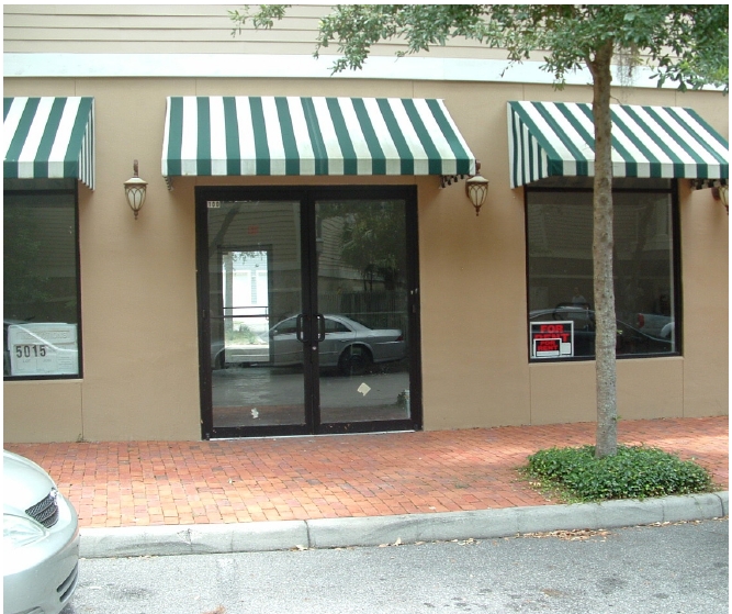
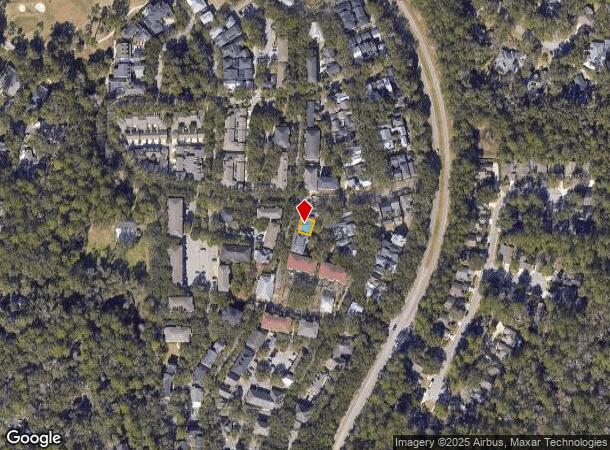
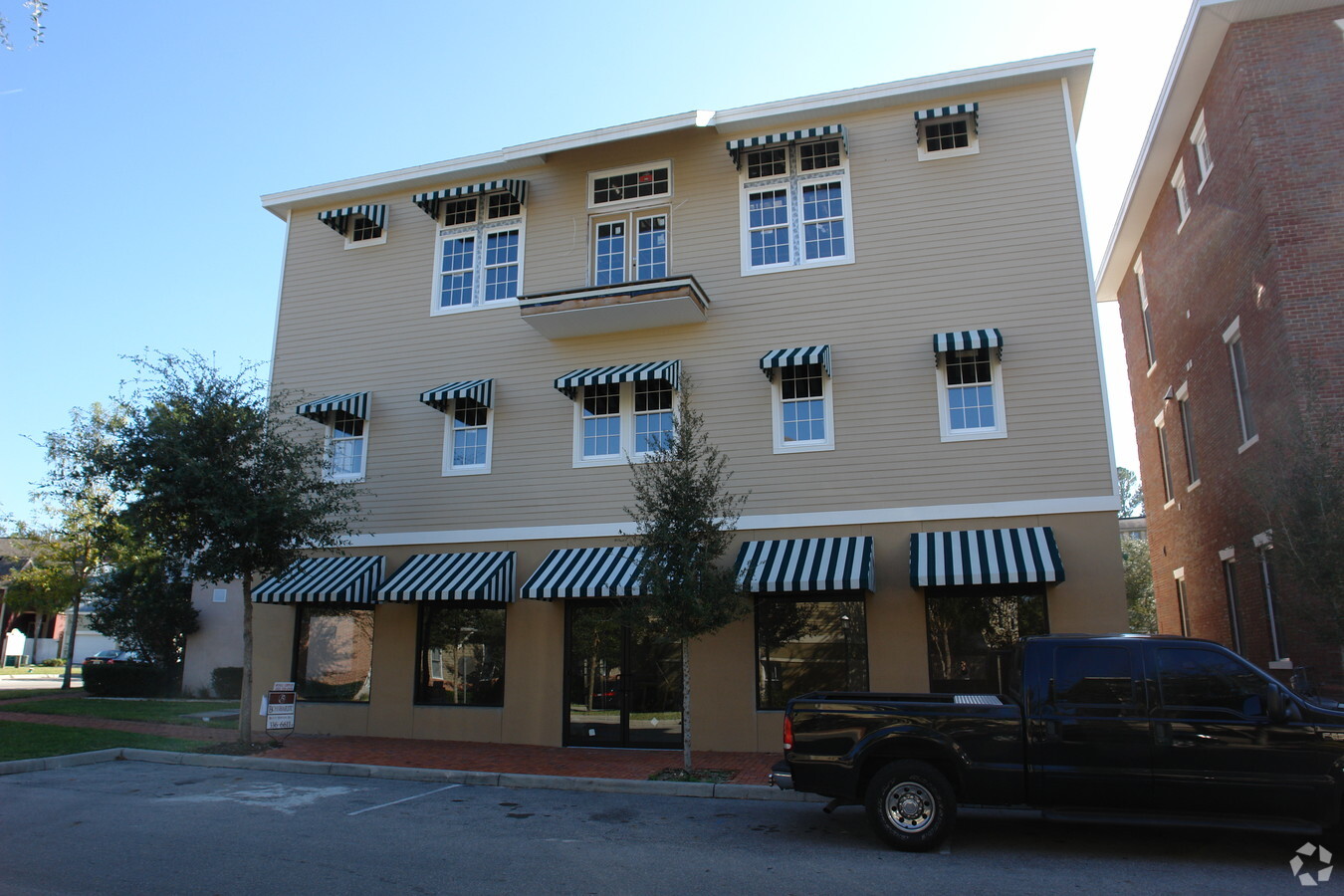
5015 Sw 91St Ter, Gainesville, FL 32608
NEARBY LISTINGS FOR SALE OR LEASE
Property Detail
5015 Sw 91St Ter
Gainesville, FL
Haile Plantation Unit 24
06860-400-050
COM NW COR LOT 1 HAILE PLANTATION UNIT 24 PB P-87 N 28 DEG 17 MIN 33 SEC E 40 FT N 61 DEG 42 MIN 27 SEC W 90 FT N 79 DEG 24 MIN 36 SEC W 52.49 FT N 28 DEG 17 MIN 33 SEC E 36.96 FT N 51 DEG 59 MIN 11 SEC W 155.37 FT N 74 DEG 47 MIN 04 SEC W 263.42 FT
Storesoffices
Alachua
X
Florida
12001C0430E
1
2023
0.05 AC
2024
Gainesville
002222
Other Market Areas
5,340 SF
DEMOGRAPHICS near 5015 Sw 91St Ter
1 Mile
3 Mile
5 Mile
2024 Total Population
7,741
37,258
104,421
2029 Population
8,230
39,889
110,419
Pop Growth 2024-2029
+ 6.32%
+ 7.06%
+ 5.74%
Average Age
42
39
35
2024 Total Households
3,341
15,138
42,435
HH Growth 2024-2029
+ 6.52%
+ 7.27%
+ 5.77%
Median Household Inc
$118,590
$92,312
$59,933
Avg Household Size
2.30
2.40
2.30
2024 Avg HH Vehicles
2.00
2.00
2.00
Median Home Value
$383,471
$343,009
$322,869
Median Year Built
1997
1996
1992
Nearby Places
- Restaurants
- Banks
- Shops
- Fitness
- Groceries
PUBLIC TRANSPORTATION
AIRPORT
Gainesville Regional
DRIVE
WALK
Distance
Gainesville Regional
33 min
14.9 mi
Freight Ports
Jacksonville Port
DRIVE
WALK
Distance
Jacksonville Port
118 min
84.7 mi
Nearby Properties
Address
Land Use
TOTAL SIZE
Lot Size
Zoning
Address
Land Use
TOTAL SIZE
Lot Size
Zoning
318,578 SF
21.24 AC
RMF7
Address
Land Use
TOTAL SIZE
Lot Size
Zoning
332,878 SF
34.15 AC
PD
Address
Land Use
TOTAL SIZE
Lot Size
Zoning
134,068 SF
3.47 AC
R-2
Address
Land Use
TOTAL SIZE
Lot Size
Zoning
371,933 SF
15 AC
PD
Address
Land Use
TOTAL SIZE
Lot Size
Zoning
309,967 SF
12.58 AC
PD
Address
Land Use
TOTAL SIZE
Lot Size
Zoning
205,412 SF
23.80 AC
R-1A
Address
Land Use
TOTAL SIZE
Lot Size
Zoning
311,673 SF
34.15 AC
R-2
Address
Land Use
TOTAL SIZE
Lot Size
Zoning
307,316 SF
25.99 AC
R-2
Address
Land Use
TOTAL SIZE
Lot Size
Zoning
112,213 SF
18.62 AC
R-1AA
Address
Land Use
TOTAL SIZE
Lot Size
Zoning
311,290 SF
25.20 AC
R-1A
Address
Land Use
TOTAL SIZE
Lot Size
Zoning
97,648 SF
44.62 AC
A
Address
Land Use
TOTAL SIZE
Lot Size
Zoning
87,104 SF
14.59 AC
PD
Address
Land Use
TOTAL SIZE
Lot Size
Zoning
168,512 SF
15.22 AC
R-2
Address
Land Use
TOTAL SIZE
Lot Size
Zoning
140,592 SF
66.88 AC
RM
Address
Land Use
TOTAL SIZE
Lot Size
Zoning
64,710 SF
8.30 AC
PD
Address
Land Use
TOTAL SIZE
Lot Size
Zoning
407,034 SF
2.35 AC
R-1AA
Address
Land Use
TOTAL SIZE
Lot Size
Zoning
150,324 SF
3.22 AC
R-1AA
Address
Land Use
TOTAL SIZE
Lot Size
Zoning
92,735 SF
1.07 AC
R-1A
Address
Land Use
TOTAL SIZE
Lot Size
Zoning
106,659 SF
10.21 AC
R-2A
Address
Land Use
TOTAL SIZE
Lot Size
Zoning
50,240 SF
41.99 AC
RM
Address
Land Use
TOTAL SIZE
Lot Size
Zoning
97,174 SF
11.94 AC
PD
Address
Land Use
TOTAL SIZE
Lot Size
Zoning
129,560 SF
19.10 AC
A
Address
Land Use
TOTAL SIZE
Lot Size
Zoning
72,945 SF
11.77 AC
R-1AA
Address
Land Use
TOTAL SIZE
Lot Size
Zoning
26,334 SF
0.77 AC
R1-AA
Address
Land Use
TOTAL SIZE
Lot Size
Zoning
98,278 SF
3.40 AC
MP
Address
Land Use
TOTAL SIZE
Lot Size
Zoning
53,880 SF
7.38 AC
Address
Land Use
TOTAL SIZE
Lot Size
Zoning
17,640 SF
7.23 AC
PD
Address
Land Use
TOTAL SIZE
Lot Size
Zoning
50,445 SF
5.39 AC
R-1A
Address
Land Use
TOTAL SIZE
Lot Size
Zoning
65,260 SF
0.84 AC
Address
Land Use
TOTAL SIZE
Lot Size
Zoning
34,327 SF
0.62 AC
PD
The World's #1 Commercial Real Estate Marketplace
Connect with us
© 2025 CoStar Group
The information above has been obtained from sources believed reliable. While we do not doubt its accuracy we have not verified it and make no guarantee, warranty or representation about it. It is your responsibility to independently confirm its accuracy and completeness. Any projections, opinions, assumptions, or estimates used are for example only and do not represent the current or future performance of the property. The value of this transaction to you depends on tax and other factors which should be evaluated by your tax, financial, and legal advisors. You and your advisors should conduct a careful, independent investigation of the property to determine to your satisfaction the suitability of the property for your needs.