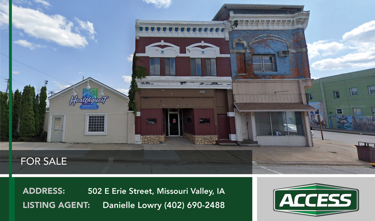
Property Record
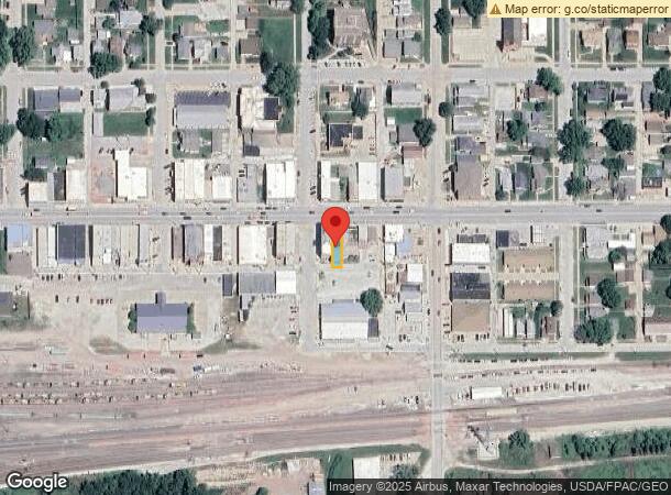
502 E Erie St, Missouri Valley, IA 51555
NEARBY LISTINGS FOR SALE OR LEASE
-
-
View all Missouri Valley listings for sale on LoopNet.com
Property Detail
502 E Erie St
Omaha/Council Bluffs
Town Of Missouri Valley
Omaha-Council Bluffs, NE-IA
OT LOTS E LOTS 21 & 22 BLK 5
603002480200000
Harrison
Bartavern
Iowa
2023
21-22
2024
0.06 AC
290400
Harrison County
3,988 SF
DEMOGRAPHICS near 502 E Erie St
1 Mile
3 Mile
5 Mile
2024 Total Population
2,881
3,818
4,580
2029 Population
2,929
3,866
4,622
Pop Growth 2024-2029
+ 1.67%
+ 1.26%
+ 0.92%
Average Age
43
43
43
2024 Total Households
1,221
1,595
1,886
HH Growth 2024-2029
+ 1.72%
+ 1.25%
+ 1.01%
Median Household Inc
$59,272
$62,916
$67,408
Avg Household Size
2.20
2.30
2.30
2024 Avg HH Vehicles
2.00
2.00
2.00
Median Home Value
$112,305
$130,365
$149,402
Median Year Built
1948
1949
1957
Nearby Places
- Restaurants
- Banks
- Shops
- Fitness
- Groceries
PUBLIC TRANSPORTATION
AIRPORT
Eppley Airfield
DRIVE
WALK
Distance
Eppley Airfield
38 min
25.6 mi
Freight Ports
Tulsa Port Of Catoosa
DRIVE
WALK
Distance
Tulsa Port Of Catoosa
488 min
438.2 mi
SALE & LEASE HISTORY
LISTING DATE
SALE/LEASE

Nov 04, 2021
For Sale
Nearby Properties
Address
Land Use
TOTAL SIZE
Lot Size
Zoning
Address
Land Use
TOTAL SIZE
Lot Size
Zoning
127,334 SF
33.40 AC
Address
Land Use
TOTAL SIZE
Lot Size
Zoning
42,307 SF
2.66 AC
Address
Land Use
TOTAL SIZE
Lot Size
Zoning
1,152 SF
3.63 AC
Address
Land Use
TOTAL SIZE
Lot Size
Zoning
79,856 SF
0.62 AC
Address
Land Use
TOTAL SIZE
Lot Size
Zoning
4,730 SF
4.51 AC
Address
Land Use
TOTAL SIZE
Lot Size
Zoning
14.80 AC
Address
Land Use
TOTAL SIZE
Lot Size
Zoning
5,900 SF
3.48 AC
Address
Land Use
TOTAL SIZE
Lot Size
Zoning
18,000 SF
4.20 AC
Address
Land Use
TOTAL SIZE
Lot Size
Zoning
8,000 SF
3.48 AC
Address
Land Use
TOTAL SIZE
Lot Size
Zoning
9,529 SF
0.41 AC
Address
Land Use
TOTAL SIZE
Lot Size
Zoning
3,200 SF
15.07 AC
Address
Land Use
TOTAL SIZE
Lot Size
Zoning
30,232 SF
2.88 AC
Address
Land Use
TOTAL SIZE
Lot Size
Zoning
1,932 SF
1.81 AC
Address
Land Use
TOTAL SIZE
Lot Size
Zoning
82,266 SF
13 AC
Address
Land Use
TOTAL SIZE
Lot Size
Zoning
4,688 SF
2.09 AC
Address
Land Use
TOTAL SIZE
Lot Size
Zoning
22,528 SF
2.16 AC
Address
Land Use
TOTAL SIZE
Lot Size
Zoning
17,160 SF
0.23 AC
Address
Land Use
TOTAL SIZE
Lot Size
Zoning
11,527 SF
2.20 AC
Address
Land Use
TOTAL SIZE
Lot Size
Zoning
21,380 SF
5.30 AC
Address
Land Use
TOTAL SIZE
Lot Size
Zoning
4,828 SF
1.67 AC
Address
Land Use
TOTAL SIZE
Lot Size
Zoning
4,922 SF
5.45 AC
Address
Land Use
TOTAL SIZE
Lot Size
Zoning
624 SF
6.02 AC
Address
Land Use
TOTAL SIZE
Lot Size
Zoning
2,794 SF
1.05 AC
Address
Land Use
TOTAL SIZE
Lot Size
Zoning
5,620 SF
0.41 AC
Address
Land Use
TOTAL SIZE
Lot Size
Zoning
4,629 SF
3.25 AC
Address
Land Use
TOTAL SIZE
Lot Size
Zoning
3,015 SF
1.28 AC
Address
Land Use
TOTAL SIZE
Lot Size
Zoning
Address
Land Use
TOTAL SIZE
Lot Size
Zoning
1,408 SF
0.84 AC
Address
Land Use
TOTAL SIZE
Lot Size
Zoning
3,360 SF
0.71 AC
Address
Land Use
TOTAL SIZE
Lot Size
Zoning
6,000 SF
12 AC
The World's #1 Commercial Real Estate Marketplace
Connect with us
© 2025 CoStar Group
The information above has been obtained from sources believed reliable. While we do not doubt its accuracy we have not verified it and make no guarantee, warranty or representation about it. It is your responsibility to independently confirm its accuracy and completeness. Any projections, opinions, assumptions, or estimates used are for example only and do not represent the current or future performance of the property. The value of this transaction to you depends on tax and other factors which should be evaluated by your tax, financial, and legal advisors. You and your advisors should conduct a careful, independent investigation of the property to determine to your satisfaction the suitability of the property for your needs.