Property Record
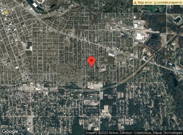
502 W 5Th St, Michigan City, IN 46360
NEARBY LISTINGS FOR SALE OR LEASE
Property Detail
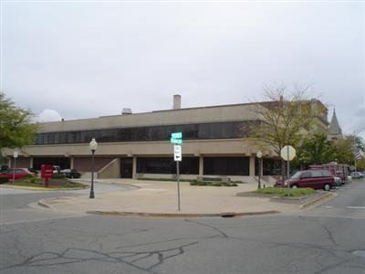
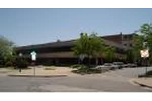
502 W 5Th St
46-01-29-405-014.000-022
Elstons Original Survey
Officebuilding
42-01-29-405-014 EOS LTS. 3 & 4 BLK 22. TIF ASSMT #51
X
La Porte
18091C0109E
Indiana
2023
4
2024
0.62 AC
040700
Other Market Areas
32,694 SF
Michigan City-La Porte, IN
DEMOGRAPHICS near 502 W 5Th St
1 Mile
3 Mile
5 Mile
2024 Total Population
8,791
32,697
42,914
2029 Population
8,881
32,688
43,001
Pop Growth 2024-2029
+ 1.02%
(0.03%)
+ 0.20%
Average Age
38
41
42
2024 Total Households
3,640
13,181
17,574
HH Growth 2024-2029
+ 1.10%
(0.06%)
+ 0.23%
Median Household Inc
$48,506
$52,056
$55,389
Avg Household Size
2.30
2.20
2.20
2024 Avg HH Vehicles
2.00
2.00
2.00
Median Home Value
$95,112
$124,976
$143,308
Median Year Built
1948
1959
1963
Nearby Places
- Restaurants
- Banks
- Shops
- Fitness
- Groceries
PUBLIC TRANSPORTATION
COMMUTER RAIL
Carroll Avenue (Michigan City) Station (South Shore Line - Northern Indiana Commuter Transportation District (South Shore Line))
DRIVE
WALK
Distance
Carroll Avenue (Michigan City) Station (South Shore Line - Northern Indiana Commuter Transportation District (South Shore Line))
3 min
20 min
1.0 mi
AIRPORT
South Bend International
DRIVE
WALK
Distance
South Bend International
54 min
32.8 mi
Freight Ports
Port Milwaukee
DRIVE
WALK
Distance
Port Milwaukee
182 min
144.6 mi
Nearby Properties
Address
Land Use
TOTAL SIZE
Lot Size
Zoning
Address
Land Use
TOTAL SIZE
Lot Size
Zoning
920,913 SF
34.37 AC
Address
Land Use
TOTAL SIZE
Lot Size
Zoning
472,695 SF
46.06 AC
Address
Land Use
TOTAL SIZE
Lot Size
Zoning
617,575 SF
7.36 AC
Address
Land Use
TOTAL SIZE
Lot Size
Zoning
71,212 SF
10.66 AC
Address
Land Use
TOTAL SIZE
Lot Size
Zoning
168,624 SF
9.47 AC
Address
Land Use
TOTAL SIZE
Lot Size
Zoning
154,171 SF
9.92 AC
Address
Land Use
TOTAL SIZE
Lot Size
Zoning
167,108 SF
16.38 AC
Address
Land Use
TOTAL SIZE
Lot Size
Zoning
197,186 SF
31.58 AC
Address
Land Use
TOTAL SIZE
Lot Size
Zoning
286,688 SF
24.13 AC
Address
Land Use
TOTAL SIZE
Lot Size
Zoning
165,756 SF
21.97 AC
Address
Land Use
TOTAL SIZE
Lot Size
Zoning
201,125 SF
7.95 AC
Address
Land Use
TOTAL SIZE
Lot Size
Zoning
122,915 SF
23.22 AC
Address
Land Use
TOTAL SIZE
Lot Size
Zoning
79,944 SF
7.50 AC
Address
Land Use
TOTAL SIZE
Lot Size
Zoning
229,606 SF
24.92 AC
Address
Land Use
TOTAL SIZE
Lot Size
Zoning
58,932 SF
3.25 AC
Address
Land Use
TOTAL SIZE
Lot Size
Zoning
82,217 SF
15.20 AC
Address
Land Use
TOTAL SIZE
Lot Size
Zoning
203,370 SF
5.83 AC
Address
Land Use
TOTAL SIZE
Lot Size
Zoning
139,650 SF
9.44 AC
Address
Land Use
TOTAL SIZE
Lot Size
Zoning
204,752 SF
10.98 AC
Address
Land Use
TOTAL SIZE
Lot Size
Zoning
540,651 SF
17.27 AC
Address
Land Use
TOTAL SIZE
Lot Size
Zoning
100,720 SF
11.58 AC
Address
Land Use
TOTAL SIZE
Lot Size
Zoning
172,106 SF
33.69 AC
Address
Land Use
TOTAL SIZE
Lot Size
Zoning
207,823 SF
18.28 AC
Address
Land Use
TOTAL SIZE
Lot Size
Zoning
129,367 SF
16.04 AC
Address
Land Use
TOTAL SIZE
Lot Size
Zoning
125,634 SF
8.97 AC
Address
Land Use
TOTAL SIZE
Lot Size
Zoning
55,763 SF
11.51 AC
Address
Land Use
TOTAL SIZE
Lot Size
Zoning
36,522 SF
4.03 AC
Address
Land Use
TOTAL SIZE
Lot Size
Zoning
118,686 SF
21.85 AC
Address
Land Use
TOTAL SIZE
Lot Size
Zoning
120,170 SF
46.25 AC
Address
Land Use
TOTAL SIZE
Lot Size
Zoning
105,603 SF
8.02 AC
The World's #1 Commercial Real Estate Marketplace
Connect with us
© 2025 CoStar Group
The information above has been obtained from sources believed reliable. While we do not doubt its accuracy we have not verified it and make no guarantee, warranty or representation about it. It is your responsibility to independently confirm its accuracy and completeness. Any projections, opinions, assumptions, or estimates used are for example only and do not represent the current or future performance of the property. The value of this transaction to you depends on tax and other factors which should be evaluated by your tax, financial, and legal advisors. You and your advisors should conduct a careful, independent investigation of the property to determine to your satisfaction the suitability of the property for your needs.