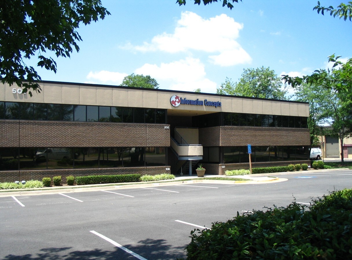
Property Record
503 Carlisle Dr, Herndon, VA 20170

Current Lease Availabilities
NEARBY LISTINGS FOR SALE OR LEASE
Property Detail
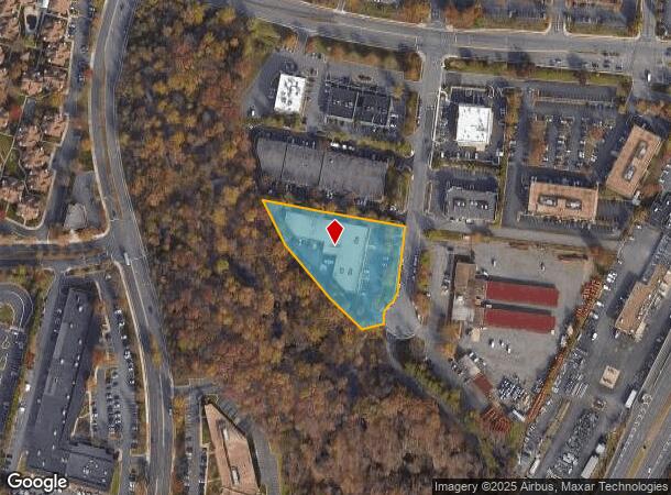
503 Carlisle Dr
Washington-Arlington-Alexandria, DC-VA-MD-WV
Sugarland
0171-06-0001A3
SUGARLAND INDUSTRIAL PARK PCL A3
Officebuilding
Fairfax
X
Virginia
51059C0130E
1a
2024
1.80 AC
2024
Herndon
480802
Washington, DC
26,997 SF
DEMOGRAPHICS near 503 Carlisle Dr
1 Mile
3 Mile
5 Mile
2024 Total Population
14,127
142,450
228,662
2029 Population
13,958
142,030
230,110
Pop Growth 2024-2029
(1.20%)
(0.29%)
+ 0.63%
Average Age
41
39
39
2024 Total Households
7,008
55,408
83,404
HH Growth 2024-2029
(1.00%)
(0.20%)
+ 0.55%
Median Household Inc
$145,178
$132,038
$141,449
Avg Household Size
2.00
2.50
2.70
2024 Avg HH Vehicles
2.00
2.00
2.00
Median Home Value
$636,069
$614,008
$665,593
Median Year Built
1997
1987
1986
Nearby Places
- Restaurants
- Banks
- Shops
- Fitness
- Groceries
PUBLIC TRANSPORTATION
AIRPORT
Washington Dulles International
DRIVE
WALK
Distance
Washington Dulles International
15 min
6.7 mi
Ronald Reagan Washington Ntl
DRIVE
WALK
Distance
Ronald Reagan Washington Ntl
39 min
25.5 mi
Freight Ports
Port of Baltimore
DRIVE
WALK
Distance
Port of Baltimore
80 min
57.5 mi
Nearby Properties
Address
Land Use
TOTAL SIZE
Lot Size
Zoning
Address
Land Use
TOTAL SIZE
Lot Size
Zoning
6.67 AC
PDC
Address
Land Use
TOTAL SIZE
Lot Size
Zoning
1,071,881 SF
PRC
Address
Land Use
TOTAL SIZE
Lot Size
Zoning
643,232 SF
2.81 AC
PRC
Address
Land Use
TOTAL SIZE
Lot Size
Zoning
764,166 SF
73.90 AC
PDIP
Address
Land Use
TOTAL SIZE
Lot Size
Zoning
473,458 SF
13.74 AC
I-4
Address
Land Use
TOTAL SIZE
Lot Size
Zoning
1,096,572 SF
85.06 AC
R-1
Address
Land Use
TOTAL SIZE
Lot Size
Zoning
446,810 SF
1.12 AC
PRC
Address
Land Use
TOTAL SIZE
Lot Size
Zoning
450,397 SF
1.07 AC
PRC
Address
Land Use
TOTAL SIZE
Lot Size
Zoning
332,957 SF
12.68 AC
I-5
Address
Land Use
TOTAL SIZE
Lot Size
Zoning
275,809 SF
0.75 AC
PRC
Address
Land Use
TOTAL SIZE
Lot Size
Zoning
469,276 SF
11.42 AC
PRC
Address
Land Use
TOTAL SIZE
Lot Size
Zoning
532,480 SF
4.62 AC
373
Address
Land Use
TOTAL SIZE
Lot Size
Zoning
498,299 SF
7.40 AC
PDC
Address
Land Use
TOTAL SIZE
Lot Size
Zoning
560,356 SF
4.33 AC
PRC
Address
Land Use
TOTAL SIZE
Lot Size
Zoning
429,038 SF
11.41 AC
PDC
Address
Land Use
TOTAL SIZE
Lot Size
Zoning
263,767 SF
2.34 AC
PRC
Address
Land Use
TOTAL SIZE
Lot Size
Zoning
357,437 SF
3.76 AC
PRM
Address
Land Use
TOTAL SIZE
Lot Size
Zoning
396,112 SF
15.92 AC
PDH-30
Address
Land Use
TOTAL SIZE
Lot Size
Zoning
337,921 SF
13.57 AC
PRC
Address
Land Use
TOTAL SIZE
Lot Size
Zoning
264,888 SF
8.59 AC
I-4
Address
Land Use
TOTAL SIZE
Lot Size
Zoning
411,519 SF
3.48 AC
PRM
Address
Land Use
TOTAL SIZE
Lot Size
Zoning
519,708 SF
18.73 AC
PDH-16
Address
Land Use
TOTAL SIZE
Lot Size
Zoning
490,340 SF
18.30 AC
PDH-20
Address
Land Use
TOTAL SIZE
Lot Size
Zoning
491,841 SF
19.21 AC
320
Address
Land Use
TOTAL SIZE
Lot Size
Zoning
407,812 SF
33.12 AC
PRC
Address
Land Use
TOTAL SIZE
Lot Size
Zoning
274,082 SF
1.08 AC
PRC
Address
Land Use
TOTAL SIZE
Lot Size
Zoning
408,315 SF
5.06 AC
PDC
Address
Land Use
TOTAL SIZE
Lot Size
Zoning
337,100 SF
2.19 AC
PRC
Address
Land Use
TOTAL SIZE
Lot Size
Zoning
452,626 SF
3.87 AC
PDC
Address
Land Use
TOTAL SIZE
Lot Size
Zoning
340,778 SF
13.50 AC
PDC
The World's #1 Commercial Real Estate Marketplace
Connect with us
© 2025 CoStar Group
The information above has been obtained from sources believed reliable. While we do not doubt its accuracy we have not verified it and make no guarantee, warranty or representation about it. It is your responsibility to independently confirm its accuracy and completeness. Any projections, opinions, assumptions, or estimates used are for example only and do not represent the current or future performance of the property. The value of this transaction to you depends on tax and other factors which should be evaluated by your tax, financial, and legal advisors. You and your advisors should conduct a careful, independent investigation of the property to determine to your satisfaction the suitability of the property for your needs.