Property Record
5035 Nw Us Highway 24, Topeka, KS 66618
NEARBY LISTINGS FOR SALE OR LEASE
Property Detail
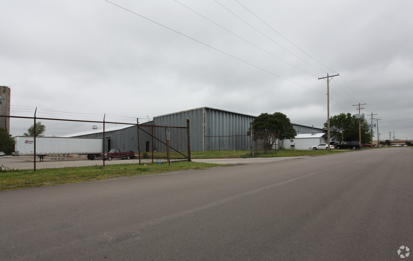
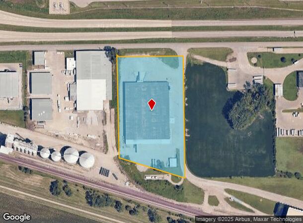
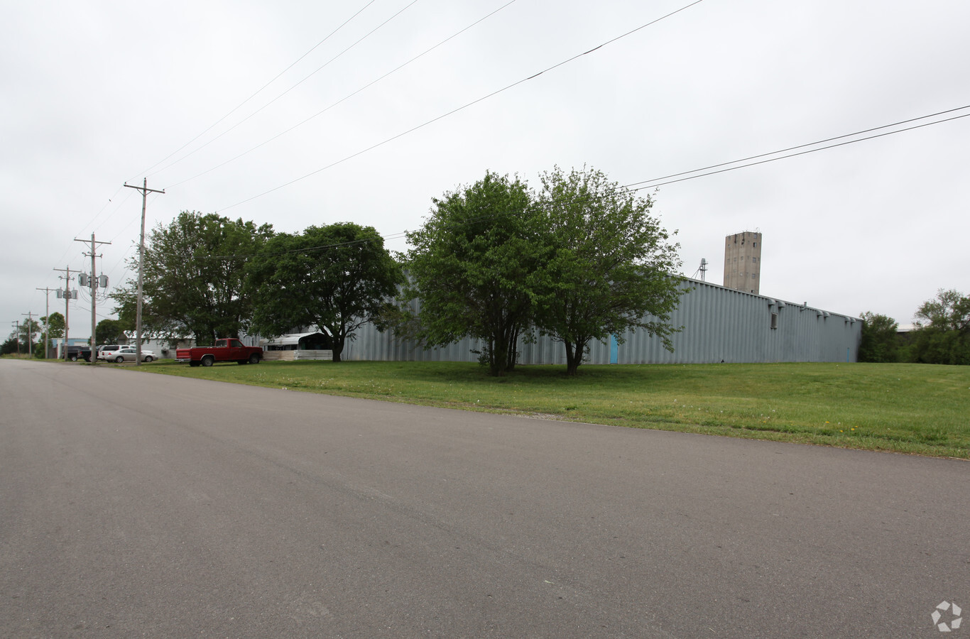
5035 Nw Us Highway 24
095-15-0-30-02-003-000
S15, T11, R15, ACRES 6.33, POB 1026.37 N & 1821.53 W OF SE COR SW 1/4, TH S 811.6, NW 424.54, N 665.94 E 365.5, N 20, E 40 TO POB LESS ROW
Shipyard
Shawnee
X
Kansas
20177C0203E
6.33 AC
2023
Topeka
2023
Kansas City
003500
Topeka, KS
101,470 SF
DEMOGRAPHICS near 5035 Nw Us Highway 24
1 Mile
3 Mile
5 Mile
2024 Total Population
76
11,848
67,206
2029 Population
75
11,667
66,775
Pop Growth 2024-2029
(1.32%)
(1.53%)
(0.64%)
Average Age
41
43
41
2024 Total Households
28
5,508
29,482
HH Growth 2024-2029
0.00%
(1.54%)
(0.66%)
Median Household Inc
$80,000
$54,713
$51,907
Avg Household Size
2.60
2.10
2.10
2024 Avg HH Vehicles
2.00
2.00
2.00
Median Home Value
$207,143
$153,520
$128,854
Median Year Built
1982
1971
1961
Nearby Places
- Restaurants
- Banks
- Shops
- Fitness
- Groceries
PUBLIC TRANSPORTATION
COMMUTER RAIL
Topeka Amtrak Station (Southwest Chief - Amtrak)
DRIVE
WALK
Distance
Topeka Amtrak Station (Southwest Chief - Amtrak)
12 min
7.3 mi
Freight Ports
Tulsa Port Of Catoosa
DRIVE
WALK
Distance
Tulsa Port Of Catoosa
283 min
232.5 mi
Nearby Properties
Address
Land Use
TOTAL SIZE
Lot Size
Zoning
Address
Land Use
TOTAL SIZE
Lot Size
Zoning
32,544 SF
17.25 AC
PUD
Address
Land Use
TOTAL SIZE
Lot Size
Zoning
90,929 SF
8.68 AC
PUD,OI3,I1
Address
Land Use
TOTAL SIZE
Lot Size
Zoning
218,962 SF
49.63 AC
R1
Address
Land Use
TOTAL SIZE
Lot Size
Zoning
94,830 SF
17.08 AC
PUD,M4
Address
Land Use
TOTAL SIZE
Lot Size
Zoning
123,795 SF
16.45 AC
PUD,R1,I1,
Address
Land Use
TOTAL SIZE
Lot Size
Zoning
70,578 SF
10.16 AC
PUD,C2
Address
Land Use
TOTAL SIZE
Lot Size
Zoning
175,246 SF
80.42 AC
R1
Address
Land Use
TOTAL SIZE
Lot Size
Zoning
67,302 SF
8.35 AC
OI2,OI3
Address
Land Use
TOTAL SIZE
Lot Size
Zoning
116,026 SF
47.17 AC
R1
Address
Land Use
TOTAL SIZE
Lot Size
Zoning
55,353 SF
12.40 AC
OI2
Address
Land Use
TOTAL SIZE
Lot Size
Zoning
7,704 SF
13.43 AC
PUD
Address
Land Use
TOTAL SIZE
Lot Size
Zoning
135,164 SF
11.01 AC
PUD,I1
Address
Land Use
TOTAL SIZE
Lot Size
Zoning
64,310 SF
12.95 AC
PUD,R1,I1,
Address
Land Use
TOTAL SIZE
Lot Size
Zoning
231,116 SF
42.17 AC
PUD,OI3,RR
Address
Land Use
TOTAL SIZE
Lot Size
Zoning
15,880 SF
85.20 AC
R1
Address
Land Use
TOTAL SIZE
Lot Size
Zoning
22,484 SF
75.33 AC
R1
Address
Land Use
TOTAL SIZE
Lot Size
Zoning
52,406 SF
4.87 AC
M1
Address
Land Use
TOTAL SIZE
Lot Size
Zoning
17,544 SF
42.80 AC
PUD,I1,M2,
Address
Land Use
TOTAL SIZE
Lot Size
Zoning
26,783 SF
3.11 AC
PUD,I1,M2,
Address
Land Use
TOTAL SIZE
Lot Size
Zoning
64,318 SF
10.17 AC
RR1
Address
Land Use
TOTAL SIZE
Lot Size
Zoning
51,285 SF
36.63 AC
PUD,I1,M2,
Address
Land Use
TOTAL SIZE
Lot Size
Zoning
91,840 SF
13.74 AC
PUD,I1
Address
Land Use
TOTAL SIZE
Lot Size
Zoning
50,854 SF
4.42 AC
PUD,R1
Address
Land Use
TOTAL SIZE
Lot Size
Zoning
421,639 SF
30.15 AC
PUD,I1
Address
Land Use
TOTAL SIZE
Lot Size
Zoning
72,105 SF
13.79 AC
C2,M1,M2,R
Address
Land Use
TOTAL SIZE
Lot Size
Zoning
35,713 SF
4.03 AC
OI2
Address
Land Use
TOTAL SIZE
Lot Size
Zoning
45,231 SF
11.95 AC
OI2
Address
Land Use
TOTAL SIZE
Lot Size
Zoning
67,997 SF
7.83 AC
PUD
Address
Land Use
TOTAL SIZE
Lot Size
Zoning
7,395 SF
41.77 AC
R1
Address
Land Use
TOTAL SIZE
Lot Size
Zoning
2,595,744 SF
197.79 AC
I2
The World's #1 Commercial Real Estate Marketplace
Connect with us
© 2025 CoStar Group
The information above has been obtained from sources believed reliable. While we do not doubt its accuracy we have not verified it and make no guarantee, warranty or representation about it. It is your responsibility to independently confirm its accuracy and completeness. Any projections, opinions, assumptions, or estimates used are for example only and do not represent the current or future performance of the property. The value of this transaction to you depends on tax and other factors which should be evaluated by your tax, financial, and legal advisors. You and your advisors should conduct a careful, independent investigation of the property to determine to your satisfaction the suitability of the property for your needs.