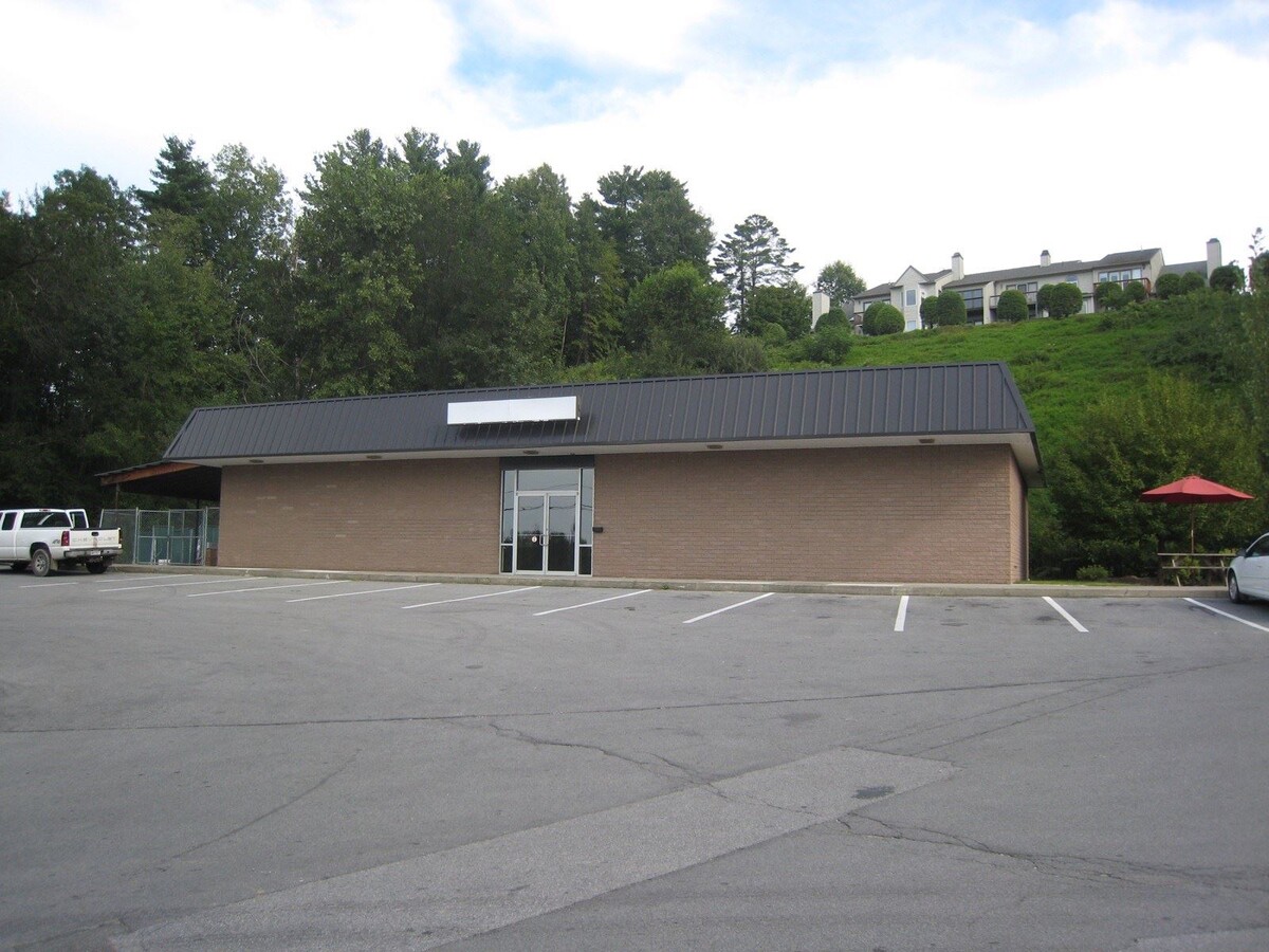
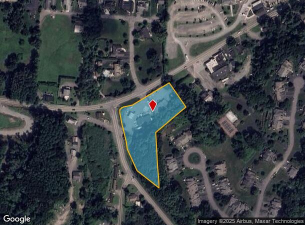
Property Record
504 Nys Route 9P, Saratoga Springs, NY 12866
NEARBY LISTINGS FOR SALE OR LEASE
Property Detail
504 Nys Route 9P
Albany-Schenectady-Troy, NY
Saratoga
415289-218-020-0002-028-000-0000
New York
Servicestationmarket
26.00
2016
2.43 AC
2023
Saratoga County
062002
Albany/Schenectady/Troy
2,982 SF
DEMOGRAPHICS near 504 Nys Route 9P
1 Mile
3 Mile
5 Mile
2024 Total Population
1,650
11,136
23,648
2029 Population
1,734
11,677
24,677
Pop Growth 2024-2029
+ 5.09%
+ 4.86%
+ 4.35%
Average Age
44
44
43
2024 Total Households
713
5,064
10,273
HH Growth 2024-2029
+ 4.91%
+ 4.78%
+ 4.29%
Median Household Inc
$103,022
$97,620
$98,874
Avg Household Size
2.30
2.20
2.30
2024 Avg HH Vehicles
2.00
2.00
2.00
Median Home Value
$337,063
$296,761
$327,309
Median Year Built
1996
1992
1991
Nearby Places
- Restaurants
- Banks
- Shops
- Fitness
- Groceries
PUBLIC TRANSPORTATION
AIRPORT
Albany International
DRIVE
WALK
Distance
Albany International
30 min
21.0 mi
Freight Ports
Albany, NY Port
DRIVE
WALK
Distance
Albany, NY Port
45 min
31.4 mi
SALE & LEASE HISTORY
LISTING DATE
SALE/LEASE

Sep 03, 2021
For Lease
Nearby Properties
Address
Land Use
TOTAL SIZE
Lot Size
Zoning
Address
Land Use
TOTAL SIZE
Lot Size
Zoning
1,491,280 SF
163.04 AC
PDD
Address
Land Use
TOTAL SIZE
Lot Size
Zoning
11,884 SF
25.60 AC
RA-3
Address
Land Use
TOTAL SIZE
Lot Size
Zoning
79,653 SF
8.84 AC
Address
Land Use
TOTAL SIZE
Lot Size
Zoning
10,322 SF
29.43 AC
PDD
Address
Land Use
TOTAL SIZE
Lot Size
Zoning
43,856 SF
259.97 AC
C3
Address
Land Use
TOTAL SIZE
Lot Size
Zoning
128,767 SF
16.51 AC
PDD
Address
Land Use
TOTAL SIZE
Lot Size
Zoning
1,377 SF
75.07 AC
Address
Land Use
TOTAL SIZE
Lot Size
Zoning
102,726 SF
0.01 AC
C3
Address
Land Use
TOTAL SIZE
Lot Size
Zoning
86,475 SF
7.18 AC
PDD
Address
Land Use
TOTAL SIZE
Lot Size
Zoning
10,700 SF
36.54 AC
DN-4
Address
Land Use
TOTAL SIZE
Lot Size
Zoning
120,000 SF
PDD
Address
Land Use
TOTAL SIZE
Lot Size
Zoning
12,923 SF
3.92 AC
PDD
Address
Land Use
TOTAL SIZE
Lot Size
Zoning
58,692 SF
2.06 AC
PDD
Address
Land Use
TOTAL SIZE
Lot Size
Zoning
61,786 SF
0.78 AC
PDD
Address
Land Use
TOTAL SIZE
Lot Size
Zoning
600 SF
50.28 AC
R3
Address
Land Use
TOTAL SIZE
Lot Size
Zoning
58,334 SF
7.96 AC
PDD
Address
Land Use
TOTAL SIZE
Lot Size
Zoning
81,464 SF
39.81 AC
PDD
Address
Land Use
TOTAL SIZE
Lot Size
Zoning
105,750 SF
3.71 AC
C1
Address
Land Use
TOTAL SIZE
Lot Size
Zoning
2,900 SF
59.41 AC
PDD
Address
Land Use
TOTAL SIZE
Lot Size
Zoning
28,036 SF
3.33 AC
C2
Address
Land Use
TOTAL SIZE
Lot Size
Zoning
13,468 SF
1.87 AC
Address
Land Use
TOTAL SIZE
Lot Size
Zoning
34,140 SF
1.78 AC
Address
Land Use
TOTAL SIZE
Lot Size
Zoning
17,800 SF
2.82 AC
DA-2
Address
Land Use
TOTAL SIZE
Lot Size
Zoning
28,279 SF
5.91 AC
GC-3
Address
Land Use
TOTAL SIZE
Lot Size
Zoning
19,972 SF
4.18 AC
GC-3
Address
Land Use
TOTAL SIZE
Lot Size
Zoning
43,276 SF
2.61 AC
PDD
Address
Land Use
TOTAL SIZE
Lot Size
Zoning
33,675 SF
6.61 AC
Address
Land Use
TOTAL SIZE
Lot Size
Zoning
11,420 SF
3.84 AC
DX-3
Address
Land Use
TOTAL SIZE
Lot Size
Zoning
25,000 SF
2.82 AC
PDD
Address
Land Use
TOTAL SIZE
Lot Size
Zoning
30,091 SF
2.60 AC
C2
The World's #1 Commercial Real Estate Marketplace
Connect with us
© 2025 CoStar Group
The information above has been obtained from sources believed reliable. While we do not doubt its accuracy we have not verified it and make no guarantee, warranty or representation about it. It is your responsibility to independently confirm its accuracy and completeness. Any projections, opinions, assumptions, or estimates used are for example only and do not represent the current or future performance of the property. The value of this transaction to you depends on tax and other factors which should be evaluated by your tax, financial, and legal advisors. You and your advisors should conduct a careful, independent investigation of the property to determine to your satisfaction the suitability of the property for your needs.