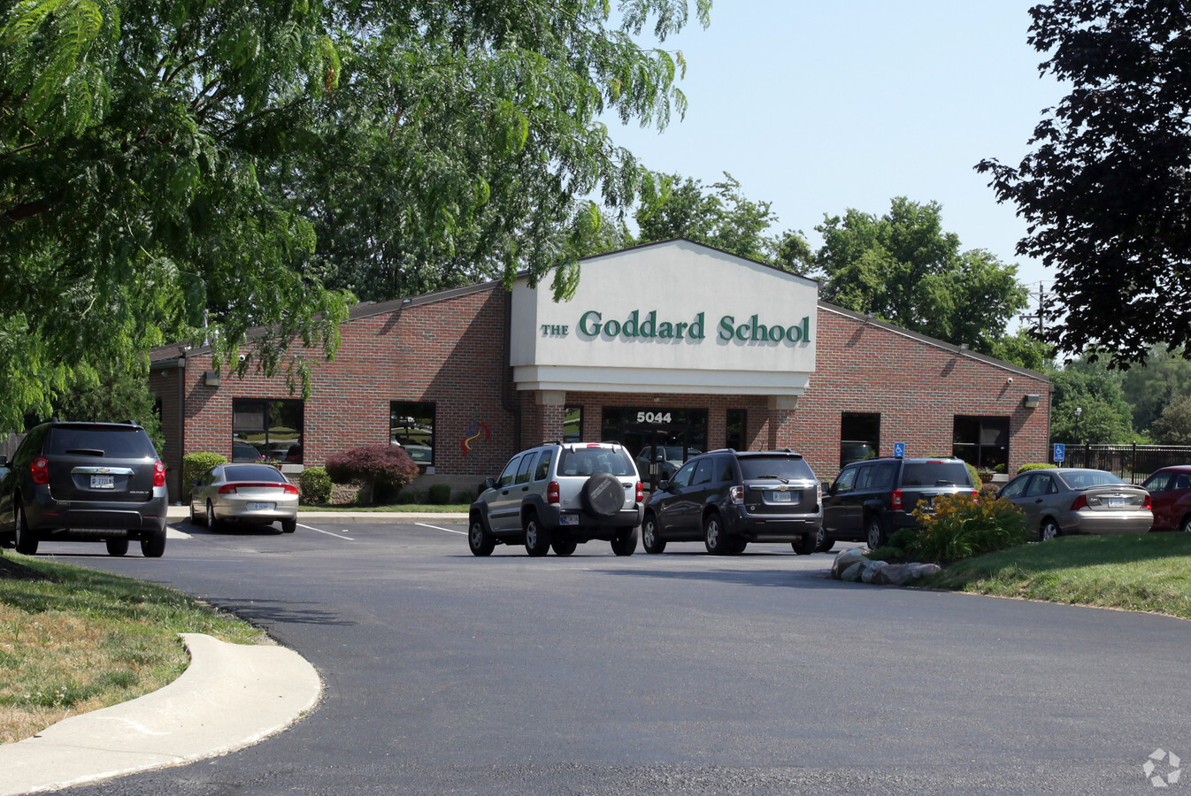
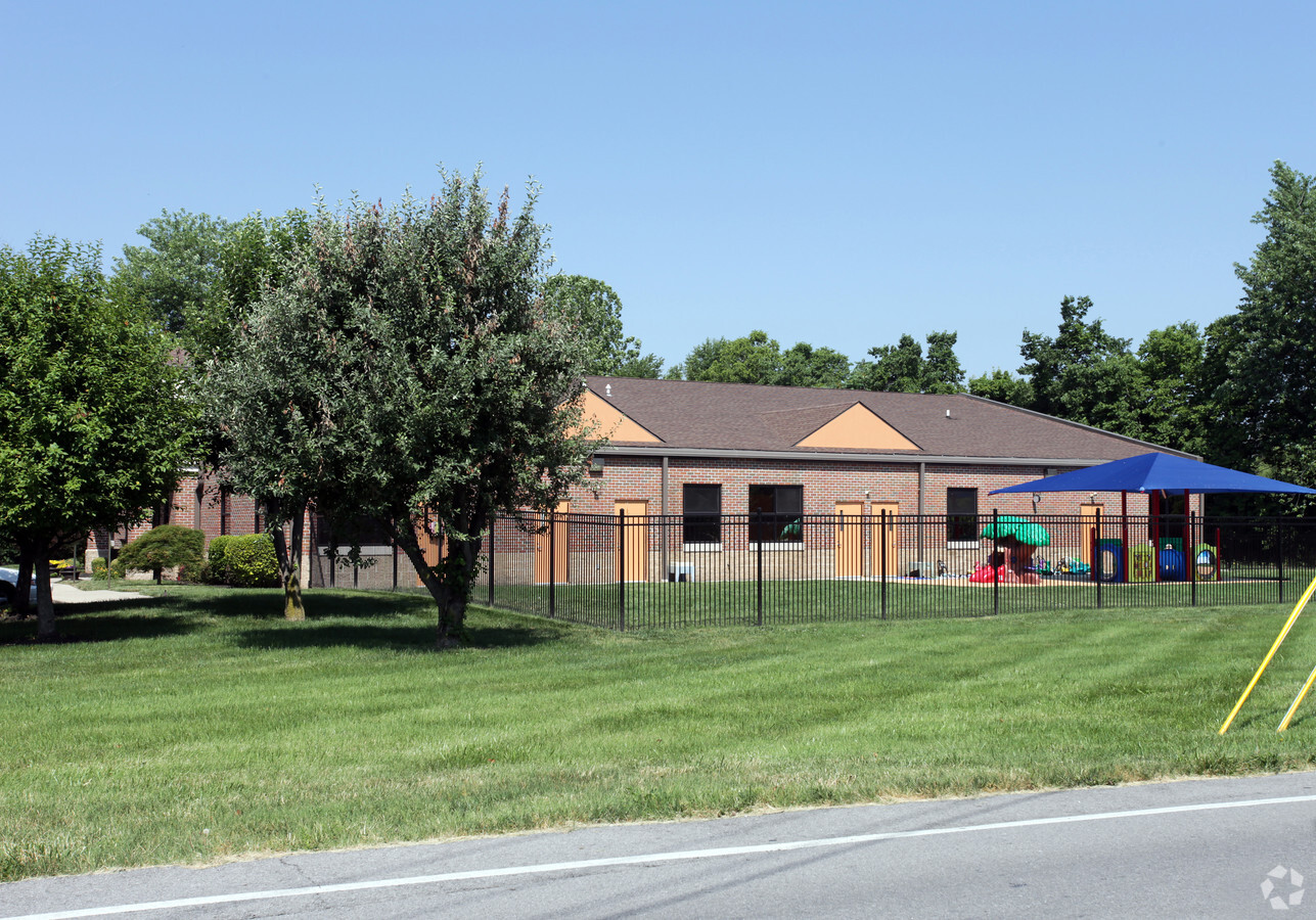
Property Record
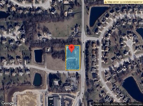
5044 Bancroft Ln, Greenwood, IN 46142
NEARBY LISTINGS FOR SALE OR LEASE
Property Detail
5044 Bancroft Ln
Indianapolis-Carmel-Anderson, IN
Wakefield Commercial Subdivision
41-03-33-044-038.000-038
WAKEFIELD COMMERCIAL SUB LOT 2
Officebuilding
Johnson
X
Indiana
18109C0180E
2
2023
1.29 AC
2024
Greenwood
610607
Indianapolis
9,870 SF
DEMOGRAPHICS near 5044 Bancroft Ln
1 Mile
3 Mile
5 Mile
2024 Total Population
7,958
45,092
121,673
2029 Population
8,417
47,295
125,575
Pop Growth 2024-2029
+ 5.77%
+ 4.89%
+ 3.21%
Average Age
39
40
39
2024 Total Households
2,728
16,334
45,806
HH Growth 2024-2029
+ 5.90%
+ 5.00%
+ 3.21%
Median Household Inc
$121,461
$96,948
$78,377
Avg Household Size
2.90
2.70
2.60
2024 Avg HH Vehicles
2.00
2.00
2.00
Median Home Value
$262,409
$259,002
$242,533
Median Year Built
1995
1991
1989
Nearby Places
- Restaurants
- Banks
- Shops
- Fitness
- Groceries
PUBLIC TRANSPORTATION
AIRPORT
Indianapolis International
DRIVE
WALK
Distance
Indianapolis International
32 min
19.0 mi
Freight Ports
Port of Toledo
DRIVE
WALK
Distance
Port of Toledo
289 min
241.0 mi
Nearby Properties
Address
Land Use
TOTAL SIZE
Lot Size
Zoning
Address
Land Use
TOTAL SIZE
Lot Size
Zoning
4,582 SF
30.22 AC
R4
Address
Land Use
TOTAL SIZE
Lot Size
Zoning
3,346 SF
21.35 AC
Address
Land Use
TOTAL SIZE
Lot Size
Zoning
33,790 SF
13.01 AC
Address
Land Use
TOTAL SIZE
Lot Size
Zoning
11,546 SF
14.18 AC
Address
Land Use
TOTAL SIZE
Lot Size
Zoning
176,228 SF
1.57 AC
Address
Land Use
TOTAL SIZE
Lot Size
Zoning
748 SF
6.83 AC
Address
Land Use
TOTAL SIZE
Lot Size
Zoning
193,178 SF
14.48 AC
Address
Land Use
TOTAL SIZE
Lot Size
Zoning
28,590 SF
7.16 AC
Address
Land Use
TOTAL SIZE
Lot Size
Zoning
3,360 SF
14.68 AC
Address
Land Use
TOTAL SIZE
Lot Size
Zoning
11,326 SF
7.88 AC
Address
Land Use
TOTAL SIZE
Lot Size
Zoning
173,052 SF
17.35 AC
Address
Land Use
TOTAL SIZE
Lot Size
Zoning
152,664 SF
14.82 AC
Address
Land Use
TOTAL SIZE
Lot Size
Zoning
217,468 SF
28.06 AC
Address
Land Use
TOTAL SIZE
Lot Size
Zoning
15,024 SF
5.62 AC
Address
Land Use
TOTAL SIZE
Lot Size
Zoning
4,308 SF
8.36 AC
ZO01
Address
Land Use
TOTAL SIZE
Lot Size
Zoning
24,483 SF
5.48 AC
R4
Address
Land Use
TOTAL SIZE
Lot Size
Zoning
51,840 SF
4.31 AC
Address
Land Use
TOTAL SIZE
Lot Size
Zoning
66,351 SF
2.28 AC
Address
Land Use
TOTAL SIZE
Lot Size
Zoning
46,171 SF
4.55 AC
Address
Land Use
TOTAL SIZE
Lot Size
Zoning
78,421 SF
9.62 AC
Address
Land Use
TOTAL SIZE
Lot Size
Zoning
93,870 SF
18.53 AC
B2
Address
Land Use
TOTAL SIZE
Lot Size
Zoning
72,977 SF
9.03 AC
Address
Land Use
TOTAL SIZE
Lot Size
Zoning
98,316 SF
10.58 AC
Address
Land Use
TOTAL SIZE
Lot Size
Zoning
63,084 SF
9.14 AC
Address
Land Use
TOTAL SIZE
Lot Size
Zoning
47,171 SF
4.48 AC
Address
Land Use
TOTAL SIZE
Lot Size
Zoning
26,880 SF
4.70 AC
B1
Address
Land Use
TOTAL SIZE
Lot Size
Zoning
1,131 SF
26.34 AC
ZO01
Address
Land Use
TOTAL SIZE
Lot Size
Zoning
42,057 SF
3.70 AC
Address
Land Use
TOTAL SIZE
Lot Size
Zoning
60,909 SF
6.56 AC
Address
Land Use
TOTAL SIZE
Lot Size
Zoning
32,792 SF
1 AC
The World's #1 Commercial Real Estate Marketplace
Connect with us
© 2025 CoStar Group
The information above has been obtained from sources believed reliable. While we do not doubt its accuracy we have not verified it and make no guarantee, warranty or representation about it. It is your responsibility to independently confirm its accuracy and completeness. Any projections, opinions, assumptions, or estimates used are for example only and do not represent the current or future performance of the property. The value of this transaction to you depends on tax and other factors which should be evaluated by your tax, financial, and legal advisors. You and your advisors should conduct a careful, independent investigation of the property to determine to your satisfaction the suitability of the property for your needs.