Property Record
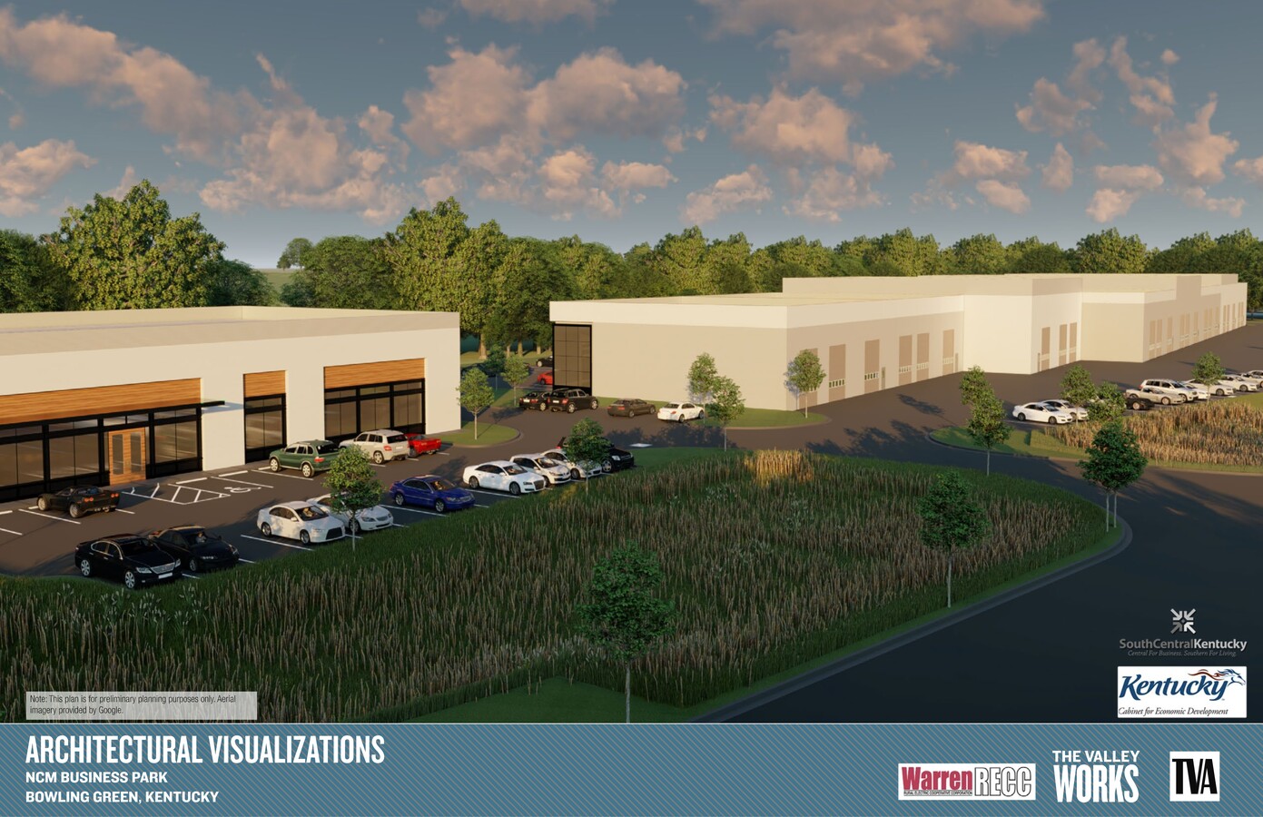
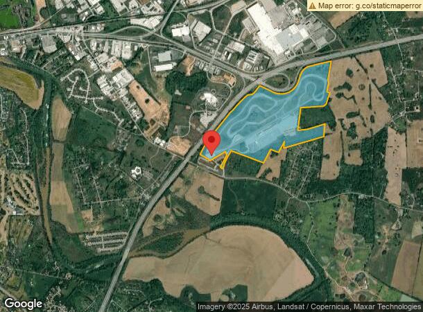
505 Kimberlee A Fast Dr, Bowling Green, KY 42103
NEARBY LISTINGS FOR SALE OR LEASE
Property Detail
505 Kimberlee A Fast Dr
051A-09
Ncm Motorsports Park Subdivision Bowling
Municipalproperty
Warren
X
Kentucky
21061C0225B
189.16 AC
2024
Bowling Green Area
2024
Other Market Areas
011600
Bowling Green, KY
13,342 SF
DEMOGRAPHICS near 505 Kimberlee A Fast Dr
1 Mile
3 Mile
5 Mile
2024 Total Population
737
15,138
51,517
2029 Population
820
16,873
57,055
Pop Growth 2024-2029
+ 11.26%
+ 11.46%
+ 10.75%
Average Age
36
37
36
2024 Total Households
303
6,230
20,082
HH Growth 2024-2029
+ 11.88%
+ 11.99%
+ 11.80%
Median Household Inc
$53,437
$61,548
$49,621
Avg Household Size
2.30
2.40
2.30
2024 Avg HH Vehicles
2.00
2.00
2.00
Median Home Value
$169,999
$227,371
$219,435
Median Year Built
2002
1996
1988
Nearby Places
- Restaurants
- Banks
- Shops
- Fitness
- Groceries
SALE & LEASE HISTORY
LISTING DATE
SALE/LEASE

Oct 05, 2018
For Lease
Nearby Properties
Address
Land Use
TOTAL SIZE
Lot Size
Zoning
Address
Land Use
TOTAL SIZE
Lot Size
Zoning
2,196,945 SF
212 AC
Address
Land Use
TOTAL SIZE
Lot Size
Zoning
175,830 SF
8 AC
Address
Land Use
TOTAL SIZE
Lot Size
Zoning
Address
Land Use
TOTAL SIZE
Lot Size
Zoning
105,987 SF
7.98 AC
Address
Land Use
TOTAL SIZE
Lot Size
Zoning
167,354 SF
13.63 AC
Address
Land Use
TOTAL SIZE
Lot Size
Zoning
41,192 SF
6 AC
Address
Land Use
TOTAL SIZE
Lot Size
Zoning
89,129 SF
49.26 AC
Address
Land Use
TOTAL SIZE
Lot Size
Zoning
3,120 SF
5 AC
Address
Land Use
TOTAL SIZE
Lot Size
Zoning
176,450 SF
19.82 AC
Address
Land Use
TOTAL SIZE
Lot Size
Zoning
3,840 SF
5.83 AC
Address
Land Use
TOTAL SIZE
Lot Size
Zoning
1,397 SF
10.42 AC
Address
Land Use
TOTAL SIZE
Lot Size
Zoning
1,740 SF
136.33 AC
Address
Land Use
TOTAL SIZE
Lot Size
Zoning
191,054 SF
9.02 AC
Address
Land Use
TOTAL SIZE
Lot Size
Zoning
6,000 SF
242.33 AC
Address
Land Use
TOTAL SIZE
Lot Size
Zoning
24,440 SF
5 AC
Address
Land Use
TOTAL SIZE
Lot Size
Zoning
170,932 SF
12.42 AC
Address
Land Use
TOTAL SIZE
Lot Size
Zoning
168,414 SF
18.03 AC
Address
Land Use
TOTAL SIZE
Lot Size
Zoning
34,601 SF
2.17 AC
Address
Land Use
TOTAL SIZE
Lot Size
Zoning
145,624 SF
19.66 AC
Address
Land Use
TOTAL SIZE
Lot Size
Zoning
50,600 SF
8.01 AC
Address
Land Use
TOTAL SIZE
Lot Size
Zoning
52,522 SF
20.06 AC
Address
Land Use
TOTAL SIZE
Lot Size
Zoning
44,800 SF
4.51 AC
Address
Land Use
TOTAL SIZE
Lot Size
Zoning
6,600 SF
3.24 AC
Address
Land Use
TOTAL SIZE
Lot Size
Zoning
9,975 SF
1.43 AC
Address
Land Use
TOTAL SIZE
Lot Size
Zoning
123,096 SF
54.35 AC
Address
Land Use
TOTAL SIZE
Lot Size
Zoning
21,304 SF
4.96 AC
Address
Land Use
TOTAL SIZE
Lot Size
Zoning
5,292 SF
2.96 AC
Address
Land Use
TOTAL SIZE
Lot Size
Zoning
142,800 SF
13.10 AC
Address
Land Use
TOTAL SIZE
Lot Size
Zoning
52,840 SF
30.40 AC
The World's #1 Commercial Real Estate Marketplace
Connect with us
© 2025 CoStar Group
The information above has been obtained from sources believed reliable. While we do not doubt its accuracy we have not verified it and make no guarantee, warranty or representation about it. It is your responsibility to independently confirm its accuracy and completeness. Any projections, opinions, assumptions, or estimates used are for example only and do not represent the current or future performance of the property. The value of this transaction to you depends on tax and other factors which should be evaluated by your tax, financial, and legal advisors. You and your advisors should conduct a careful, independent investigation of the property to determine to your satisfaction the suitability of the property for your needs.