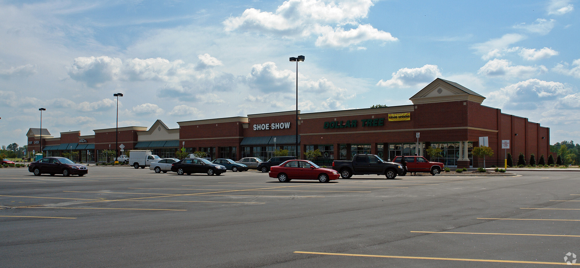
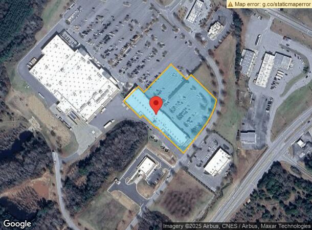
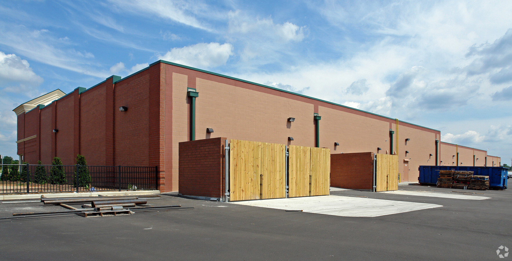
Property Record
505 Retail Way, Louisburg, NC 27549
NEARBY LISTINGS FOR SALE OR LEASE
-
-
View all Louisburg listings for lease on LoopNet.com
Property Detail
505 Retail Way
040449
Louisburg Plaza Parcel
Storebuilding
Franklin
X
North Carolina
3720280400K
4
2024
3.72 AC
2024
Franklin County
060302
Raleigh/Durham
35,320 SF
Raleigh, NC
DEMOGRAPHICS near 505 Retail Way
1 Mile
3 Mile
5 Mile
2024 Total Population
1,070
6,103
10,625
2029 Population
1,301
7,419
12,925
Pop Growth 2024-2029
+ 21.59%
+ 21.56%
+ 21.65%
Average Age
40
40
41
2024 Total Households
421
2,269
4,000
HH Growth 2024-2029
+ 21.85%
+ 21.95%
+ 21.88%
Median Household Inc
$44,166
$47,016
$55,015
Avg Household Size
2.40
2.40
2.40
2024 Avg HH Vehicles
2.00
2.00
2.00
Median Home Value
$99,518
$160,956
$190,134
Median Year Built
1979
1977
1982
Nearby Places
- Restaurants
- Banks
- Shops
- Fitness
- Groceries
PUBLIC TRANSPORTATION
AIRPORT
Raleigh-Durham International
DRIVE
WALK
Distance
Raleigh-Durham International
54 min
38.5 mi
Freight Ports
Virginia Port Authority - Richmond
DRIVE
WALK
Distance
Virginia Port Authority - Richmond
153 min
127.4 mi
SALE & LEASE HISTORY
LISTING DATE
SALE/LEASE

Sep 25, 2016
For Lease
Nearby Properties
Address
Land Use
TOTAL SIZE
Lot Size
Zoning
Address
Land Use
TOTAL SIZE
Lot Size
Zoning
94,459 SF
26.30 AC
A R
Address
Land Use
TOTAL SIZE
Lot Size
Zoning
41,268 SF
8.60 AC
O I
Address
Land Use
TOTAL SIZE
Lot Size
Zoning
21,885 SF
18.12 AC
O I
Address
Land Use
TOTAL SIZE
Lot Size
Zoning
83,404 SF
29.47 AC
A R
Address
Land Use
TOTAL SIZE
Lot Size
Zoning
151,761 SF
25.13 AC
B 2
Address
Land Use
TOTAL SIZE
Lot Size
Zoning
27,553 SF
22 AC
R 30
Address
Land Use
TOTAL SIZE
Lot Size
Zoning
8,644 SF
3.97 AC
R 1
Address
Land Use
TOTAL SIZE
Lot Size
Zoning
33,922 SF
18.40 AC
R 1
Address
Land Use
TOTAL SIZE
Lot Size
Zoning
195,000 SF
15.93 AC
A R
Address
Land Use
TOTAL SIZE
Lot Size
Zoning
32,676 SF
4.53 AC
O I
Address
Land Use
TOTAL SIZE
Lot Size
Zoning
28,172 SF
21.76 AC
FCO GB
Address
Land Use
TOTAL SIZE
Lot Size
Zoning
32,890 SF
20.32 AC
A R
Address
Land Use
TOTAL SIZE
Lot Size
Zoning
51,052 SF
4.58 AC
I 1
Address
Land Use
TOTAL SIZE
Lot Size
Zoning
31,494 SF
4.83 AC
O I
Address
Land Use
TOTAL SIZE
Lot Size
Zoning
25,278 SF
0.40 AC
B 1
Address
Land Use
TOTAL SIZE
Lot Size
Zoning
50,038 SF
4.14 AC
O I
Address
Land Use
TOTAL SIZE
Lot Size
Zoning
192,780 SF
24.92 AC
FCO GB
Address
Land Use
TOTAL SIZE
Lot Size
Zoning
70,704 SF
7.11 AC
B 2
Address
Land Use
TOTAL SIZE
Lot Size
Zoning
61,032 SF
8.36 AC
B 2
Address
Land Use
TOTAL SIZE
Lot Size
Zoning
53,402 SF
18 AC
B 2
Address
Land Use
TOTAL SIZE
Lot Size
Zoning
14,120 SF
2.56 AC
O I
Address
Land Use
TOTAL SIZE
Lot Size
Zoning
85,932 SF
7.47 AC
I 2
Address
Land Use
TOTAL SIZE
Lot Size
Zoning
6,576 SF
2.50 AC
B 2
Address
Land Use
TOTAL SIZE
Lot Size
Zoning
34,480 SF
5 AC
L I
Address
Land Use
TOTAL SIZE
Lot Size
Zoning
40,591 SF
4.39 AC
O I
Address
Land Use
TOTAL SIZE
Lot Size
Zoning
990.78 AC
A R
Address
Land Use
TOTAL SIZE
Lot Size
Zoning
26,842 SF
1.56 AC
B 2
Address
Land Use
TOTAL SIZE
Lot Size
Zoning
34,440 SF
Address
Land Use
TOTAL SIZE
Lot Size
Zoning
14,736 SF
2.27 AC
B 2
The World's #1 Commercial Real Estate Marketplace
Connect with us
© 2025 CoStar Group
The information above has been obtained from sources believed reliable. While we do not doubt its accuracy we have not verified it and make no guarantee, warranty or representation about it. It is your responsibility to independently confirm its accuracy and completeness. Any projections, opinions, assumptions, or estimates used are for example only and do not represent the current or future performance of the property. The value of this transaction to you depends on tax and other factors which should be evaluated by your tax, financial, and legal advisors. You and your advisors should conduct a careful, independent investigation of the property to determine to your satisfaction the suitability of the property for your needs.