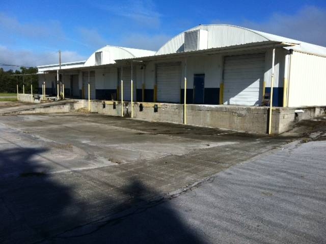
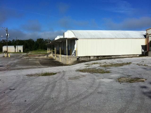
Property Record
5050 Wesley Rd, Apopka, FL 32712

NEARBY LISTINGS FOR SALE OR LEASE
Property Detail
5050 Wesley Rd
Orlando-Kissimmee-Sanford, FL
Acreage & Unrec
27-2027-0000-00-052
E 316.77 FT OF THE N 15 FT OF THE NW1/4 OF THE SW1/4 OF THE SW1/4 OF SEC 26-20-27
Warehouse
Orange
X
Florida
12095C0125H
27
2023
90.98 AC
2024
NW Orange County
017901
Orlando
1,272,151 SF
DEMOGRAPHICS near 5050 Wesley Rd
1 Mile
3 Mile
5 Mile
2024 Total Population
693
9,584
45,787
2029 Population
730
10,015
47,933
Pop Growth 2024-2029
+ 5.34%
+ 4.50%
+ 4.69%
Average Age
58
46
42
2024 Total Households
341
3,746
15,988
HH Growth 2024-2029
+ 5.28%
+ 4.51%
+ 4.68%
Median Household Inc
$52,121
$62,279
$88,498
Avg Household Size
2.00
2.50
2.80
2024 Avg HH Vehicles
2.00
2.00
2.00
Median Home Value
$180,262
$298,970
$342,189
Median Year Built
1988
1993
2001
Nearby Places
- Restaurants
- Banks
- Shops
- Fitness
- Groceries
PUBLIC TRANSPORTATION
AIRPORT
Orlando Sanford International
DRIVE
WALK
Distance
Orlando Sanford International
48 min
31.7 mi
Orlando International
DRIVE
WALK
Distance
Orlando International
47 min
35.8 mi
Freight Ports
Port Canaveral
DRIVE
WALK
Distance
Port Canaveral
95 min
78.4 mi
Nearby Properties
Address
Land Use
TOTAL SIZE
Lot Size
Zoning
Address
Land Use
TOTAL SIZE
Lot Size
Zoning
1,208,378 SF
57.24 AC
PD
Address
Land Use
TOTAL SIZE
Lot Size
Zoning
722,019 SF
35.47 AC
PD
Address
Land Use
TOTAL SIZE
Lot Size
Zoning
588,076 SF
38.89 AC
PD
Address
Land Use
TOTAL SIZE
Lot Size
Zoning
3,322 SF
152.85 AC
MU-KPI
Address
Land Use
TOTAL SIZE
Lot Size
Zoning
323,161 SF
43.61 AC
PD
Address
Land Use
TOTAL SIZE
Lot Size
Zoning
347,706 SF
40.19 AC
PD
Address
Land Use
TOTAL SIZE
Lot Size
Zoning
589,600 SF
19.60 AC
I-L
Address
Land Use
TOTAL SIZE
Lot Size
Zoning
80 SF
12,252.31 AC
A-1
Address
Land Use
TOTAL SIZE
Lot Size
Zoning
255,880 SF
15.73 AC
PD
Address
Land Use
TOTAL SIZE
Lot Size
Zoning
133,960 SF
17.21 AC
PD
Address
Land Use
TOTAL SIZE
Lot Size
Zoning
805,668 SF
23.02 AC
I-L
Address
Land Use
TOTAL SIZE
Lot Size
Zoning
23 AC
U-ORG-P-D
Address
Land Use
TOTAL SIZE
Lot Size
Zoning
92,579 SF
5.86 AC
RSTD IND-2
Address
Land Use
TOTAL SIZE
Lot Size
Zoning
98,625 SF
4.71 AC
C-C
Address
Land Use
TOTAL SIZE
Lot Size
Zoning
121,723 SF
8.41 AC
T
Address
Land Use
TOTAL SIZE
Lot Size
Zoning
110,332 SF
13.52 AC
IND-4
Address
Land Use
TOTAL SIZE
Lot Size
Zoning
162,920 SF
15.05 AC
R-CE
Address
Land Use
TOTAL SIZE
Lot Size
Zoning
52,695 SF
57.69 AC
I-L
Address
Land Use
TOTAL SIZE
Lot Size
Zoning
28.25 AC
PUD
Address
Land Use
TOTAL SIZE
Lot Size
Zoning
41,268 SF
7.37 AC
I-L
Address
Land Use
TOTAL SIZE
Lot Size
Zoning
251,616 SF
36.99 AC
A-1
Address
Land Use
TOTAL SIZE
Lot Size
Zoning
117,023 SF
4.62 AC
I-L
Address
Land Use
TOTAL SIZE
Lot Size
Zoning
161.32 AC
R-CE-2
Address
Land Use
TOTAL SIZE
Lot Size
Zoning
19.87 AC
PUD
Address
Land Use
TOTAL SIZE
Lot Size
Zoning
42,420 SF
5.51 AC
I-L
Address
Land Use
TOTAL SIZE
Lot Size
Zoning
52,712 SF
19.83 AC
IND-2/IND-
Address
Land Use
TOTAL SIZE
Lot Size
Zoning
17,860 SF
5.02 AC
I-L
Address
Land Use
TOTAL SIZE
Lot Size
Zoning
90,401 SF
10.82 AC
IND-4
Address
Land Use
TOTAL SIZE
Lot Size
Zoning
67,051 SF
3.99 AC
T
The World's #1 Commercial Real Estate Marketplace
Connect with us
© 2025 CoStar Group
The information above has been obtained from sources believed reliable. While we do not doubt its accuracy we have not verified it and make no guarantee, warranty or representation about it. It is your responsibility to independently confirm its accuracy and completeness. Any projections, opinions, assumptions, or estimates used are for example only and do not represent the current or future performance of the property. The value of this transaction to you depends on tax and other factors which should be evaluated by your tax, financial, and legal advisors. You and your advisors should conduct a careful, independent investigation of the property to determine to your satisfaction the suitability of the property for your needs.