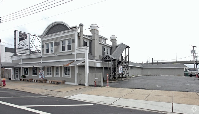
Property Record
507 Main St, Belmar, NJ 07719


NEARBY LISTINGS FOR SALE OR LEASE
Property Detail
507 Main St
07-00056-0000-00002
ALSO LOTS 2 & 10 NIT 1A
Commercialnec
Monmouth
X
New Jersey
34025C0342G
2
2024
0.47 AC
2025
Southern Monmouth
808401
Northern New Jersey
10,608 SF
New York-Jersey City-White Plains, NY-NJ
DEMOGRAPHICS near 507 Main St
1 Mile
3 Mile
5 Mile
2024 Total Population
13,962
77,633
128,536
2029 Population
14,378
79,018
130,434
Pop Growth 2024-2029
+ 2.98%
+ 1.78%
+ 1.48%
Average Age
45
44
45
2024 Total Households
6,582
34,126
55,438
HH Growth 2024-2029
+ 2.95%
+ 1.97%
+ 1.51%
Median Household Inc
$93,336
$86,085
$96,265
Avg Household Size
2.10
2.20
2.20
2024 Avg HH Vehicles
2.00
2.00
2.00
Median Home Value
$649,910
$539,297
$587,174
Median Year Built
1958
1962
1965
Nearby Places
Map Layers
Map Styles
 Street
 Aerial
- Restaurants
- Banks
- Shops
- Fitness
- Groceries
PUBLIC TRANSPORTATION
COMMUTER RAIL
Belmar (North Jersey Coast Line - NJ Transit Commuter Rail (NJ Transit))
DRIVE
WALK
Distance
Belmar (North Jersey Coast Line - NJ Transit Commuter Rail (NJ Transit))
1 min
6 min
0.3 mi
Bradley Beach (North Jersey Coast Line - NJ Transit Commuter Rail (NJ Transit))
DRIVE
WALK
Distance
Bradley Beach (North Jersey Coast Line - NJ Transit Commuter Rail (NJ Transit))
3 min
1.5 mi
Freight Ports
New York Container Terminal
DRIVE
WALK
Distance
New York Container Terminal
59 min
44.9 mi
SALE & LEASE HISTORY
LISTING DATE
SALE/LEASE

Dec 22, 2017
For Sale
Apr 05, 2018
For Lease
Nearby Properties
Address
Land Use
TOTAL SIZE
Lot Size
Zoning
Address
Land Use
TOTAL SIZE
Lot Size
Zoning
26,282 SF
4.59 AC
C
Address
Land Use
TOTAL SIZE
Lot Size
Zoning
2,596 SF
54.13 AC
SF10
Address
Land Use
TOTAL SIZE
Lot Size
Zoning
5,776 SF
25.50 AC
PB
Address
Land Use
TOTAL SIZE
Lot Size
Zoning
739,651 SF
27.89 AC
C
Address
Land Use
TOTAL SIZE
Lot Size
Zoning
1,846 SF
23.23 AC
R-2
Address
Land Use
TOTAL SIZE
Lot Size
Zoning
320,341 SF
57.85 AC
C
Address
Land Use
TOTAL SIZE
Lot Size
Zoning
23,868 SF
137.35 AC
R-1
Address
Land Use
TOTAL SIZE
Lot Size
Zoning
1.61 AC
R1
Address
Land Use
TOTAL SIZE
Lot Size
Zoning
190,893 SF
36.69 AC
POS
Address
Land Use
TOTAL SIZE
Lot Size
Zoning
1,152 SF
87 SF
WPRA
Address
Land Use
TOTAL SIZE
Lot Size
Zoning
108,641 SF
10.64 AC
C-6
Address
Land Use
TOTAL SIZE
Lot Size
Zoning
49,657 SF
11.22 AC
HB80
Address
Land Use
TOTAL SIZE
Lot Size
Zoning
1,288 SF
25.49 AC
HD-R
Address
Land Use
TOTAL SIZE
Lot Size
Zoning
20,959 SF
3.10 AC
R-1
Address
Land Use
TOTAL SIZE
Lot Size
Zoning
3.44 AC
R-2
Address
Land Use
TOTAL SIZE
Lot Size
Zoning
3,094 SF
277.60 AC
C
Address
Land Use
TOTAL SIZE
Lot Size
Zoning
224,683 SF
21.56 AC
CHS
Address
Land Use
TOTAL SIZE
Lot Size
Zoning
91,173 SF
4.07 AC
R3
Address
Land Use
TOTAL SIZE
Lot Size
Zoning
254,714 SF
3.40 AC
WPRA
Address
Land Use
TOTAL SIZE
Lot Size
Zoning
9.30 AC
SF05
Address
Land Use
TOTAL SIZE
Lot Size
Zoning
3.44 AC
SF05
Address
Land Use
TOTAL SIZE
Lot Size
Zoning
Address
Land Use
TOTAL SIZE
Lot Size
Zoning
1,487 SF
7.50 AC
R-B
Address
Land Use
TOTAL SIZE
Lot Size
Zoning
0.88 AC
STNB
Address
Land Use
TOTAL SIZE
Lot Size
Zoning
8.82 AC
R2
Address
Land Use
TOTAL SIZE
Lot Size
Zoning
Address
Land Use
TOTAL SIZE
Lot Size
Zoning
27,328 SF
6.79 AC
HB12
Address
Land Use
TOTAL SIZE
Lot Size
Zoning
26.05 AC
SF10
Address
Land Use
TOTAL SIZE
Lot Size
Zoning
0.86 AC
R-1
Address
Land Use
TOTAL SIZE
Lot Size
Zoning
7.39 AC
R2
The World's #1 Commercial Real Estate Marketplace
Connect with us
© 2025 CoStar Group
The information above has been obtained from sources believed reliable. While we do not doubt its accuracy we have not verified it and make no guarantee, warranty or representation about it. It is your responsibility to independently confirm its accuracy and completeness. Any projections, opinions, assumptions, or estimates used are for example only and do not represent the current or future performance of the property. The value of this transaction to you depends on tax and other factors which should be evaluated by your tax, financial, and legal advisors. You and your advisors should conduct a careful, independent investigation of the property to determine to your satisfaction the suitability of the property for your needs.