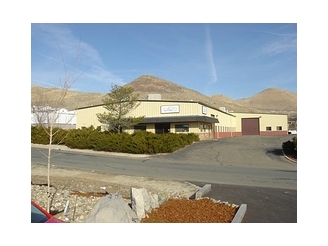
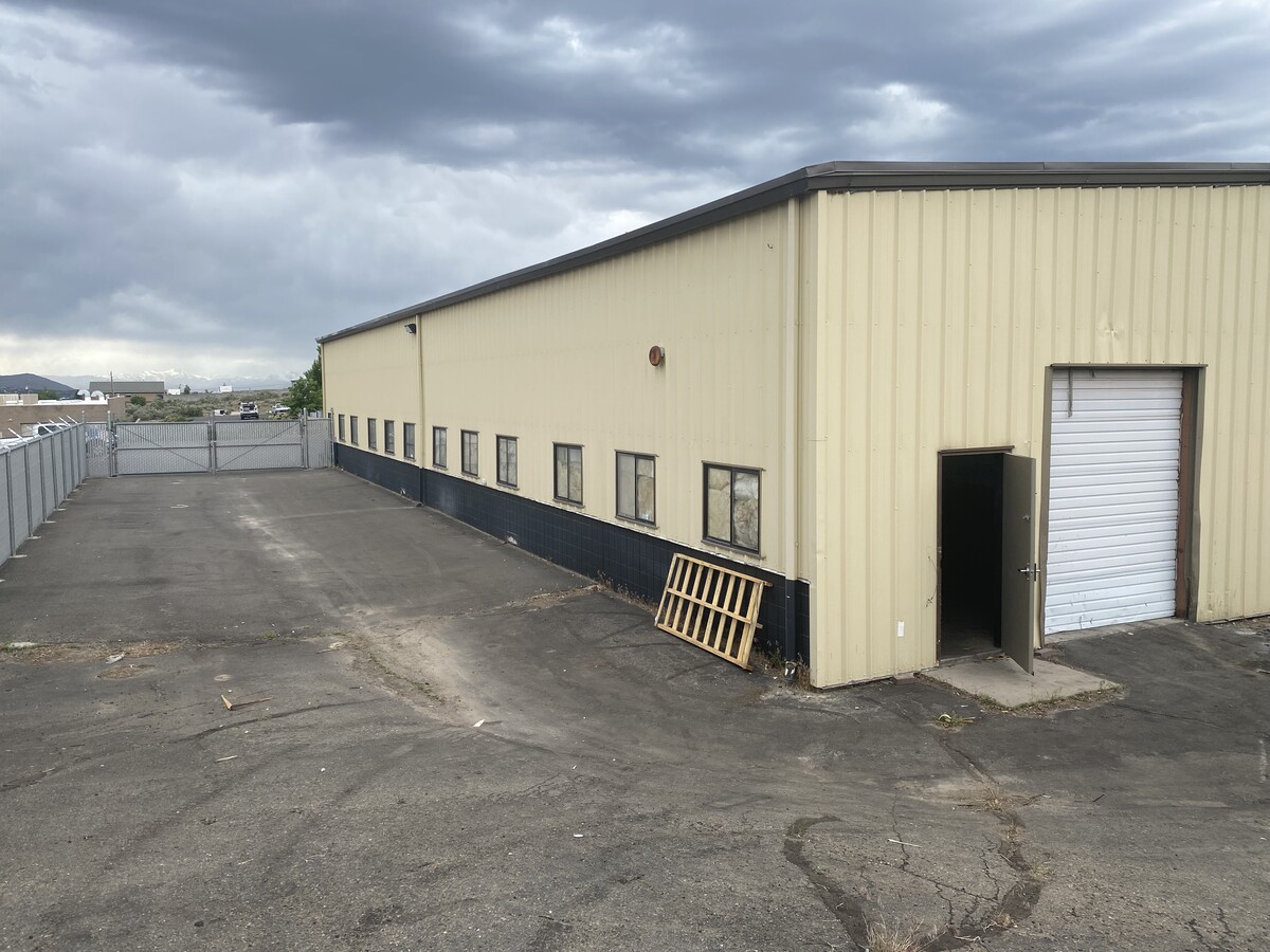
Property Record
1700 Forrest Way, Carson City, NV 89706

NEARBY LISTINGS FOR SALE OR LEASE
Property Detail
1700 Forrest Way
Carson City, NV
Parcel B Map #778
008-681-32
PARCEL B MAP #778
Lightindustrial
Carson City
X
Nevada
32031C3475G
b
2024
0.97 AC
2024
Carson City County
000400
Reno/Sparks
18,165 SF
DEMOGRAPHICS near 1700 Forrest Way
1 Mile
3 Mile
5 Mile
2024 Total Population
958
35,760
55,195
2029 Population
948
36,105
55,705
Pop Growth 2024-2029
(1.04%)
+ 0.96%
+ 0.92%
Average Age
48
42
43
2024 Total Households
412
14,870
22,685
HH Growth 2024-2029
(1.21%)
+ 0.85%
+ 0.90%
Median Household Inc
$88,117
$64,126
$68,120
Avg Household Size
2.30
2.30
2.30
2024 Avg HH Vehicles
2.00
2.00
2.00
Median Home Value
$455,208
$358,012
$380,601
Median Year Built
1983
1979
1981
Nearby Places
- Restaurants
- Banks
- Shops
- Fitness
- Groceries
PUBLIC TRANSPORTATION
AIRPORT
Reno/Tahoe International
DRIVE
WALK
Distance
Reno/Tahoe International
52 min
31.4 mi
Freight Ports
Port of Stockton
DRIVE
WALK
Distance
Port of Stockton
224 min
155.7 mi
SALE & LEASE HISTORY
LISTING DATE
SALE/LEASE

Nov 17, 2020
For Sale
Jun 22, 2023
For Lease
Aug 20, 2019
For Lease
Nearby Properties
Address
Land Use
TOTAL SIZE
Lot Size
Zoning
Address
Land Use
TOTAL SIZE
Lot Size
Zoning
333,095 SF
31.92 AC
RC
Address
Land Use
TOTAL SIZE
Lot Size
Zoning
208,552 SF
84.87 AC
PR
Address
Land Use
TOTAL SIZE
Lot Size
Zoning
356,776 SF
64.42 AC
P
Address
Land Use
TOTAL SIZE
Lot Size
Zoning
175,233 SF
5.88 AC
PR
Address
Land Use
TOTAL SIZE
Lot Size
Zoning
7,419 SF
264.90 AC
PR
Address
Land Use
TOTAL SIZE
Lot Size
Zoning
92,560 SF
4.93 AC
MFA
Address
Land Use
TOTAL SIZE
Lot Size
Zoning
96,057 SF
10 AC
LI
Address
Land Use
TOTAL SIZE
Lot Size
Zoning
157,914 SF
7.15 AC
PR
Address
Land Use
TOTAL SIZE
Lot Size
Zoning
213,246 SF
19.48 AC
GC-RC
Address
Land Use
TOTAL SIZE
Lot Size
Zoning
169,086 SF
18.49 AC
RC-P
Address
Land Use
TOTAL SIZE
Lot Size
Zoning
137,022 SF
5.29 AC
RC
Address
Land Use
TOTAL SIZE
Lot Size
Zoning
138,001 SF
2.20 AC
P
Address
Land Use
TOTAL SIZE
Lot Size
Zoning
70,843 SF
24.29 AC
PR
Address
Land Use
TOTAL SIZE
Lot Size
Zoning
75,863 SF
3.92 AC
RC
Address
Land Use
TOTAL SIZE
Lot Size
Zoning
109,200 SF
9.35 AC
GC
Address
Land Use
TOTAL SIZE
Lot Size
Zoning
113,007 SF
52.90 AC
PR
Address
Land Use
TOTAL SIZE
Lot Size
Zoning
111,950 SF
18.19 AC
RC-MHP
Address
Land Use
TOTAL SIZE
Lot Size
Zoning
156,408 SF
2.08 AC
MFA-GC
Address
Land Use
TOTAL SIZE
Lot Size
Zoning
160,769 SF
15 AC
LI
Address
Land Use
TOTAL SIZE
Lot Size
Zoning
86,783 SF
52 AC
PR
Address
Land Use
TOTAL SIZE
Lot Size
Zoning
21.67 AC
RC-P
Address
Land Use
TOTAL SIZE
Lot Size
Zoning
68,342 SF
2.47 AC
TC
Address
Land Use
TOTAL SIZE
Lot Size
Zoning
20,800 SF
2.90 AC
GC
Address
Land Use
TOTAL SIZE
Lot Size
Zoning
256.42 AC
Address
Land Use
TOTAL SIZE
Lot Size
Zoning
107,063 SF
10.96 AC
GC
Address
Land Use
TOTAL SIZE
Lot Size
Zoning
33,059 SF
4.90 AC
RC
Address
Land Use
TOTAL SIZE
Lot Size
Zoning
89,186 SF
4.54 AC
P
Address
Land Use
TOTAL SIZE
Lot Size
Zoning
47,359 SF
6.46 AC
P
Address
Land Use
TOTAL SIZE
Lot Size
Zoning
40,804 SF
3.87 AC
RC
Address
Land Use
TOTAL SIZE
Lot Size
Zoning
34,438 SF
37.99 AC
CR-RC
The World's #1 Commercial Real Estate Marketplace
Connect with us
© 2025 CoStar Group
The information above has been obtained from sources believed reliable. While we do not doubt its accuracy we have not verified it and make no guarantee, warranty or representation about it. It is your responsibility to independently confirm its accuracy and completeness. Any projections, opinions, assumptions, or estimates used are for example only and do not represent the current or future performance of the property. The value of this transaction to you depends on tax and other factors which should be evaluated by your tax, financial, and legal advisors. You and your advisors should conduct a careful, independent investigation of the property to determine to your satisfaction the suitability of the property for your needs.