Property Record
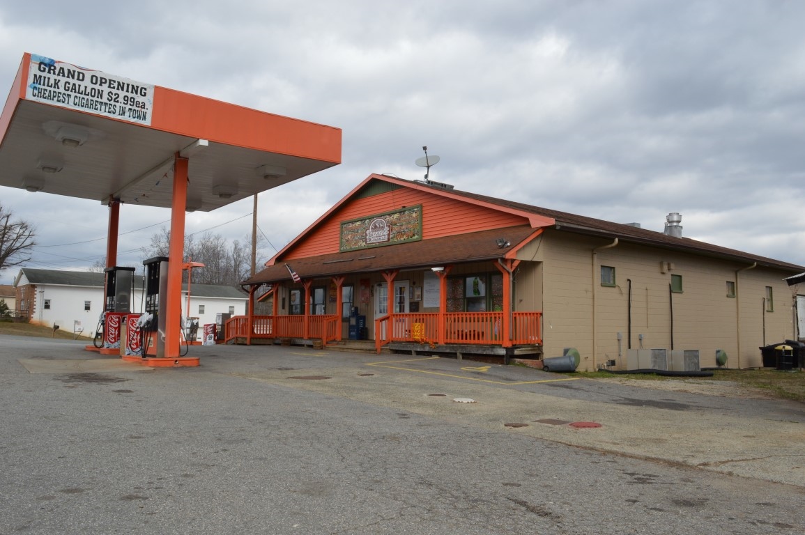
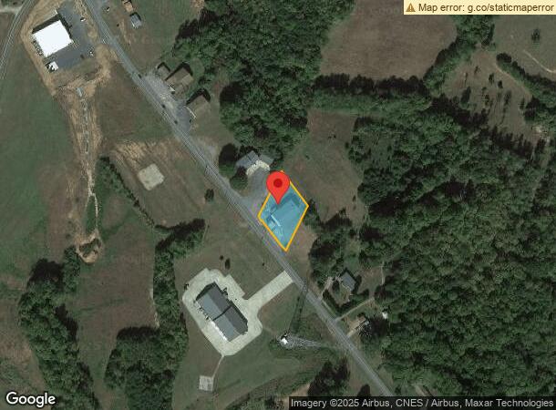
5083 Nc 704 Hwy E, Sandy Ridge, NC 27046

NEARBY LISTINGS FOR SALE OR LEASE
Property Detail
5083 Nc 704 Hwy E
607004603984
Survey For Michael R Lawless Darlene H L
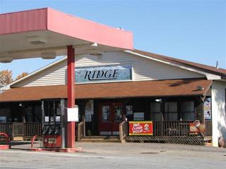
Conveniencestore
Stokes
X
North Carolina
3711606000J
0.48 AC
2024
Stokes County
2024
Greensboro/Winston-Salem
0701002010
Winston-Salem, NC
6,099 SF
DEMOGRAPHICS near 5083 Nc 704 Hwy E
1 Mile
3 Mile
5 Mile
2024 Total Population
213
1,587
3,885
2029 Population
224
1,669
4,062
Pop Growth 2024-2029
+ 5.16%
+ 5.17%
+ 4.56%
Average Age
45
45
45
2024 Total Households
91
681
1,665
HH Growth 2024-2029
+ 5.49%
+ 5.14%
+ 4.56%
Median Household Inc
$62,500
$53,600
$52,696
Avg Household Size
2.30
2.30
2.30
2024 Avg HH Vehicles
2.00
2.00
2.00
Median Home Value
$161,764
$144,650
$148,401
Median Year Built
1979
1983
1983
Nearby Places
- Restaurants
- Banks
- Shops
- Fitness
- Groceries
PUBLIC TRANSPORTATION
AIRPORT
Piedmont Triad International
DRIVE
WALK
Distance
Piedmont Triad International
60 min
40.8 mi
Freight Ports
Virginia Port Authority - Richmond
DRIVE
WALK
Distance
Virginia Port Authority - Richmond
256 min
197.6 mi
SALE & LEASE HISTORY
LISTING DATE
SALE/LEASE

Jun 28, 2017
For Lease
Jun 28, 2017
For Sale
Nearby Properties
Address
Land Use
TOTAL SIZE
Lot Size
Zoning
Address
Land Use
TOTAL SIZE
Lot Size
Zoning
1,184 SF
25 AC
R-A
Address
Land Use
TOTAL SIZE
Lot Size
Zoning
14,320 SF
7.23 AC
R-A
Address
Land Use
TOTAL SIZE
Lot Size
Zoning
7,334 SF
10.28 AC
H-B-CZ,R-A
Address
Land Use
TOTAL SIZE
Lot Size
Zoning
363.78 AC
R-A
Address
Land Use
TOTAL SIZE
Lot Size
Zoning
1,563 SF
53 AC
R-A
Address
Land Use
TOTAL SIZE
Lot Size
Zoning
1,912 SF
4.23 AC
R-A
Address
Land Use
TOTAL SIZE
Lot Size
Zoning
272.38 AC
R-A
Address
Land Use
TOTAL SIZE
Lot Size
Zoning
9,217 SF
1.85 AC
H-B
Address
Land Use
TOTAL SIZE
Lot Size
Zoning
9,180 SF
1.73 AC
H-B-CU
Address
Land Use
TOTAL SIZE
Lot Size
Zoning
12,800 SF
49.16 AC
R-A
Address
Land Use
TOTAL SIZE
Lot Size
Zoning
186.50 AC
R-A
Address
Land Use
TOTAL SIZE
Lot Size
Zoning
157.03 AC
R-A
Address
Land Use
TOTAL SIZE
Lot Size
Zoning
134.01 AC
R-A
Address
Land Use
TOTAL SIZE
Lot Size
Zoning
3,660 SF
2.72 AC
H-B
Address
Land Use
TOTAL SIZE
Lot Size
Zoning
8,400 SF
1.64 AC
H-B
Address
Land Use
TOTAL SIZE
Lot Size
Zoning
111.31 AC
R-A
Address
Land Use
TOTAL SIZE
Lot Size
Zoning
6,000 SF
0.71 AC
H-B
Address
Land Use
TOTAL SIZE
Lot Size
Zoning
104.46 AC
R-A
Address
Land Use
TOTAL SIZE
Lot Size
Zoning
6,296 SF
0.85 AC
R-A
Address
Land Use
TOTAL SIZE
Lot Size
Zoning
121.30 AC
R-A
Address
Land Use
TOTAL SIZE
Lot Size
Zoning
6,512 SF
1.95 AC
R-A
Address
Land Use
TOTAL SIZE
Lot Size
Zoning
104.99 AC
R-A
Address
Land Use
TOTAL SIZE
Lot Size
Zoning
5,502 SF
2.45 AC
R-A
Address
Land Use
TOTAL SIZE
Lot Size
Zoning
3,904 SF
1.19 AC
R-A
Address
Land Use
TOTAL SIZE
Lot Size
Zoning
88.40 AC
R-A
Address
Land Use
TOTAL SIZE
Lot Size
Zoning
95.14 AC
R-A
Address
Land Use
TOTAL SIZE
Lot Size
Zoning
5,078 SF
1.96 AC
R-A
Address
Land Use
TOTAL SIZE
Lot Size
Zoning
145.90 AC
R-A
Address
Land Use
TOTAL SIZE
Lot Size
Zoning
75.39 AC
R-A
Address
Land Use
TOTAL SIZE
Lot Size
Zoning
88.75 AC
R-A
The World's #1 Commercial Real Estate Marketplace
Connect with us
© 2025 CoStar Group
The information above has been obtained from sources believed reliable. While we do not doubt its accuracy we have not verified it and make no guarantee, warranty or representation about it. It is your responsibility to independently confirm its accuracy and completeness. Any projections, opinions, assumptions, or estimates used are for example only and do not represent the current or future performance of the property. The value of this transaction to you depends on tax and other factors which should be evaluated by your tax, financial, and legal advisors. You and your advisors should conduct a careful, independent investigation of the property to determine to your satisfaction the suitability of the property for your needs.