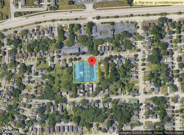
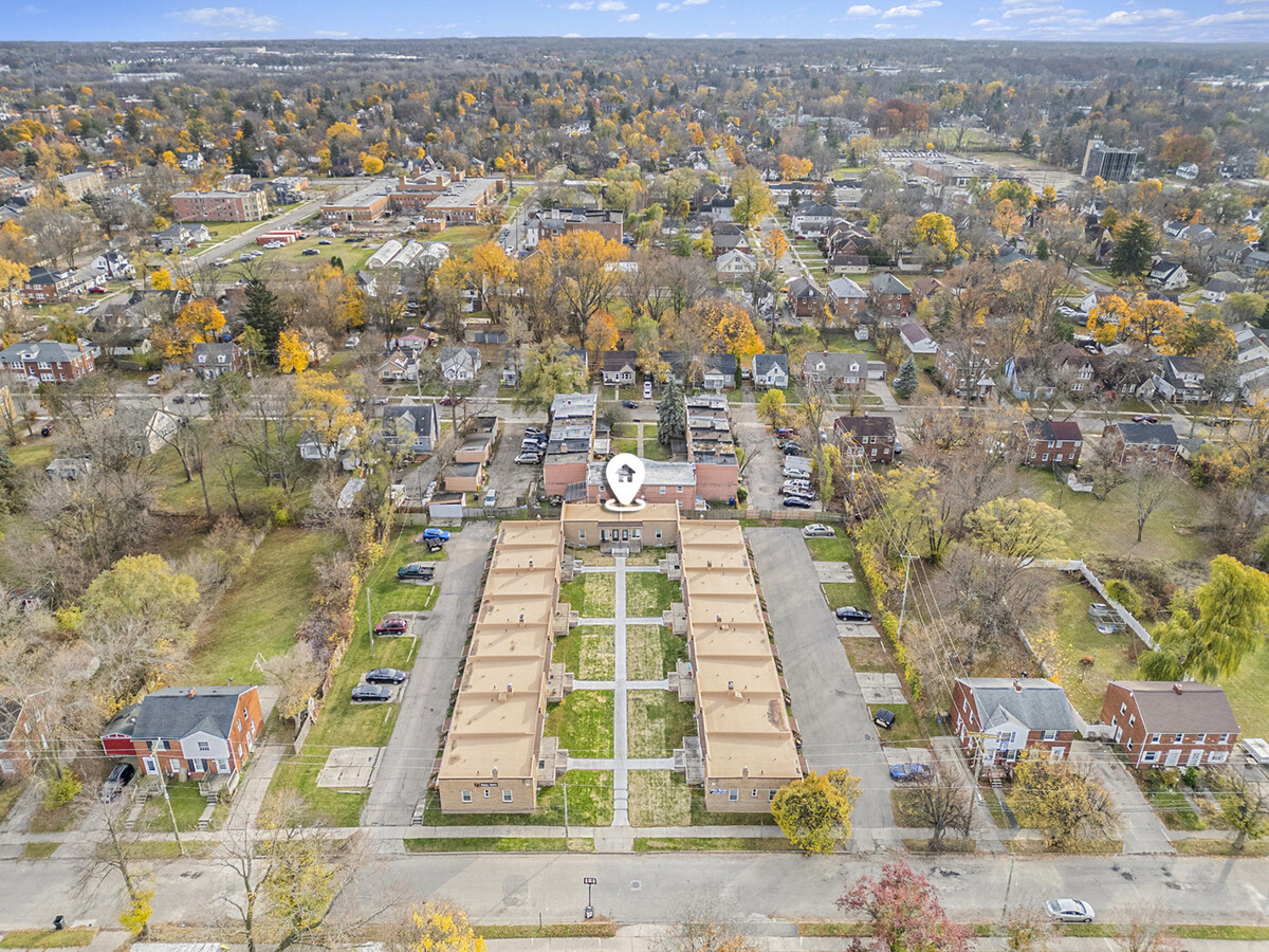
Property Record
51 Spokane Dr, Pontiac, MI 48341
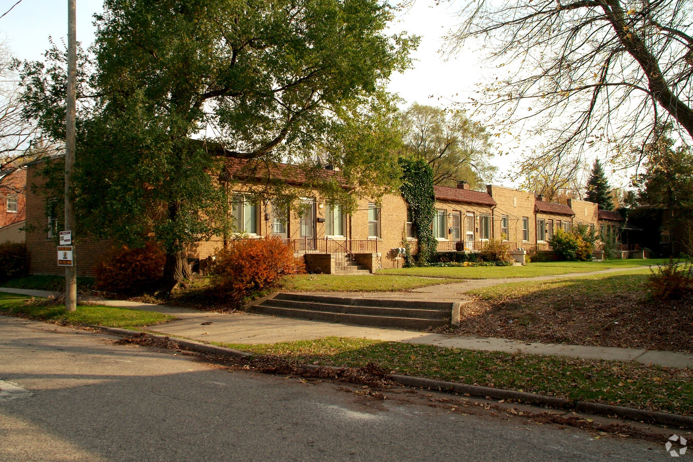
This Property Is For Sale
NEARBY LISTINGS FOR SALE OR LEASE
Property Detail
51 Spokane Dr
14-30-402-009
Assessments
Multifamilydwelling
T3N, R10E, SEC 30 ASSESSOR'S PLAT NO. 109 LOTS 17 TO 25 INCL, ALSO LOTS 40 TO 48 INCL
X
Oakland
26125C0364F
Michigan
2024
1.15 AC
2024
Pontiac
142000
Detroit
12,746 SF
Detroit-Warren-Dearborn, MI
DEMOGRAPHICS near 51 Spokane Dr
1 Mile
3 Mile
5 Mile
2024 Total Population
11,672
81,138
160,206
2029 Population
11,715
81,032
159,529
Pop Growth 2024-2029
+ 0.37%
(0.13%)
(0.42%)
Average Age
39
39
41
2024 Total Households
4,659
33,798
66,332
HH Growth 2024-2029
+ 0.28%
(0.17%)
(0.47%)
Median Household Inc
$48,200
$46,679
$60,113
Avg Household Size
2.30
2.30
2.30
2024 Avg HH Vehicles
2.00
2.00
2.00
Median Home Value
$131,471
$145,665
$213,160
Median Year Built
1949
1961
1968
Nearby Places
- Restaurants
- Banks
- Shops
- Fitness
- Groceries
PUBLIC TRANSPORTATION
COMMUTER RAIL
Pontiac Amtrak Station (Wolverine - Amtrak)
DRIVE
WALK
Distance
Pontiac Amtrak Station (Wolverine - Amtrak)
5 min
1.9 mi
AIRPORT
Detroit Metro Wayne County
DRIVE
WALK
Distance
Detroit Metro Wayne County
58 min
40.4 mi
Freight Ports
Port of Toledo
DRIVE
WALK
Distance
Port of Toledo
107 min
82.1 mi
Nearby Properties
Address
Land Use
TOTAL SIZE
Lot Size
Zoning
Address
Land Use
TOTAL SIZE
Lot Size
Zoning
526,398 SF
32.99 AC
Address
Land Use
TOTAL SIZE
Lot Size
Zoning
1,771,589 SF
96.73 AC
Address
Land Use
TOTAL SIZE
Lot Size
Zoning
608,251 SF
50.49 AC
II
Address
Land Use
TOTAL SIZE
Lot Size
Zoning
481,186 SF
42.14 AC
AI
Address
Land Use
TOTAL SIZE
Lot Size
Zoning
374,400 SF
4.10 AC
Address
Land Use
TOTAL SIZE
Lot Size
Zoning
426,034 SF
24.99 AC
AI
Address
Land Use
TOTAL SIZE
Lot Size
Zoning
221,340 SF
26.88 AC
Address
Land Use
TOTAL SIZE
Lot Size
Zoning
157,589 SF
5.21 AC
Address
Land Use
TOTAL SIZE
Lot Size
Zoning
156,668 SF
13.19 AC
BI
Address
Land Use
TOTAL SIZE
Lot Size
Zoning
23.28 AC
AI
Address
Land Use
TOTAL SIZE
Lot Size
Zoning
97,172 SF
13.82 AC
BI
Address
Land Use
TOTAL SIZE
Lot Size
Zoning
101,320 SF
28.20 AC
Address
Land Use
TOTAL SIZE
Lot Size
Zoning
58,661 SF
3.31 AC
BI
Address
Land Use
TOTAL SIZE
Lot Size
Zoning
79,263 SF
22.27 AC
Address
Land Use
TOTAL SIZE
Lot Size
Zoning
145,712 SF
10.51 AC
BV
Address
Land Use
TOTAL SIZE
Lot Size
Zoning
87,560 SF
7.94 AC
BI
Address
Land Use
TOTAL SIZE
Lot Size
Zoning
288,124 SF
15.76 AC
Address
Land Use
TOTAL SIZE
Lot Size
Zoning
1,870,974 SF
61.73 AC
Address
Land Use
TOTAL SIZE
Lot Size
Zoning
93,706 SF
1.13 AC
Address
Land Use
TOTAL SIZE
Lot Size
Zoning
55,912 SF
1.11 AC
Address
Land Use
TOTAL SIZE
Lot Size
Zoning
143,701 SF
9.85 AC
AI
Address
Land Use
TOTAL SIZE
Lot Size
Zoning
131,214 SF
10.75 AC
AI
Address
Land Use
TOTAL SIZE
Lot Size
Zoning
146,736 SF
14.81 AC
AI
Address
Land Use
TOTAL SIZE
Lot Size
Zoning
137,256 SF
14.97 AC
BI
Address
Land Use
TOTAL SIZE
Lot Size
Zoning
235,395 SF
Address
Land Use
TOTAL SIZE
Lot Size
Zoning
64,053 SF
2.69 AC
Address
Land Use
TOTAL SIZE
Lot Size
Zoning
88,110 SF
3.15 AC
AI
Address
Land Use
TOTAL SIZE
Lot Size
Zoning
1,332,530 SF
95.81 AC
Address
Land Use
TOTAL SIZE
Lot Size
Zoning
86,264 SF
7.85 AC
BI
Address
Land Use
TOTAL SIZE
Lot Size
Zoning
235,395 SF
37.19 AC
The World's #1 Commercial Real Estate Marketplace
Connect with us
© 2025 CoStar Group
The information above has been obtained from sources believed reliable. While we do not doubt its accuracy we have not verified it and make no guarantee, warranty or representation about it. It is your responsibility to independently confirm its accuracy and completeness. Any projections, opinions, assumptions, or estimates used are for example only and do not represent the current or future performance of the property. The value of this transaction to you depends on tax and other factors which should be evaluated by your tax, financial, and legal advisors. You and your advisors should conduct a careful, independent investigation of the property to determine to your satisfaction the suitability of the property for your needs.