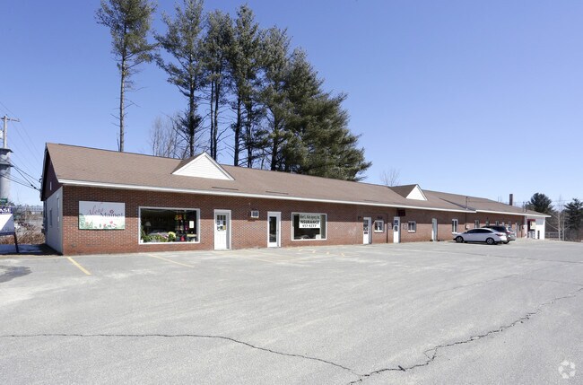
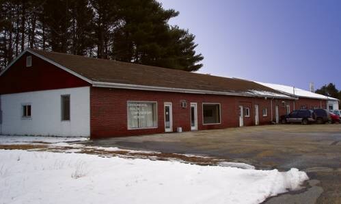
Property Record
51 W Gray Rd, Gray, ME 04039

NEARBY LISTINGS FOR SALE OR LEASE
Property Detail
51 W Gray Rd
GRAY-000043-000024-000015
Cumberland
Multipleuses
Maine
X
15-0
23005C0289F
3.23 AC
2025
NE Cumberland County
2025
Portland/South Portland
004702
Portland-South Portland, ME
DEMOGRAPHICS near 51 W Gray Rd
1 Mile
3 Mile
5 Mile
2024 Total Population
960
5,639
16,045
2029 Population
994
5,870
16,697
Pop Growth 2024-2029
+ 3.54%
+ 4.10%
+ 4.06%
Average Age
41
42
42
2024 Total Households
391
2,305
6,398
HH Growth 2024-2029
+ 3.58%
+ 4.08%
+ 4.16%
Median Household Inc
$97,655
$96,538
$95,770
Avg Household Size
2.40
2.40
2.50
2024 Avg HH Vehicles
2.00
2.00
2.00
Median Home Value
$262,204
$282,735
$324,094
Median Year Built
1984
1986
1984
Nearby Places
Map Layers
Map Styles
 Street
 Aerial
- Restaurants
- Banks
- Shops
- Fitness
- Groceries
PUBLIC TRANSPORTATION
AIRPORT
Portland International Jetport
DRIVE
WALK
Distance
Portland International Jetport
26 min
18.8 mi
Freight Ports
Portland, ME
DRIVE
WALK
Distance
Portland, ME
28 min
18.6 mi
SALE & LEASE HISTORY
LISTING DATE
SALE/LEASE

Sep 25, 2016
For Lease
Nearby Properties
Address
Land Use
TOTAL SIZE
Lot Size
Zoning
Address
Land Use
TOTAL SIZE
Lot Size
Zoning
6.80 AC
BUSINE
Address
Land Use
TOTAL SIZE
Lot Size
Zoning
19.06 AC
BUSINE
Address
Land Use
TOTAL SIZE
Lot Size
Zoning
66.66 AC
RA
Address
Land Use
TOTAL SIZE
Lot Size
Zoning
14,315 SF
2.25 AC
VILLAG
Address
Land Use
TOTAL SIZE
Lot Size
Zoning
9,864 SF
153.52 AC
RA
Address
Land Use
TOTAL SIZE
Lot Size
Zoning
Address
Land Use
TOTAL SIZE
Lot Size
Zoning
5.50 AC
BUSINE
Address
Land Use
TOTAL SIZE
Lot Size
Zoning
12.62 AC
VILLAG
Address
Land Use
TOTAL SIZE
Lot Size
Zoning
7,032 SF
5 AC
RB
Address
Land Use
TOTAL SIZE
Lot Size
Zoning
10.30 AC
VILLAG
Address
Land Use
TOTAL SIZE
Lot Size
Zoning
7.62 AC
RURAL
Address
Land Use
TOTAL SIZE
Lot Size
Zoning
720 SF
14 AC
RURAL
Address
Land Use
TOTAL SIZE
Lot Size
Zoning
2.76 AC
BUSINE
Address
Land Use
TOTAL SIZE
Lot Size
Zoning
147.49 AC
RA
Address
Land Use
TOTAL SIZE
Lot Size
Zoning
20 AC
RA
Address
Land Use
TOTAL SIZE
Lot Size
Zoning
1.20 AC
VILLAG
Address
Land Use
TOTAL SIZE
Lot Size
Zoning
6,600 SF
5.43 AC
BUSINE
Address
Land Use
TOTAL SIZE
Lot Size
Zoning
13,240 SF
9 AC
VILLAG
Address
Land Use
TOTAL SIZE
Lot Size
Zoning
2,579 SF
1.36 AC
VILLAG
Address
Land Use
TOTAL SIZE
Lot Size
Zoning
4.12 AC
RURAL
Address
Land Use
TOTAL SIZE
Lot Size
Zoning
5.50 AC
VILLAG
Address
Land Use
TOTAL SIZE
Lot Size
Zoning
12 AC
RURAL
Address
Land Use
TOTAL SIZE
Lot Size
Zoning
19 AC
RA
Address
Land Use
TOTAL SIZE
Lot Size
Zoning
5.83 AC
RURAL
Address
Land Use
TOTAL SIZE
Lot Size
Zoning
1.81 AC
RURAL
Address
Land Use
TOTAL SIZE
Lot Size
Zoning
1.94 AC
VILLAG
Address
Land Use
TOTAL SIZE
Lot Size
Zoning
90.16 AC
RA
Address
Land Use
TOTAL SIZE
Lot Size
Zoning
1.85 AC
RURAL
Address
Land Use
TOTAL SIZE
Lot Size
Zoning
11.50 AC
VILLAG
Address
Land Use
TOTAL SIZE
Lot Size
Zoning
26.51 AC
BB
The World's #1 Commercial Real Estate Marketplace
Connect with us
© 2025 CoStar Group
The information above has been obtained from sources believed reliable. While we do not doubt its accuracy we have not verified it and make no guarantee, warranty or representation about it. It is your responsibility to independently confirm its accuracy and completeness. Any projections, opinions, assumptions, or estimates used are for example only and do not represent the current or future performance of the property. The value of this transaction to you depends on tax and other factors which should be evaluated by your tax, financial, and legal advisors. You and your advisors should conduct a careful, independent investigation of the property to determine to your satisfaction the suitability of the property for your needs.