Property Record
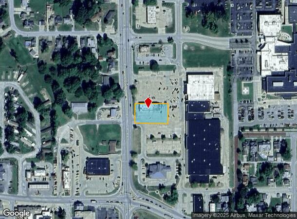
510 N Webster St, Taylorville, IL 62568


NEARBY LISTINGS FOR SALE OR LEASE
Property Detail
510 N Webster St
17-13-22-403-013-00
TR 3 BEG 409' N & 402' W SE COR SW1/4 SE1/4 TH N122' W204' S122' E203' TO POB 122X204' 170203.002 13-22-G
Commercialnec
Christian
X
Illinois
17021C0275D
0.57 AC
2023
Effingham/Central Illinois Area
2023
Other Market Areas
958300
Taylorville, IL
DEMOGRAPHICS near 510 N Webster St
1 Mile
3 Mile
5 Mile
2024 Total Population
8,998
11,707
14,553
2029 Population
8,912
11,534
14,267
Pop Growth 2024-2029
(0.96%)
(1.48%)
(1.97%)
Average Age
42
43
43
2024 Total Households
4,159
5,315
6,177
HH Growth 2024-2029
(1.11%)
(1.56%)
(2.02%)
Median Household Inc
$46,449
$48,068
$50,733
Avg Household Size
2.10
2.10
2.20
2024 Avg HH Vehicles
2.00
2.00
2.00
Median Home Value
$89,453
$95,762
$110,808
Median Year Built
1963
1967
1969
Nearby Places
- Restaurants
- Banks
- Shops
- Fitness
- Groceries
PUBLIC TRANSPORTATION
AIRPORT
Abraham Lincoln Capital
DRIVE
WALK
Distance
Abraham Lincoln Capital
44 min
31.8 mi
Freight Ports
Port Milwaukee
DRIVE
WALK
Distance
Port Milwaukee
339 min
296.1 mi
SALE & LEASE HISTORY
LISTING DATE
SALE/LEASE

Sep 30, 2020
For Sale
Sep 27, 2019
For Sale
Nov 16, 2020
For Sale
May 19, 2020
For Sale
Mar 02, 2020
For Sale
Jul 13, 2020
For Sale
Jan 21, 2020
For Sale
Aug 17, 2020
For Sale
Nearby Properties
Address
Land Use
TOTAL SIZE
Lot Size
Zoning
Address
Land Use
TOTAL SIZE
Lot Size
Zoning
2.48 AC
R-2
Address
Land Use
TOTAL SIZE
Lot Size
Zoning
17.15 AC
C-2
Address
Land Use
TOTAL SIZE
Lot Size
Zoning
12.80 AC
I-1
Address
Land Use
TOTAL SIZE
Lot Size
Zoning
17 AC
I-2
Address
Land Use
TOTAL SIZE
Lot Size
Zoning
1.88 AC
C-1 & C-2
Address
Land Use
TOTAL SIZE
Lot Size
Zoning
3.06 AC
C-2
Address
Land Use
TOTAL SIZE
Lot Size
Zoning
27,945 SF
2.77 AC
R-1 & I-2
Address
Land Use
TOTAL SIZE
Lot Size
Zoning
4.23 AC
R-2
Address
Land Use
TOTAL SIZE
Lot Size
Zoning
1.32 AC
C-2
Address
Land Use
TOTAL SIZE
Lot Size
Zoning
2.42 AC
C-2
Address
Land Use
TOTAL SIZE
Lot Size
Zoning
3.75 AC
C-2
Address
Land Use
TOTAL SIZE
Lot Size
Zoning
8,032 SF
0.12 AC
R-2
Address
Land Use
TOTAL SIZE
Lot Size
Zoning
1.08 AC
C-2
Address
Land Use
TOTAL SIZE
Lot Size
Zoning
1.70 AC
C-2
Address
Land Use
TOTAL SIZE
Lot Size
Zoning
1.13 AC
C-2
Address
Land Use
TOTAL SIZE
Lot Size
Zoning
5.63 AC
C-1 & C-2
Address
Land Use
TOTAL SIZE
Lot Size
Zoning
2.38 AC
C-1
Address
Land Use
TOTAL SIZE
Lot Size
Zoning
5.45 AC
C-2
Address
Land Use
TOTAL SIZE
Lot Size
Zoning
4.98 AC
C-1 & R-1
Address
Land Use
TOTAL SIZE
Lot Size
Zoning
Address
Land Use
TOTAL SIZE
Lot Size
Zoning
3.86 AC
I-2
Address
Land Use
TOTAL SIZE
Lot Size
Zoning
Address
Land Use
TOTAL SIZE
Lot Size
Zoning
1.16 AC
C-1
Address
Land Use
TOTAL SIZE
Lot Size
Zoning
6.95 AC
I-2
Address
Land Use
TOTAL SIZE
Lot Size
Zoning
0.98 AC
C-1
Address
Land Use
TOTAL SIZE
Lot Size
Zoning
6,560 SF
1.38 AC
R-2
Address
Land Use
TOTAL SIZE
Lot Size
Zoning
1.21 AC
C-1
Address
Land Use
TOTAL SIZE
Lot Size
Zoning
0.32 AC
C-1
Address
Land Use
TOTAL SIZE
Lot Size
Zoning
5.40 AC
I-2
The World's #1 Commercial Real Estate Marketplace
Connect with us
© 2025 CoStar Group
The information above has been obtained from sources believed reliable. While we do not doubt its accuracy we have not verified it and make no guarantee, warranty or representation about it. It is your responsibility to independently confirm its accuracy and completeness. Any projections, opinions, assumptions, or estimates used are for example only and do not represent the current or future performance of the property. The value of this transaction to you depends on tax and other factors which should be evaluated by your tax, financial, and legal advisors. You and your advisors should conduct a careful, independent investigation of the property to determine to your satisfaction the suitability of the property for your needs.