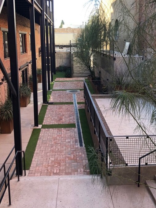
Property Record
510 Western St, El Paso, TX 79901


NEARBY LISTINGS FOR SALE OR LEASE
Property Detail
510 Western St
El Paso, TX
O Campbell
C050-999-1700-4800
170 CAMPBELL E 1/2 OF 9 TO 11 (4740.00 SQ FT)
Commercialnec
El Paso
2024
Texas
2025
0.11 AC
001700
CBD
14,040 SF
El Paso
DEMOGRAPHICS near 510 Western St
1 Mile
3 Mile
5 Mile
2024 Total Population
12,767
42,847
109,438
2029 Population
13,135
44,064
111,778
Pop Growth 2024-2029
+ 2.88%
+ 2.84%
+ 2.14%
Average Age
40
40
39
2024 Total Households
5,663
17,598
44,649
HH Growth 2024-2029
+ 3.13%
+ 2.94%
+ 2.18%
Median Household Inc
$18,362
$24,425
$33,007
Avg Household Size
2.00
2.20
2.30
2024 Avg HH Vehicles
1.00
1.00
1.00
Median Home Value
$151,724
$164,879
$140,573
Median Year Built
1949
1954
1961
Nearby Places
Map Layers
Map Styles
 Street
 Aerial
- Restaurants
- Banks
- Shops
- Fitness
- Groceries
PUBLIC TRANSPORTATION
AIRPORT
El Paso International
DRIVE
WALK
Distance
El Paso International
26 min
14.2 mi
SALE & LEASE HISTORY
LISTING DATE
SALE/LEASE

Sep 25, 2016
For Lease
Jan 13, 2020
For Sale
Nearby Properties
Address
Land Use
TOTAL SIZE
Lot Size
Zoning
Address
Land Use
TOTAL SIZE
Lot Size
Zoning
1,387,028 SF
65.27 AC
R4
Address
Land Use
TOTAL SIZE
Lot Size
Zoning
558,800 SF
1.55 AC
C5
Address
Land Use
TOTAL SIZE
Lot Size
Zoning
318,665 SF
1.43 AC
C5
Address
Land Use
TOTAL SIZE
Lot Size
Zoning
859,302 SF
21.17 AC
C2
Address
Land Use
TOTAL SIZE
Lot Size
Zoning
324,056 SF
1.49 AC
C4
Address
Land Use
TOTAL SIZE
Lot Size
Zoning
1 SF
5.75 AC
C5S
Address
Land Use
TOTAL SIZE
Lot Size
Zoning
347,241 SF
Address
Land Use
TOTAL SIZE
Lot Size
Zoning
169,031 SF
1.22 AC
SP
Address
Land Use
TOTAL SIZE
Lot Size
Zoning
313,532 SF
5.73 AC
C1S
Address
Land Use
TOTAL SIZE
Lot Size
Zoning
1 SF
45.46 AC
M1
Address
Land Use
TOTAL SIZE
Lot Size
Zoning
629,002 SF
1.22 AC
C5
Address
Land Use
TOTAL SIZE
Lot Size
Zoning
128,916 SF
1.50 AC
C5
Address
Land Use
TOTAL SIZE
Lot Size
Zoning
86,391 SF
1.55 AC
C5
Address
Land Use
TOTAL SIZE
Lot Size
Zoning
156,184 SF
8.39 AC
R5S
Address
Land Use
TOTAL SIZE
Lot Size
Zoning
114,289 SF
3.03 AC
R5
Address
Land Use
TOTAL SIZE
Lot Size
Zoning
185,087 SF
10.27 AC
A3S
Address
Land Use
TOTAL SIZE
Lot Size
Zoning
420,509 SF
1.02 AC
C5
Address
Land Use
TOTAL SIZE
Lot Size
Zoning
128,560 SF
0.72 AC
M1
Address
Land Use
TOTAL SIZE
Lot Size
Zoning
73,574 SF
0.69 AC
C5
Address
Land Use
TOTAL SIZE
Lot Size
Zoning
155,308 SF
Address
Land Use
TOTAL SIZE
Lot Size
Zoning
231,480 SF
12.77 AC
C4S
Address
Land Use
TOTAL SIZE
Lot Size
Zoning
55,208 SF
5.34 AC
SD
Address
Land Use
TOTAL SIZE
Lot Size
Zoning
221,370 SF
0.73 AC
GMU
Address
Land Use
TOTAL SIZE
Lot Size
Zoning
92,100 SF
5.23 AC
C1
Address
Land Use
TOTAL SIZE
Lot Size
Zoning
149,818 SF
Address
Land Use
TOTAL SIZE
Lot Size
Zoning
112,692 SF
C4
Address
Land Use
TOTAL SIZE
Lot Size
Zoning
260,800 SF
0.61 AC
C5
Address
Land Use
TOTAL SIZE
Lot Size
Zoning
109,585 SF
1.97 AC
SD
Address
Land Use
TOTAL SIZE
Lot Size
Zoning
370,741 SF
1.21 AC
C5
The World's #1 Commercial Real Estate Marketplace
Connect with us
© 2026 CoStar Group
The information above has been obtained from sources believed reliable. While we do not doubt its accuracy we have not verified it and make no guarantee, warranty or representation about it. It is your responsibility to independently confirm its accuracy and completeness. Any projections, opinions, assumptions, or estimates used are for example only and do not represent the current or future performance of the property. The value of this transaction to you depends on tax and other factors which should be evaluated by your tax, financial, and legal advisors. You and your advisors should conduct a careful, independent investigation of the property to determine to your satisfaction the suitability of the property for your needs.