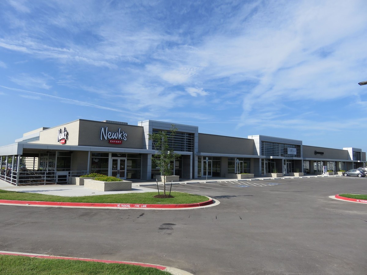
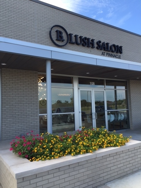
Property Record
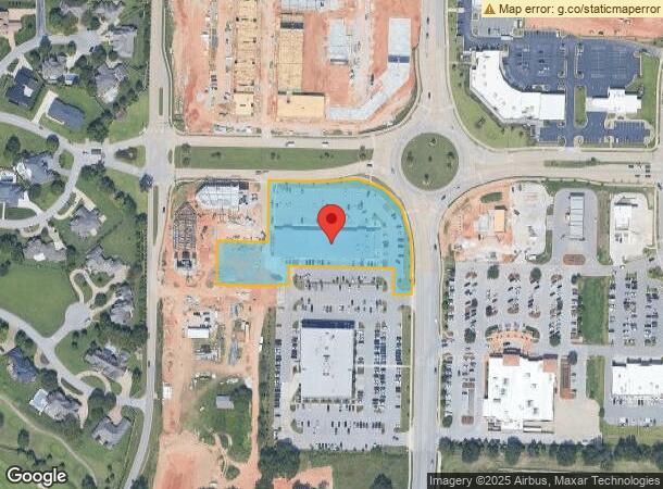
5100 W Pauline Whitaker Pky, Rogers, AR 72758
NEARBY LISTINGS FOR SALE OR LEASE
Property Detail
5100 W Pauline Whitaker Pky
02-02087-408
Rogers
Regionalshoppingcenterormallwithanchorstore
TRACT C2, AS SHOWN ON TRACT SPLIT DATED SEPTEMBER 5, 2014 AND RECORDED IN THE OFFICE OF THE CIRCUIT CLERK AND EX-OFFICIO RECORDER FOR BENTON COUNTY, ARKANSAS IN PLAT BOOK 2014 AT PAGE 637, MORE PARTICULARLY DESCRIBED AS FOLLOWS: A PART OF TRACT C AS
X
Benton
05007C0265K
Arkansas
2024
2.90 AC
2024
West Rogers
020405
Fayetteville/Springdale/Rogers
22,699 SF
Fayetteville-Springdale-Rogers, AR-MO
DEMOGRAPHICS near 5100 W Pauline Whitaker Pky
1 Mile
3 Mile
5 Mile
2024 Total Population
4,821
43,480
119,402
2029 Population
5,760
51,651
140,623
Pop Growth 2024-2029
+ 19.48%
+ 18.79%
+ 17.77%
Average Age
38
36
35
2024 Total Households
1,850
16,296
43,686
HH Growth 2024-2029
+ 19.78%
+ 19.06%
+ 17.89%
Median Household Inc
$159,181
$103,828
$82,517
Avg Household Size
2.60
2.60
2.70
2024 Avg HH Vehicles
2.00
2.00
2.00
Median Home Value
$430,150
$334,934
$259,902
Median Year Built
2008
2007
2000
Nearby Places
- Restaurants
- Banks
- Shops
- Fitness
- Groceries
PUBLIC TRANSPORTATION
AIRPORT
Northwest Arkansas Ntl
DRIVE
WALK
Distance
Northwest Arkansas Ntl
25 min
10.7 mi
Freight Ports
Tulsa Port of Inola
DRIVE
WALK
Distance
Tulsa Port of Inola
110 min
94.5 mi
SALE & LEASE HISTORY
LISTING DATE
SALE/LEASE

Sep 25, 2016
For Lease
Jan 16, 2019
For Lease
Dec 12, 2019
For Lease
Nearby Properties
Address
Land Use
TOTAL SIZE
Lot Size
Zoning
Address
Land Use
TOTAL SIZE
Lot Size
Zoning
52,778 SF
1.04 AC
Address
Land Use
TOTAL SIZE
Lot Size
Zoning
441,673 SF
55.19 AC
Address
Land Use
TOTAL SIZE
Lot Size
Zoning
384,427 SF
10.51 AC
Address
Land Use
TOTAL SIZE
Lot Size
Zoning
216,538 SF
22.14 AC
Address
Land Use
TOTAL SIZE
Lot Size
Zoning
472,987 SF
3.75 AC
Address
Land Use
TOTAL SIZE
Lot Size
Zoning
405,394 SF
10.97 AC
Address
Land Use
TOTAL SIZE
Lot Size
Zoning
573,822 SF
10.56 AC
Address
Land Use
TOTAL SIZE
Lot Size
Zoning
375,605 SF
24.54 AC
Address
Land Use
TOTAL SIZE
Lot Size
Zoning
412,893 SF
11.51 AC
Address
Land Use
TOTAL SIZE
Lot Size
Zoning
306,814 SF
9.46 AC
Address
Land Use
TOTAL SIZE
Lot Size
Zoning
234,432 SF
19.98 AC
Address
Land Use
TOTAL SIZE
Lot Size
Zoning
299,595 SF
18 AC
Address
Land Use
TOTAL SIZE
Lot Size
Zoning
305,450 SF
12.16 AC
Address
Land Use
TOTAL SIZE
Lot Size
Zoning
42,848 SF
3.08 AC
Address
Land Use
TOTAL SIZE
Lot Size
Zoning
251,593 SF
6.95 AC
Address
Land Use
TOTAL SIZE
Lot Size
Zoning
270,199 SF
10.23 AC
Address
Land Use
TOTAL SIZE
Lot Size
Zoning
17,340 SF
14.15 AC
Address
Land Use
TOTAL SIZE
Lot Size
Zoning
365,674 SF
18.05 AC
Address
Land Use
TOTAL SIZE
Lot Size
Zoning
108,103 SF
8.53 AC
Address
Land Use
TOTAL SIZE
Lot Size
Zoning
80,045 SF
8.29 AC
Address
Land Use
TOTAL SIZE
Lot Size
Zoning
152,925 SF
16.49 AC
Address
Land Use
TOTAL SIZE
Lot Size
Zoning
148,292 SF
4.32 AC
Address
Land Use
TOTAL SIZE
Lot Size
Zoning
274,950 SF
3.80 AC
Address
Land Use
TOTAL SIZE
Lot Size
Zoning
430,236 SF
3.96 AC
Address
Land Use
TOTAL SIZE
Lot Size
Zoning
141,924 SF
5.04 AC
Address
Land Use
TOTAL SIZE
Lot Size
Zoning
49,061 SF
20.50 AC
Address
Land Use
TOTAL SIZE
Lot Size
Zoning
210,971 SF
8.46 AC
Address
Land Use
TOTAL SIZE
Lot Size
Zoning
209,369 SF
21.60 AC
Address
Land Use
TOTAL SIZE
Lot Size
Zoning
269,397 SF
27.07 AC
Address
Land Use
TOTAL SIZE
Lot Size
Zoning
106,031 SF
0.87 AC
The World's #1 Commercial Real Estate Marketplace
Connect with us
© 2025 CoStar Group
The information above has been obtained from sources believed reliable. While we do not doubt its accuracy we have not verified it and make no guarantee, warranty or representation about it. It is your responsibility to independently confirm its accuracy and completeness. Any projections, opinions, assumptions, or estimates used are for example only and do not represent the current or future performance of the property. The value of this transaction to you depends on tax and other factors which should be evaluated by your tax, financial, and legal advisors. You and your advisors should conduct a careful, independent investigation of the property to determine to your satisfaction the suitability of the property for your needs.