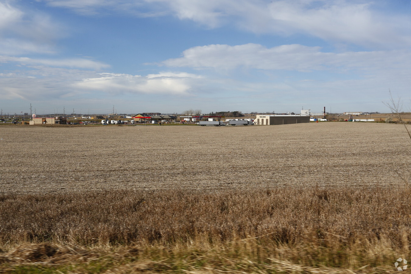
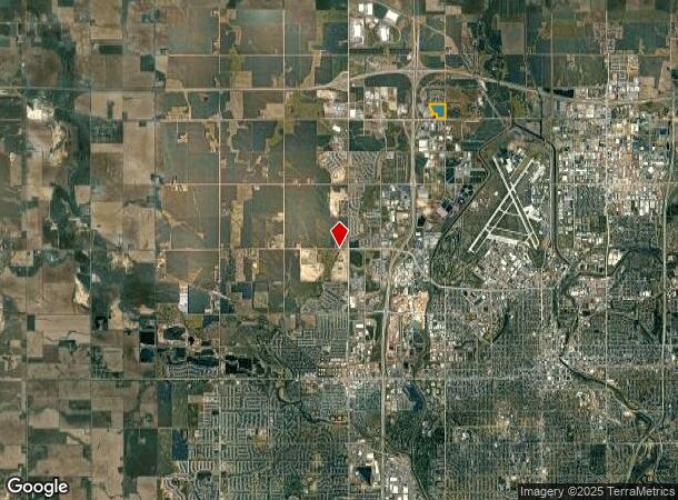
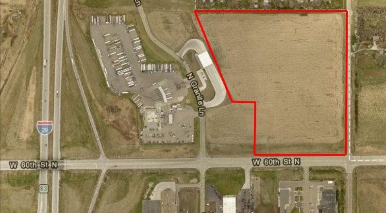
Property Record
5101 N Kiwanis Ave, Sioux Falls, SD 57107
NEARBY LISTINGS FOR SALE OR LEASE
Property Detail
5101 N Kiwanis Ave
Sioux Falls, SD
Meadow Addn
75394
TRACT 1 GREAT MEADOW ADDN TO CITY OF SIOUX FALLS
Commercialacreage
Minnehaha
X
South Dakota
46083C0050D
26.89 AC
2024
Sioux Falls
2023
Other Market Areas
010405
DEMOGRAPHICS near 5101 N Kiwanis Ave
1 Mile
3 Mile
5 Mile
2024 Total Population
205
9,233
59,705
2029 Population
225
10,049
64,748
Pop Growth 2024-2029
+ 9.76%
+ 8.84%
+ 8.45%
Average Age
47
36
38
2024 Total Households
81
3,868
25,420
HH Growth 2024-2029
+ 11.11%
+ 9.05%
+ 9.02%
Median Household Inc
$38,333
$63,503
$56,332
Avg Household Size
2.40
2.30
2.20
2024 Avg HH Vehicles
1.00
2.00
2.00
Median Home Value
$252,777
$249,091
$173,930
Median Year Built
1964
2005
1977
Nearby Places
- Restaurants
- Banks
- Shops
- Fitness
- Groceries
PUBLIC TRANSPORTATION
AIRPORT
Joe Foss Field
DRIVE
WALK
Distance
Joe Foss Field
20 min
5.1 mi
Freight Ports
Port Milwaukee
DRIVE
WALK
Distance
Port Milwaukee
549 min
506.5 mi
SALE & LEASE HISTORY
LISTING DATE
SALE/LEASE

Nov 21, 2016
For Sale
Aug 25, 2017
For Sale
Nearby Properties
Address
Land Use
TOTAL SIZE
Lot Size
Zoning
Address
Land Use
TOTAL SIZE
Lot Size
Zoning
13,806 SF
10.99 AC
Address
Land Use
TOTAL SIZE
Lot Size
Zoning
80.61 AC
Address
Land Use
TOTAL SIZE
Lot Size
Zoning
72,342 SF
6.09 AC
FP;FP
Address
Land Use
TOTAL SIZE
Lot Size
Zoning
38.43 AC
FP;FP
Address
Land Use
TOTAL SIZE
Lot Size
Zoning
31,533 SF
3.46 AC
C;COMMERCI
Address
Land Use
TOTAL SIZE
Lot Size
Zoning
35.15 AC
Address
Land Use
TOTAL SIZE
Lot Size
Zoning
117,026 SF
14.52 AC
RA;APARTME
Address
Land Use
TOTAL SIZE
Lot Size
Zoning
1,152 SF
33.86 AC
MH;MOBILE
Address
Land Use
TOTAL SIZE
Lot Size
Zoning
3,664 SF
28.55 AC
Address
Land Use
TOTAL SIZE
Lot Size
Zoning
2,124 SF
27.28 AC
FP;FP
Address
Land Use
TOTAL SIZE
Lot Size
Zoning
24.27 AC
Address
Land Use
TOTAL SIZE
Lot Size
Zoning
2,432 SF
88.85 AC
Address
Land Use
TOTAL SIZE
Lot Size
Zoning
23.87 AC
Address
Land Use
TOTAL SIZE
Lot Size
Zoning
224 SF
161.91 AC
Address
Land Use
TOTAL SIZE
Lot Size
Zoning
140,816 SF
13.80 AC
Address
Land Use
TOTAL SIZE
Lot Size
Zoning
Address
Land Use
TOTAL SIZE
Lot Size
Zoning
16,628 SF
3.74 AC
FP;FP
Address
Land Use
TOTAL SIZE
Lot Size
Zoning
193,993 SF
34.46 AC
Address
Land Use
TOTAL SIZE
Lot Size
Zoning
18,502 SF
3.08 AC
FP;FP
Address
Land Use
TOTAL SIZE
Lot Size
Zoning
8,648 SF
48 AC
FP;FP
Address
Land Use
TOTAL SIZE
Lot Size
Zoning
13,628 SF
15.01 AC
FP;FP
Address
Land Use
TOTAL SIZE
Lot Size
Zoning
71,471 SF
5.56 AC
Address
Land Use
TOTAL SIZE
Lot Size
Zoning
16,011 SF
18.79 AC
Address
Land Use
TOTAL SIZE
Lot Size
Zoning
137,651 SF
22.28 AC
Address
Land Use
TOTAL SIZE
Lot Size
Zoning
60,929 SF
13.18 AC
Address
Land Use
TOTAL SIZE
Lot Size
Zoning
167,162 SF
17.11 AC
Address
Land Use
TOTAL SIZE
Lot Size
Zoning
11.54 AC
RS;RESID S
Address
Land Use
TOTAL SIZE
Lot Size
Zoning
5,774 SF
20.37 AC
FP;FP
Address
Land Use
TOTAL SIZE
Lot Size
Zoning
11,646 SF
1.60 AC
FP;FP
Address
Land Use
TOTAL SIZE
Lot Size
Zoning
31.92 AC
I1;LIGHT I
The World's #1 Commercial Real Estate Marketplace
Connect with us
© 2025 CoStar Group
The information above has been obtained from sources believed reliable. While we do not doubt its accuracy we have not verified it and make no guarantee, warranty or representation about it. It is your responsibility to independently confirm its accuracy and completeness. Any projections, opinions, assumptions, or estimates used are for example only and do not represent the current or future performance of the property. The value of this transaction to you depends on tax and other factors which should be evaluated by your tax, financial, and legal advisors. You and your advisors should conduct a careful, independent investigation of the property to determine to your satisfaction the suitability of the property for your needs.