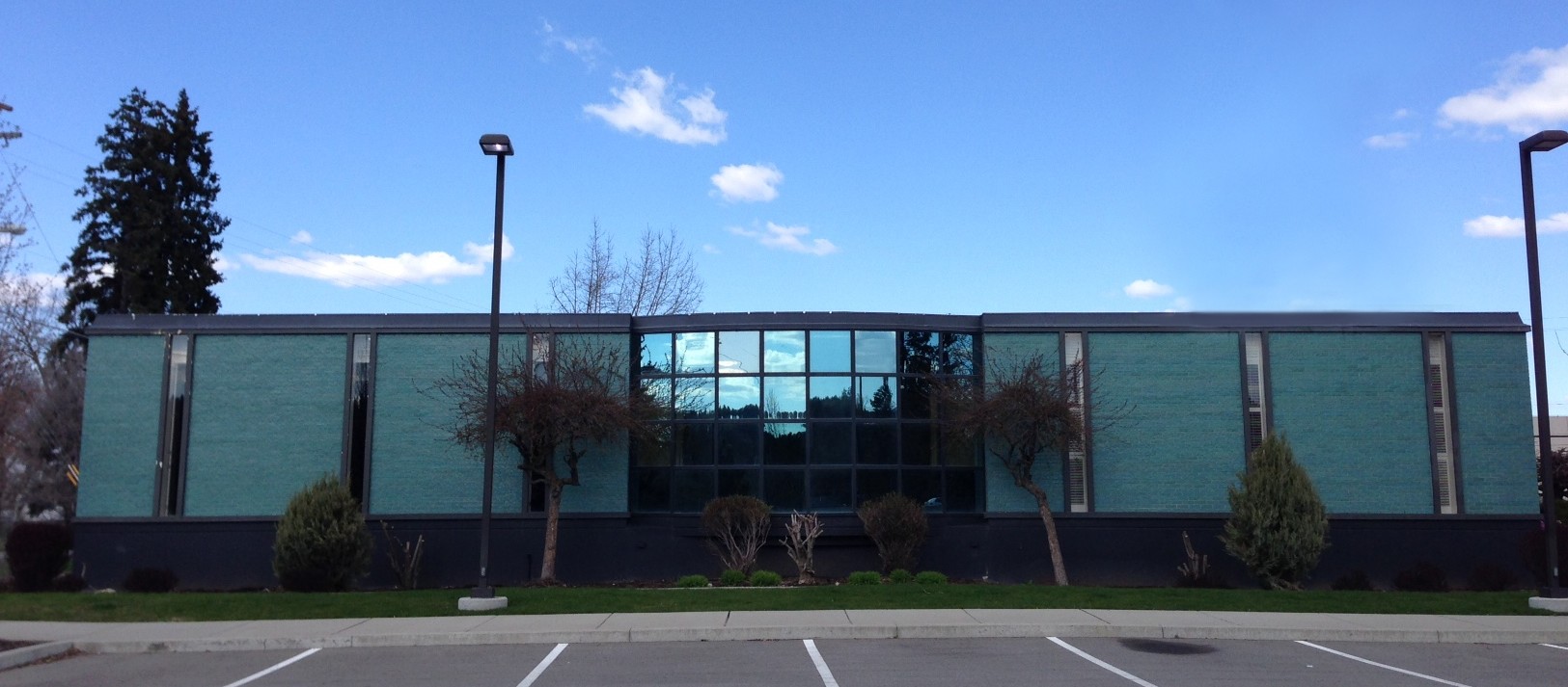
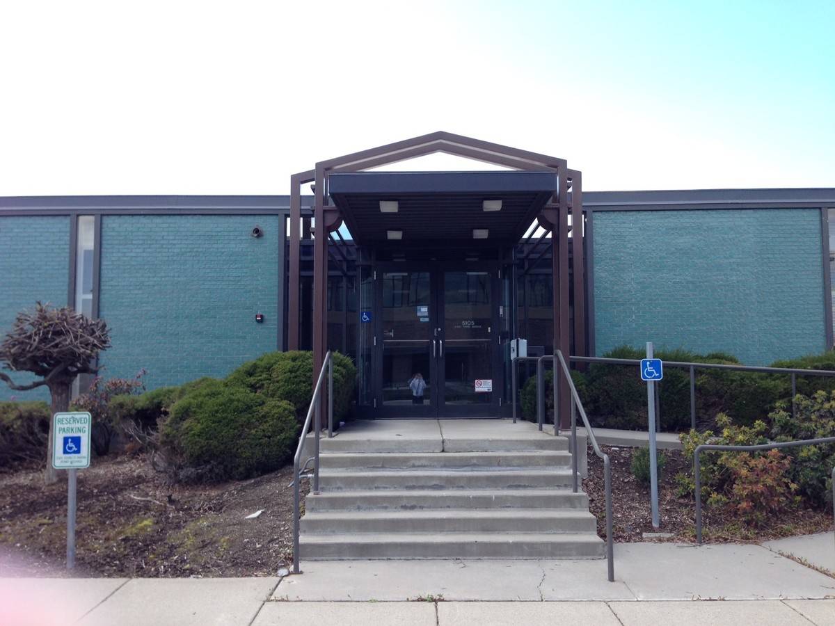
Property Record
5105 E 3Rd Ave, Spokane Valley, WA 99212


Current Lease Availabilities
NEARBY LISTINGS FOR SALE OR LEASE
Property Detail
5105 E 3Rd Ave
35231.9012
City Of Spokane Valley
Financialbuilding
(CITY OF SPOKANE VALLEY) PARCEL A ROS #5727430 BK 135 PG 18 - BEING A PTN OF NE1/4 OF 23-25-43
X
Spokane
53063C0564D
Washington
2025
0.99 AC
2024
Valley
012300
Spokane
6,565 SF
Spokane-Spokane Valley, WA
DEMOGRAPHICS near 5105 E 3Rd Ave
1 Mile
3 Mile
5 Mile
2024 Total Population
6,658
71,818
227,286
2029 Population
7,104
76,525
241,982
Pop Growth 2024-2029
+ 6.70%
+ 6.55%
+ 6.47%
Average Age
40
40
40
2024 Total Households
2,802
28,744
93,705
HH Growth 2024-2029
+ 6.60%
+ 6.75%
+ 6.75%
Median Household Inc
$54,875
$63,068
$58,719
Avg Household Size
2.30
2.40
2.30
2024 Avg HH Vehicles
2.00
2.00
2.00
Median Home Value
$312,603
$302,637
$329,351
Median Year Built
1977
1972
1969
Nearby Places
- Restaurants
- Banks
- Shops
- Fitness
- Groceries
PUBLIC TRANSPORTATION
COMMUTER RAIL
Spokane (Empire Builder - Amtrak)
DRIVE
WALK
Distance
Spokane (Empire Builder - Amtrak)
8 min
4.1 mi
AIRPORT
Spokane International
DRIVE
WALK
Distance
Spokane International
16 min
10.0 mi
Freight Ports
Port of Everett
DRIVE
WALK
Distance
Port of Everett
343 min
305.6 mi
Nearby Properties
Address
Land Use
TOTAL SIZE
Lot Size
Zoning
Address
Land Use
TOTAL SIZE
Lot Size
Zoning
915,855 SF
100.66 AC
LI
Address
Land Use
TOTAL SIZE
Lot Size
Zoning
365,804 SF
16.13 AC
RSF
Address
Land Use
TOTAL SIZE
Lot Size
Zoning
226,702 SF
49.25 AC
RSF
Address
Land Use
TOTAL SIZE
Lot Size
Zoning
427,054 SF
16.60 AC
LI
Address
Land Use
TOTAL SIZE
Lot Size
Zoning
376,566 SF
20.64 AC
LI
Address
Land Use
TOTAL SIZE
Lot Size
Zoning
289,573 SF
7.73 AC
RMF
Address
Land Use
TOTAL SIZE
Lot Size
Zoning
107,240 SF
1.54 AC
CC1
Address
Land Use
TOTAL SIZE
Lot Size
Zoning
290,380 SF
2.11 AC
CA3
Address
Land Use
TOTAL SIZE
Lot Size
Zoning
116,096 SF
17.38 AC
R-2
Address
Land Use
TOTAL SIZE
Lot Size
Zoning
58,522 SF
19.91 AC
HI
Address
Land Use
TOTAL SIZE
Lot Size
Zoning
41,890 SF
2.11 AC
OR
Address
Land Use
TOTAL SIZE
Lot Size
Zoning
107,442 SF
5.57 AC
MF-2
Address
Land Use
TOTAL SIZE
Lot Size
Zoning
133,015 SF
5.89 AC
HDR
Address
Land Use
TOTAL SIZE
Lot Size
Zoning
96,267 SF
9.04 AC
I-1
Address
Land Use
TOTAL SIZE
Lot Size
Zoning
172,388 SF
13.59 AC
RSF
Address
Land Use
TOTAL SIZE
Lot Size
Zoning
75,680 SF
3.93 AC
RSF
Address
Land Use
TOTAL SIZE
Lot Size
Zoning
150,812 SF
17.49 AC
RC
Address
Land Use
TOTAL SIZE
Lot Size
Zoning
118,818 SF
7.96 AC
HDR
Address
Land Use
TOTAL SIZE
Lot Size
Zoning
133,043 SF
1.85 AC
CC1
Address
Land Use
TOTAL SIZE
Lot Size
Zoning
164,592 SF
12.01 AC
RMF
Address
Land Use
TOTAL SIZE
Lot Size
Zoning
200 SF
159.15 AC
LI
Address
Land Use
TOTAL SIZE
Lot Size
Zoning
50,179 SF
5.54 AC
RSF
Address
Land Use
TOTAL SIZE
Lot Size
Zoning
265,644 SF
8.45 AC
RMF
Address
Land Use
TOTAL SIZE
Lot Size
Zoning
93,889 SF
2.34 AC
Address
Land Use
TOTAL SIZE
Lot Size
Zoning
104,760 SF
6.96 AC
HDR
Address
Land Use
TOTAL SIZE
Lot Size
Zoning
138,078 SF
8.44 AC
HI
Address
Land Use
TOTAL SIZE
Lot Size
Zoning
60,484 SF
2.38 AC
LI
Address
Land Use
TOTAL SIZE
Lot Size
Zoning
38,974 SF
114.18 AC
LI
Address
Land Use
TOTAL SIZE
Lot Size
Zoning
71,803 SF
2.34 AC
RMF
Address
Land Use
TOTAL SIZE
Lot Size
Zoning
91,811 SF
6.02 AC
LI
The World's #1 Commercial Real Estate Marketplace
Connect with us
© 2025 CoStar Group
The information above has been obtained from sources believed reliable. While we do not doubt its accuracy we have not verified it and make no guarantee, warranty or representation about it. It is your responsibility to independently confirm its accuracy and completeness. Any projections, opinions, assumptions, or estimates used are for example only and do not represent the current or future performance of the property. The value of this transaction to you depends on tax and other factors which should be evaluated by your tax, financial, and legal advisors. You and your advisors should conduct a careful, independent investigation of the property to determine to your satisfaction the suitability of the property for your needs.