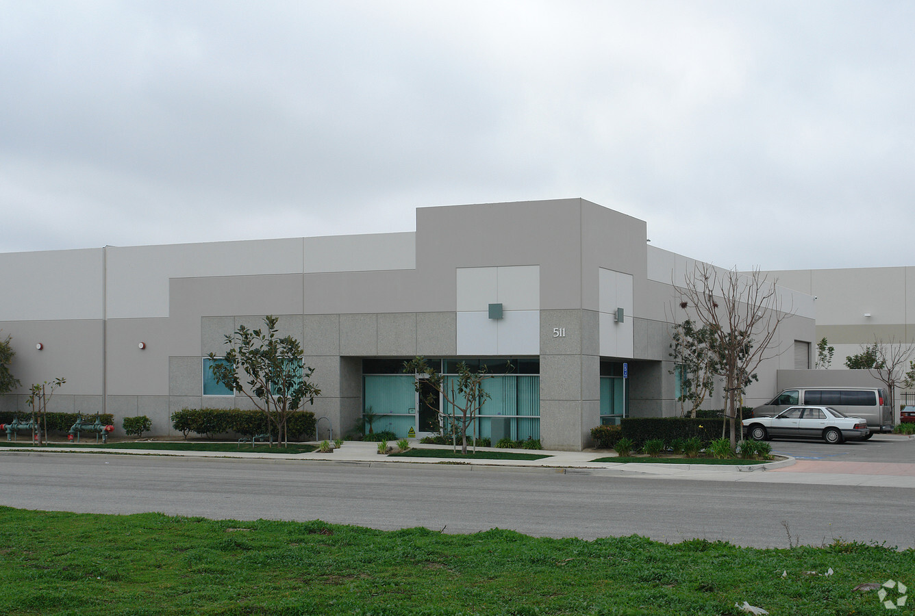
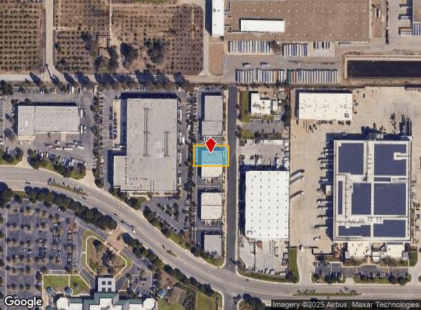
Property Record
511 N Elevar St, Oxnard, CA 93030


NEARBY LISTINGS FOR SALE OR LEASE
Property Detail
511 N Elevar St
216-0-151-435
LOT: 5 REF: 61 PM 76
Lightindustrial
Ventura
X
California
06111C0910E
5
2024
0.36 AC
2024
Oxnard/Pt Hueneme
004902
Los Angeles
6,000 SF
Oxnard-Thousand Oaks-Ventura, CA
DEMOGRAPHICS near 511 N Elevar St
1 Mile
3 Mile
5 Mile
2024 Total Population
6,585
89,938
245,235
2029 Population
6,465
88,198
241,213
Pop Growth 2024-2029
(1.82%)
(1.93%)
(1.64%)
Average Age
36
36
37
2024 Total Households
1,751
22,856
67,216
HH Growth 2024-2029
(1.94%)
(1.98%)
(1.69%)
Median Household Inc
$101,119
$75,747
$86,360
Avg Household Size
3.70
3.70
3.50
2024 Avg HH Vehicles
3.00
2.00
2.00
Median Home Value
$636,874
$547,023
$619,947
Median Year Built
2000
1974
1975
Nearby Places
- Restaurants
- Banks
- Shops
- Fitness
- Groceries
PUBLIC TRANSPORTATION
COMMUTER RAIL
Oxnard (Ventura County Line - Southern California Regional Rail Authority (Metrolink))
DRIVE
WALK
Distance
Oxnard (Ventura County Line - Southern California Regional Rail Authority (Metrolink))
6 min
3.3 mi
East Ventura Metrolink Station (Metrolink Ventura County Line - Metrolink Trains)
DRIVE
WALK
Distance
East Ventura Metrolink Station (Metrolink Ventura County Line - Metrolink Trains)
9 min
6.0 mi
Freight Ports
The Port of Hueneme
DRIVE
WALK
Distance
The Port of Hueneme
13 min
7.0 mi
SALE & LEASE HISTORY
LISTING DATE
SALE/LEASE

Oct 03, 2024
For Lease
Nearby Properties
Address
Land Use
TOTAL SIZE
Lot Size
Zoning
Address
Land Use
TOTAL SIZE
Lot Size
Zoning
135,631 SF
74.32 AC
Address
Land Use
TOTAL SIZE
Lot Size
Zoning
25.09 AC
Address
Land Use
TOTAL SIZE
Lot Size
Zoning
35.90 AC
BRP
Address
Land Use
TOTAL SIZE
Lot Size
Zoning
31.75 AC
Address
Land Use
TOTAL SIZE
Lot Size
Zoning
505,728 SF
20.81 AC
Address
Land Use
TOTAL SIZE
Lot Size
Zoning
15.09 AC
Address
Land Use
TOTAL SIZE
Lot Size
Zoning
352,898 SF
16.57 AC
ML
Address
Land Use
TOTAL SIZE
Lot Size
Zoning
11.28 AC
CMPD
Address
Land Use
TOTAL SIZE
Lot Size
Zoning
1,675 SF
18.62 AC
Address
Land Use
TOTAL SIZE
Lot Size
Zoning
30,800 SF
32.79 AC
M-1-
Address
Land Use
TOTAL SIZE
Lot Size
Zoning
15.59 AC
Address
Land Use
TOTAL SIZE
Lot Size
Zoning
70,392 SF
19.97 AC
4
Address
Land Use
TOTAL SIZE
Lot Size
Zoning
8,398 SF
45.88 AC
M1PD
Address
Land Use
TOTAL SIZE
Lot Size
Zoning
191,035 SF
8.54 AC
R3PD
Address
Land Use
TOTAL SIZE
Lot Size
Zoning
158,736 SF
6.33 AC
Address
Land Use
TOTAL SIZE
Lot Size
Zoning
41,327 SF
7.04 AC
Address
Land Use
TOTAL SIZE
Lot Size
Zoning
133,174 SF
5.94 AC
R3PD
Address
Land Use
TOTAL SIZE
Lot Size
Zoning
770 SF
9.80 AC
M1
Address
Land Use
TOTAL SIZE
Lot Size
Zoning
13,833 SF
13.91 AC
Address
Land Use
TOTAL SIZE
Lot Size
Zoning
72,335 SF
10.67 AC
Address
Land Use
TOTAL SIZE
Lot Size
Zoning
2,440 SF
7.49 AC
C2
Address
Land Use
TOTAL SIZE
Lot Size
Zoning
16,237 SF
4.23 AC
Address
Land Use
TOTAL SIZE
Lot Size
Zoning
390 SF
39.49 AC
Address
Land Use
TOTAL SIZE
Lot Size
Zoning
7.95 AC
M2
Address
Land Use
TOTAL SIZE
Lot Size
Zoning
0.75 AC
BRP
Address
Land Use
TOTAL SIZE
Lot Size
Zoning
13,189 SF
10.58 AC
Address
Land Use
TOTAL SIZE
Lot Size
Zoning
88,224 SF
7.40 AC
Address
Land Use
TOTAL SIZE
Lot Size
Zoning
17.60 AC
Address
Land Use
TOTAL SIZE
Lot Size
Zoning
60,496 SF
4.17 AC
R4PD
Address
Land Use
TOTAL SIZE
Lot Size
Zoning
11,794 SF
11.57 AC
C2PD
The World's #1 Commercial Real Estate Marketplace
Connect with us
© 2025 CoStar Group
The information above has been obtained from sources believed reliable. While we do not doubt its accuracy we have not verified it and make no guarantee, warranty or representation about it. It is your responsibility to independently confirm its accuracy and completeness. Any projections, opinions, assumptions, or estimates used are for example only and do not represent the current or future performance of the property. The value of this transaction to you depends on tax and other factors which should be evaluated by your tax, financial, and legal advisors. You and your advisors should conduct a careful, independent investigation of the property to determine to your satisfaction the suitability of the property for your needs.