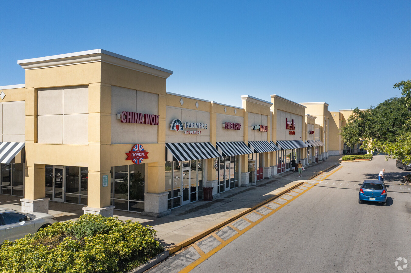
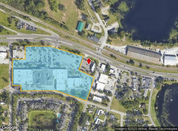
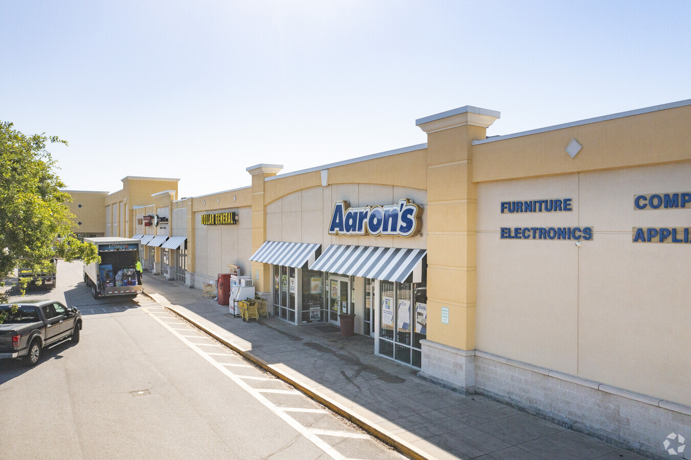
Property Record
511 Us Highway 17 92 W, Haines City, FL 33844
NEARBY LISTINGS FOR SALE OR LEASE
Property Detail
511 Us Highway 17 92 W
Lakeland-Winter Haven, FL
Live Oak Subdivision
27-27-29-777000-006041
IVE OAK SUB PB 13 PG 28 BLK F AND VACATED ORANGE AVE LYING SWLY OF BLK F LESS PART LOTS 1 TO 4 & 19 TO 23 AND THAT PART OF ORANGE AVE LYING WITHIN FOLLOWING DESC BEG 740 FT N & 20 FT E OF SW COR OF NW1/4 OF SW1/4 SEC 29 RUN N ALONG F ST 462.38 FT TO
Regionalshoppingcenterormallwithanchorstore
Polk
X
Florida
12105C0357G
1
2023
9.87 AC
2023
Polk County
012702
Tampa/St Petersburg
127,559 SF
DEMOGRAPHICS near 511 Us Highway 17 92 W
1 Mile
3 Mile
5 Mile
2024 Total Population
5,244
46,635
85,960
2029 Population
6,402
57,107
105,868
Pop Growth 2024-2029
+ 22.08%
+ 22.46%
+ 23.16%
Average Age
40
41
41
2024 Total Households
1,950
17,039
31,239
HH Growth 2024-2029
+ 22.31%
+ 22.54%
+ 23.12%
Median Household Inc
$42,112
$51,886
$54,979
Avg Household Size
2.60
2.70
2.70
2024 Avg HH Vehicles
1.00
2.00
2.00
Median Home Value
$161,383
$194,191
$209,892
Median Year Built
1989
1996
2000
Nearby Places
- Restaurants
- Banks
- Shops
- Fitness
- Groceries
PUBLIC TRANSPORTATION
AIRPORT
Orlando International
DRIVE
WALK
Distance
Orlando International
52 min
38.0 mi
Freight Ports
Port of Tampa Bay
DRIVE
WALK
Distance
Port of Tampa Bay
78 min
62.3 mi
SALE & LEASE HISTORY
LISTING DATE
SALE/LEASE

Sep 25, 2016
For Lease
Nearby Properties
Address
Land Use
TOTAL SIZE
Lot Size
Zoning
Address
Land Use
TOTAL SIZE
Lot Size
Zoning
807,937 SF
72.45 AC
Address
Land Use
TOTAL SIZE
Lot Size
Zoning
312,653 SF
51.81 AC
Address
Land Use
TOTAL SIZE
Lot Size
Zoning
190,153 SF
118.87 AC
Address
Land Use
TOTAL SIZE
Lot Size
Zoning
175,423 SF
47.09 AC
XX
Address
Land Use
TOTAL SIZE
Lot Size
Zoning
154,429 SF
51.75 AC
Address
Land Use
TOTAL SIZE
Lot Size
Zoning
200,000 SF
22.75 AC
Address
Land Use
TOTAL SIZE
Lot Size
Zoning
379,597 SF
40.77 AC
OUA
Address
Land Use
TOTAL SIZE
Lot Size
Zoning
103,673 SF
17.12 AC
Address
Land Use
TOTAL SIZE
Lot Size
Zoning
197,061 SF
32.49 AC
RC
Address
Land Use
TOTAL SIZE
Lot Size
Zoning
92,502 SF
15.22 AC
Address
Land Use
TOTAL SIZE
Lot Size
Zoning
41,438 SF
7.92 AC
Address
Land Use
TOTAL SIZE
Lot Size
Zoning
146,350 SF
19.48 AC
Address
Land Use
TOTAL SIZE
Lot Size
Zoning
78,344 SF
17.46 AC
Address
Land Use
TOTAL SIZE
Lot Size
Zoning
40,156 SF
13.54 AC
R3
Address
Land Use
TOTAL SIZE
Lot Size
Zoning
160,916 SF
38.59 AC
Address
Land Use
TOTAL SIZE
Lot Size
Zoning
35,772 SF
14.74 AC
RC
Address
Land Use
TOTAL SIZE
Lot Size
Zoning
94,518 SF
43.26 AC
Address
Land Use
TOTAL SIZE
Lot Size
Zoning
86,942 SF
20 AC
Address
Land Use
TOTAL SIZE
Lot Size
Zoning
61,597 SF
11.34 AC
OUA
Address
Land Use
TOTAL SIZE
Lot Size
Zoning
34,063 SF
21.84 AC
R1A
Address
Land Use
TOTAL SIZE
Lot Size
Zoning
37,176 SF
15.29 AC
Address
Land Use
TOTAL SIZE
Lot Size
Zoning
72,076 SF
6.26 AC
Address
Land Use
TOTAL SIZE
Lot Size
Zoning
186,101 SF
10.97 AC
R3
Address
Land Use
TOTAL SIZE
Lot Size
Zoning
91,044 SF
8.91 AC
Address
Land Use
TOTAL SIZE
Lot Size
Zoning
35,695 SF
3.38 AC
R3
Address
Land Use
TOTAL SIZE
Lot Size
Zoning
107,850 SF
15.16 AC
Address
Land Use
TOTAL SIZE
Lot Size
Zoning
54,000 SF
12.08 AC
Address
Land Use
TOTAL SIZE
Lot Size
Zoning
179,084 SF
7.92 AC
IH
Address
Land Use
TOTAL SIZE
Lot Size
Zoning
75,054 SF
5.44 AC
The World's #1 Commercial Real Estate Marketplace
Connect with us
© 2025 CoStar Group
The information above has been obtained from sources believed reliable. While we do not doubt its accuracy we have not verified it and make no guarantee, warranty or representation about it. It is your responsibility to independently confirm its accuracy and completeness. Any projections, opinions, assumptions, or estimates used are for example only and do not represent the current or future performance of the property. The value of this transaction to you depends on tax and other factors which should be evaluated by your tax, financial, and legal advisors. You and your advisors should conduct a careful, independent investigation of the property to determine to your satisfaction the suitability of the property for your needs.