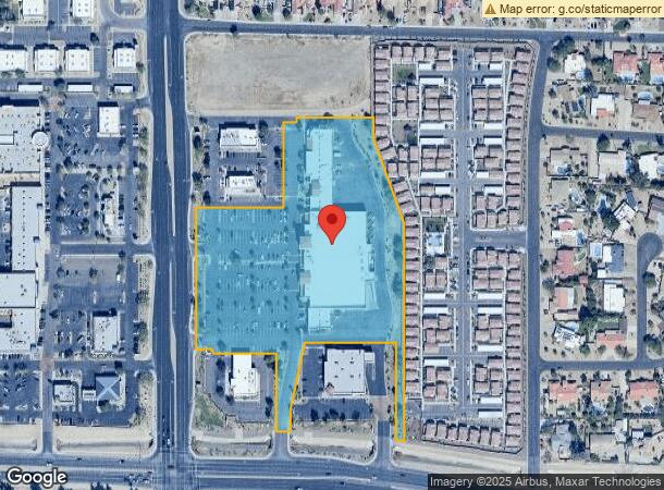
Property Record
5115 N Dysart Rd, Litchfield Park, AZ 85340

NEARBY LISTINGS FOR SALE OR LEASE
Property Detail
5115 N Dysart Rd
Phoenix-Mesa-Scottsdale, AZ
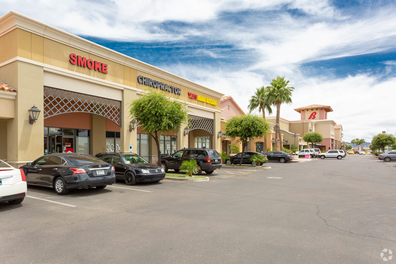
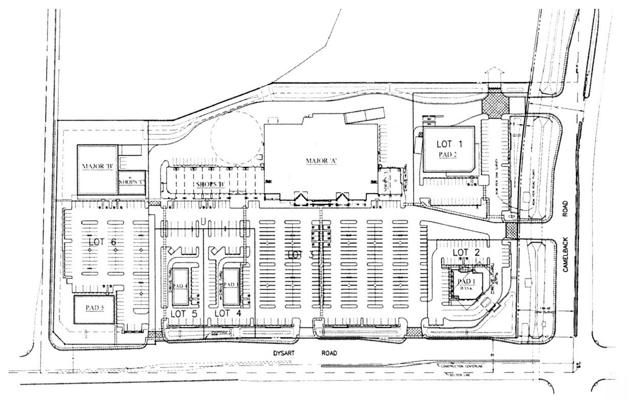
Camelback Crossing
501-63-724
CAMELBACK CROSSING MCR 929-22
Regionalshoppingcenterormallwithanchorstore
Maricopa
X
Arizona
04013C1690M
3
2024
8.31 AC
2025
N Goodyear/Litchfield
061011
Phoenix
75,182 SF
DEMOGRAPHICS near 5115 N Dysart Rd
1 Mile
3 Mile
5 Mile
2024 Total Population
10,495
76,646
176,268
2029 Population
11,411
83,428
193,069
Pop Growth 2024-2029
+ 8.73%
+ 8.85%
+ 9.53%
Average Age
36
37
38
2024 Total Households
3,156
24,809
60,060
HH Growth 2024-2029
+ 8.81%
+ 8.86%
+ 9.71%
Median Household Inc
$111,091
$95,220
$82,228
Avg Household Size
3.20
3.00
2.80
2024 Avg HH Vehicles
2.00
2.00
2.00
Median Home Value
$452,566
$379,520
$361,025
Median Year Built
2004
2002
2002
Nearby Places
- Restaurants
- Banks
- Shops
- Fitness
- Groceries
PUBLIC TRANSPORTATION
AIRPORT
Phoenix Sky Harbor International
DRIVE
WALK
Distance
Phoenix Sky Harbor International
35 min
25.3 mi
Freight Ports
Port of San Diego
DRIVE
WALK
Distance
Port of San Diego
382 min
342.7 mi
SALE & LEASE HISTORY
LISTING DATE
SALE/LEASE

Sep 25, 2016
For Lease
Sep 25, 2016
For Lease
Sep 08, 2017
For Lease
Nov 26, 2018
For Lease
May 10, 2017
For Lease
Mar 30, 2022
For Lease
Jul 05, 2018
For Lease
Apr 03, 2018
For Lease
Nearby Properties
Address
Land Use
TOTAL SIZE
Lot Size
Zoning
Address
Land Use
TOTAL SIZE
Lot Size
Zoning
1,188,764 SF
631.19 AC
AP
Address
Land Use
TOTAL SIZE
Lot Size
Zoning
1,433,378 SF
317.58 AC
AP
Address
Land Use
TOTAL SIZE
Lot Size
Zoning
1,201,280 SF
74.43 AC
PAD
Address
Land Use
TOTAL SIZE
Lot Size
Zoning
1,259,666 SF
71.73 AC
R-43
Address
Land Use
TOTAL SIZE
Lot Size
Zoning
1,200,140 SF
76.91 AC
Address
Land Use
TOTAL SIZE
Lot Size
Zoning
1,109,869 SF
67.32 AC
R-43
Address
Land Use
TOTAL SIZE
Lot Size
Zoning
510,342 SF
51.45 AC
LUKEAFB
Address
Land Use
TOTAL SIZE
Lot Size
Zoning
1,253,382 SF
74.13 AC
Address
Land Use
TOTAL SIZE
Lot Size
Zoning
401,714 SF
100.01 AC
PAD
Address
Land Use
TOTAL SIZE
Lot Size
Zoning
570,080 SF
36.76 AC
Address
Land Use
TOTAL SIZE
Lot Size
Zoning
844,524 SF
130.66 AC
LUKEAFB
Address
Land Use
TOTAL SIZE
Lot Size
Zoning
351,775 SF
53.72 AC
AP
Address
Land Use
TOTAL SIZE
Lot Size
Zoning
296,791 SF
35 AC
PAD
Address
Land Use
TOTAL SIZE
Lot Size
Zoning
634,560 SF
36.84 AC
PAD
Address
Land Use
TOTAL SIZE
Lot Size
Zoning
599,070 SF
38.33 AC
Address
Land Use
TOTAL SIZE
Lot Size
Zoning
185,870 SF
125.41 AC
S1
Address
Land Use
TOTAL SIZE
Lot Size
Zoning
522,480 SF
31.89 AC
Address
Land Use
TOTAL SIZE
Lot Size
Zoning
295,014 SF
37.63 AC
PAD
Address
Land Use
TOTAL SIZE
Lot Size
Zoning
380,477 SF
40 AC
RT
Address
Land Use
TOTAL SIZE
Lot Size
Zoning
282,993 SF
14.16 AC
PF
Address
Land Use
TOTAL SIZE
Lot Size
Zoning
198,109 SF
79 AC
R-43
Address
Land Use
TOTAL SIZE
Lot Size
Zoning
353,155 SF
16.80 AC
M-H
Address
Land Use
TOTAL SIZE
Lot Size
Zoning
349,633 SF
23.03 AC
Address
Land Use
TOTAL SIZE
Lot Size
Zoning
340,061 SF
15.50 AC
M-H
Address
Land Use
TOTAL SIZE
Lot Size
Zoning
106,351 SF
20 AC
PAD
Address
Land Use
TOTAL SIZE
Lot Size
Zoning
113,020 SF
16.37 AC
R-43
Address
Land Use
TOTAL SIZE
Lot Size
Zoning
109,856 SF
25.18 AC
R-43
Address
Land Use
TOTAL SIZE
Lot Size
Zoning
326,018 SF
21.03 AC
Address
Land Use
TOTAL SIZE
Lot Size
Zoning
102,431 SF
17.63 AC
R-10
Address
Land Use
TOTAL SIZE
Lot Size
Zoning
181,897 SF
16.71 AC
R-43AG
The World's #1 Commercial Real Estate Marketplace
Connect with us
© 2025 CoStar Group
The information above has been obtained from sources believed reliable. While we do not doubt its accuracy we have not verified it and make no guarantee, warranty or representation about it. It is your responsibility to independently confirm its accuracy and completeness. Any projections, opinions, assumptions, or estimates used are for example only and do not represent the current or future performance of the property. The value of this transaction to you depends on tax and other factors which should be evaluated by your tax, financial, and legal advisors. You and your advisors should conduct a careful, independent investigation of the property to determine to your satisfaction the suitability of the property for your needs.