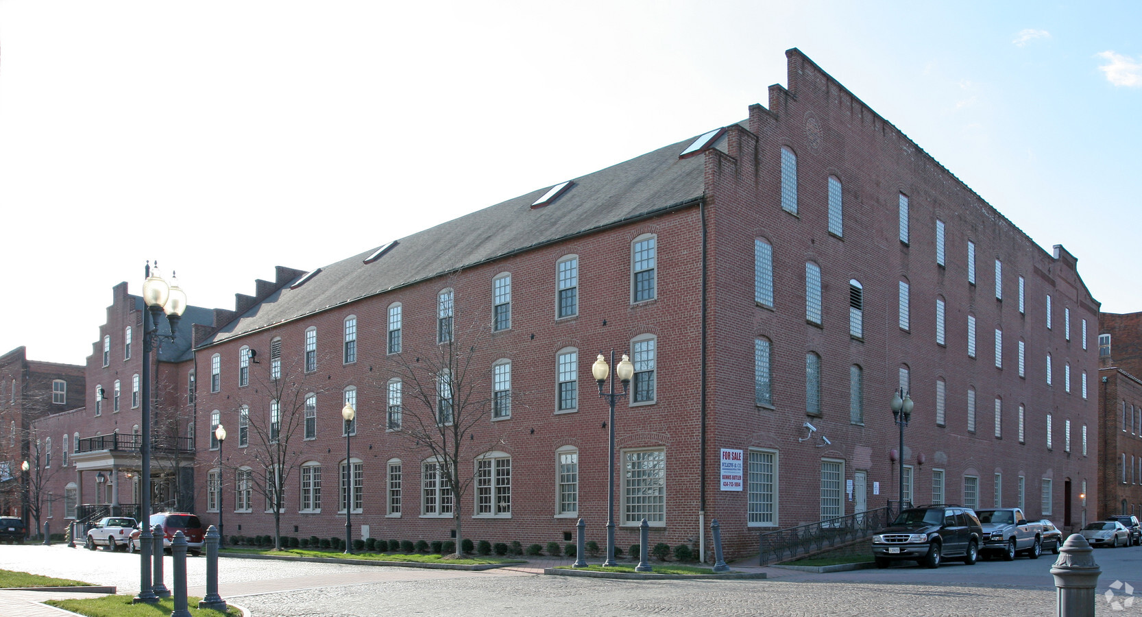
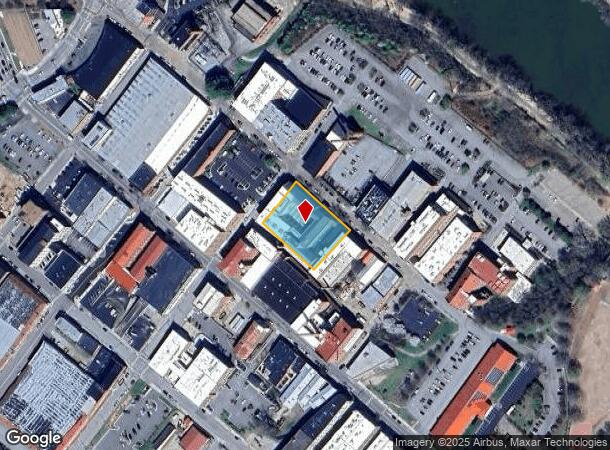
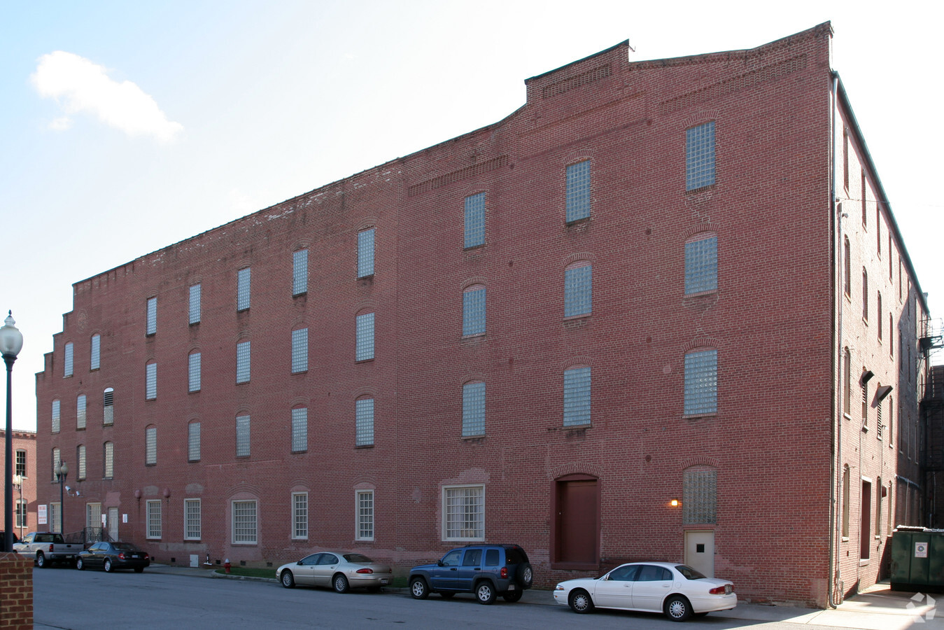
Property Record
512 Bridge St, Danville, VA 24541
NEARBY LISTINGS FOR SALE OR LEASE
Property Detail
512 Bridge St
21486
227 FT NO 91 & PT NO 92 & UNNO LOT (.862 AC) BRIDG
Officebuilding
Danville City
X
Virginia
51143C0634E
0.85 AC
2024
Virginia South Central
2024
Other Market Areas
000500
Danville, VA
96,366 SF
DEMOGRAPHICS near 512 Bridge St
1 Mile
3 Mile
5 Mile
2024 Total Population
6,321
31,199
48,048
2029 Population
6,437
31,029
47,597
Pop Growth 2024-2029
+ 1.84%
(0.54%)
(0.94%)
Average Age
42
42
43
2024 Total Households
2,863
13,880
21,288
HH Growth 2024-2029
+ 1.82%
(0.55%)
(0.93%)
Median Household Inc
$29,336
$35,533
$39,600
Avg Household Size
2.00
2.10
2.20
2024 Avg HH Vehicles
1.00
1.00
2.00
Median Home Value
$60,055
$81,303
$107,060
Median Year Built
1948
1957
1964
Nearby Places
- Restaurants
- Banks
- Shops
- Fitness
- Groceries
PUBLIC TRANSPORTATION
COMMUTER RAIL
Danville Amtrak Station (Crescent - Amtrak)
DRIVE
WALK
Distance
Danville Amtrak Station (Crescent - Amtrak)
1 min
5 min
0.3 mi
Freight Ports
Virginia Port Authority - Richmond
DRIVE
WALK
Distance
Virginia Port Authority - Richmond
185 min
141.3 mi
SALE & LEASE HISTORY
LISTING DATE
SALE/LEASE

Mar 03, 2017
For Lease
Nearby Properties
Address
Land Use
TOTAL SIZE
Lot Size
Zoning
Address
Land Use
TOTAL SIZE
Lot Size
Zoning
10,373 SF
9.49 AC
TRANSITION
Address
Land Use
TOTAL SIZE
Lot Size
Zoning
213 SF
406.98 AC
MANUFACTUR
Address
Land Use
TOTAL SIZE
Lot Size
Zoning
1,440 SF
75.14 AC
LIGHT ECON
Address
Land Use
TOTAL SIZE
Lot Size
Zoning
93,230 SF
40.74 AC
TRANSITION
Address
Land Use
TOTAL SIZE
Lot Size
Zoning
54,169 SF
3.44 AC
CENTRAL BU
Address
Land Use
TOTAL SIZE
Lot Size
Zoning
66,846 SF
22.99 AC
CYBER PARK
Address
Land Use
TOTAL SIZE
Lot Size
Zoning
23.30 AC
M-1
Address
Land Use
TOTAL SIZE
Lot Size
Zoning
48,285 SF
3.76 AC
TOBACCO WA
Address
Land Use
TOTAL SIZE
Lot Size
Zoning
7,554 SF
961.50 AC
LIGHT ECON
Address
Land Use
TOTAL SIZE
Lot Size
Zoning
159,055 SF
31.73 AC
OVERLAY PL
Address
Land Use
TOTAL SIZE
Lot Size
Zoning
789,481 SF
78.16 AC
MANUFACTUR
Address
Land Use
TOTAL SIZE
Lot Size
Zoning
25,436 SF
4.71 AC
TRANSITION
Address
Land Use
TOTAL SIZE
Lot Size
Zoning
833,039 SF
66.18 AC
MANUFACTUR
Address
Land Use
TOTAL SIZE
Lot Size
Zoning
225,611 SF
19.53 AC
PLANNED SH
Address
Land Use
TOTAL SIZE
Lot Size
Zoning
312,528 SF
23.32 AC
M-1
Address
Land Use
TOTAL SIZE
Lot Size
Zoning
102,314 SF
1.17 AC
TOBACCO WA
Address
Land Use
TOTAL SIZE
Lot Size
Zoning
81,251 SF
70.22 AC
TRANSITION
Address
Land Use
TOTAL SIZE
Lot Size
Zoning
41,664 SF
1.56 AC
TOBACCO WA
Address
Land Use
TOTAL SIZE
Lot Size
Zoning
93,442 SF
11.94 AC
CYBER PARK
Address
Land Use
TOTAL SIZE
Lot Size
Zoning
53,871 SF
6.89 AC
HIGHWAY RE
Address
Land Use
TOTAL SIZE
Lot Size
Zoning
1,000 SF
26.56 AC
TRANSITION
Address
Land Use
TOTAL SIZE
Lot Size
Zoning
21,476 SF
4.12 AC
TRANSITION
Address
Land Use
TOTAL SIZE
Lot Size
Zoning
136,211 SF
15.10 AC
PLANNED SH
Address
Land Use
TOTAL SIZE
Lot Size
Zoning
66,954 SF
17.70 AC
TOBACCO WA
Address
Land Use
TOTAL SIZE
Lot Size
Zoning
33,748 SF
3.73 AC
TOBACCO WA
Address
Land Use
TOTAL SIZE
Lot Size
Zoning
6,664 SF
102.20 AC
MANUFACTUR
Address
Land Use
TOTAL SIZE
Lot Size
Zoning
41,776 SF
2.60 AC
TRANSITION
Address
Land Use
TOTAL SIZE
Lot Size
Zoning
192,978 SF
15.17 AC
PLANNED SH
Address
Land Use
TOTAL SIZE
Lot Size
Zoning
162 SF
87 AC
HIGHWAY RE
Address
Land Use
TOTAL SIZE
Lot Size
Zoning
87,704 SF
1.70 AC
TOBACCO WA
The World's #1 Commercial Real Estate Marketplace
Connect with us
© 2025 CoStar Group
The information above has been obtained from sources believed reliable. While we do not doubt its accuracy we have not verified it and make no guarantee, warranty or representation about it. It is your responsibility to independently confirm its accuracy and completeness. Any projections, opinions, assumptions, or estimates used are for example only and do not represent the current or future performance of the property. The value of this transaction to you depends on tax and other factors which should be evaluated by your tax, financial, and legal advisors. You and your advisors should conduct a careful, independent investigation of the property to determine to your satisfaction the suitability of the property for your needs.