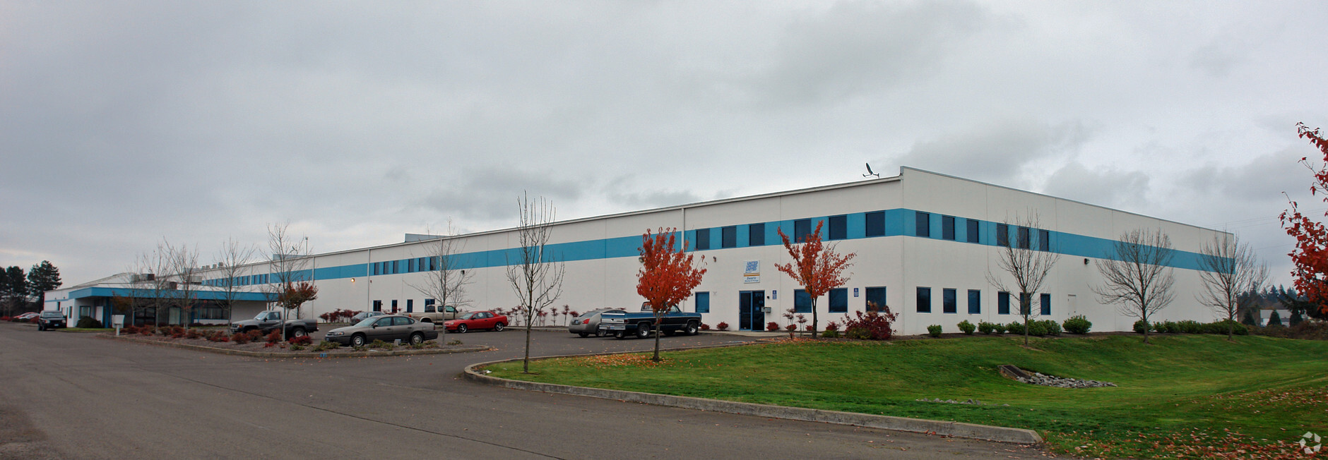
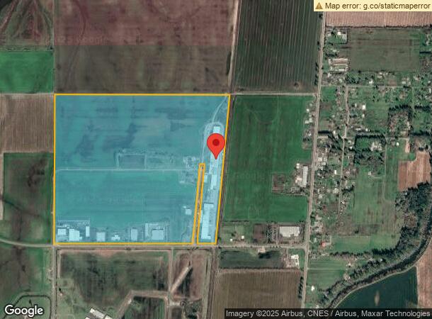
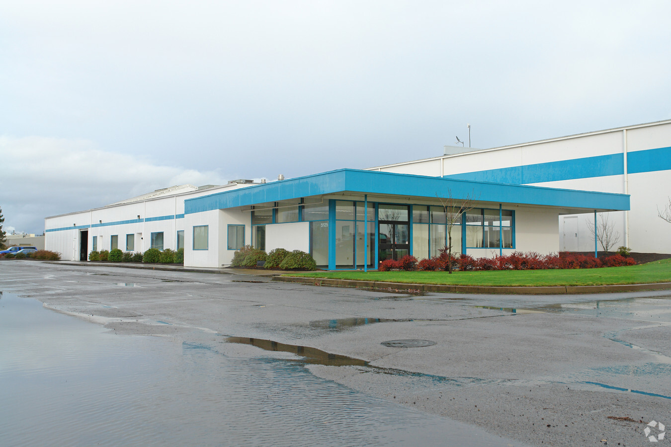
Property Record
5125 Sw Hout St, Corvallis, OR 97333

NEARBY LISTINGS FOR SALE OR LEASE
Property Detail
5125 Sw Hout St
Industrialgeneral
Benton
X
Oregon
41003C0194F
Oregon West Area
2023
Other Market Areas
2024
Corvallis, OR
010400
290498
55,562 SF
DEMOGRAPHICS near 5125 Sw Hout St
1 Mile
3 Mile
5 Mile
2024 Total Population
249
10,967
48,410
2029 Population
260
11,557
50,957
Pop Growth 2024-2029
+ 4.42%
+ 5.38%
+ 5.26%
Average Age
39
39
35
2024 Total Households
89
4,476
18,655
HH Growth 2024-2029
+ 4.49%
+ 5.74%
+ 6.01%
Median Household Inc
$94,999
$72,939
$54,993
Avg Household Size
2.70
2.40
2.20
2024 Avg HH Vehicles
2.00
2.00
2.00
Median Home Value
$395,454
$404,489
$427,406
Median Year Built
2005
1988
1978
Nearby Places
- Restaurants
- Banks
- Shops
- Fitness
- Groceries
PUBLIC TRANSPORTATION
AIRPORT
Mahlon Sweet Field
DRIVE
WALK
Distance
Mahlon Sweet Field
51 min
32.3 mi
Freight Ports
Port of Portland
DRIVE
WALK
Distance
Port of Portland
118 min
90.5 mi
SALE & LEASE HISTORY
LISTING DATE
SALE/LEASE

Sep 05, 2017
For Sale
Oct 03, 2019
For Sale
Nearby Properties
Address
Land Use
TOTAL SIZE
Lot Size
Zoning
Address
Land Use
TOTAL SIZE
Lot Size
Zoning
343.11 AC
P
Address
Land Use
TOTAL SIZE
Lot Size
Zoning
99,552 SF
474.40 AC
P
Address
Land Use
TOTAL SIZE
Lot Size
Zoning
Address
Land Use
TOTAL SIZE
Lot Size
Zoning
292,032 SF
40.52 AC
RS-3.5
Address
Land Use
TOTAL SIZE
Lot Size
Zoning
82,704 SF
7.66 AC
RS-5
Address
Land Use
TOTAL SIZE
Lot Size
Zoning
68,568 SF
14.80 AC
RTC
Address
Land Use
TOTAL SIZE
Lot Size
Zoning
Address
Land Use
TOTAL SIZE
Lot Size
Zoning
139,766 SF
6.41 AC
PD(RS-9)
Address
Land Use
TOTAL SIZE
Lot Size
Zoning
136,117 SF
6.40 AC
PD(RS-9)
Address
Land Use
TOTAL SIZE
Lot Size
Zoning
123,766 SF
6.12 AC
PD(RS-20)
Address
Land Use
TOTAL SIZE
Lot Size
Zoning
53,602 SF
4.83 AC
RTC
Address
Land Use
TOTAL SIZE
Lot Size
Zoning
2,233 SF
50.36 AC
OSU
Address
Land Use
TOTAL SIZE
Lot Size
Zoning
54,857 SF
6.57 AC
RTC
Address
Land Use
TOTAL SIZE
Lot Size
Zoning
106,912 SF
4.05 AC
PD(RS-12)
Address
Land Use
TOTAL SIZE
Lot Size
Zoning
112,048 SF
4.72 AC
RS-20
Address
Land Use
TOTAL SIZE
Lot Size
Zoning
76,625 SF
3.40 AC
PD(RS-12)
Address
Land Use
TOTAL SIZE
Lot Size
Zoning
10 SF
15.67 AC
MUT
Address
Land Use
TOTAL SIZE
Lot Size
Zoning
40,969 SF
4.59 AC
UR-5
Address
Land Use
TOTAL SIZE
Lot Size
Zoning
269,345 SF
6.63 AC
PD(MUE)
Address
Land Use
TOTAL SIZE
Lot Size
Zoning
60,118 SF
3.99 AC
RTC
Address
Land Use
TOTAL SIZE
Lot Size
Zoning
26,310 SF
4.60 AC
PD(GI)
Address
Land Use
TOTAL SIZE
Lot Size
Zoning
70,020 SF
3.21 AC
PD(RS-9)
Address
Land Use
TOTAL SIZE
Lot Size
Zoning
16,105 SF
99.20 AC
PD(AG-OS)
Address
Land Use
TOTAL SIZE
Lot Size
Zoning
68,704 SF
7.02 AC
RS-12
Address
Land Use
TOTAL SIZE
Lot Size
Zoning
38,341 SF
4.11 AC
RTC
Address
Land Use
TOTAL SIZE
Lot Size
Zoning
Address
Land Use
TOTAL SIZE
Lot Size
Zoning
Address
Land Use
TOTAL SIZE
Lot Size
Zoning
1,056 SF
140.69 AC
SU
Address
Land Use
TOTAL SIZE
Lot Size
Zoning
166.30 AC
SU
Address
Land Use
TOTAL SIZE
Lot Size
Zoning
38,824 SF
67.30 AC
AG-OS
The World's #1 Commercial Real Estate Marketplace
Connect with us
© 2025 CoStar Group
The information above has been obtained from sources believed reliable. While we do not doubt its accuracy we have not verified it and make no guarantee, warranty or representation about it. It is your responsibility to independently confirm its accuracy and completeness. Any projections, opinions, assumptions, or estimates used are for example only and do not represent the current or future performance of the property. The value of this transaction to you depends on tax and other factors which should be evaluated by your tax, financial, and legal advisors. You and your advisors should conduct a careful, independent investigation of the property to determine to your satisfaction the suitability of the property for your needs.