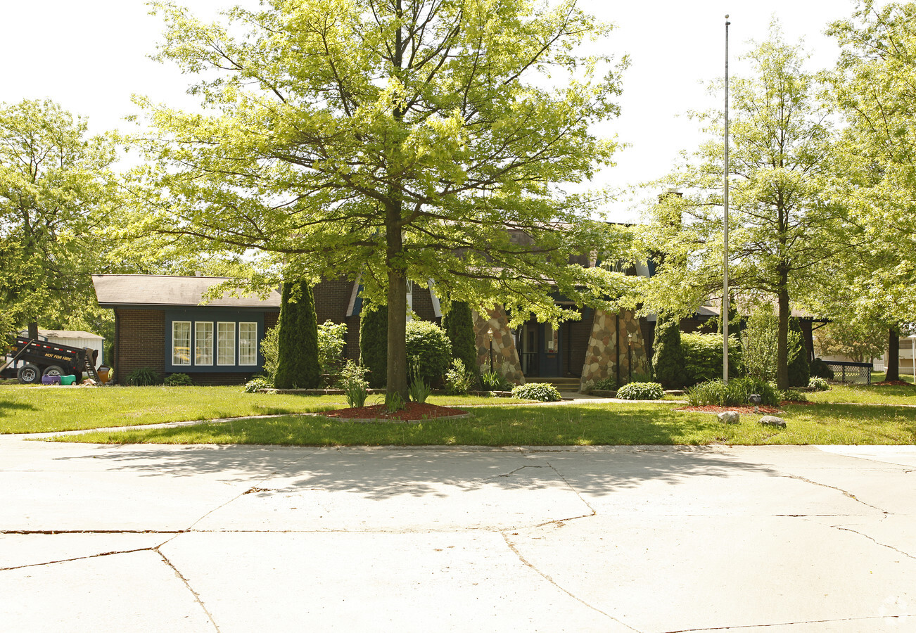
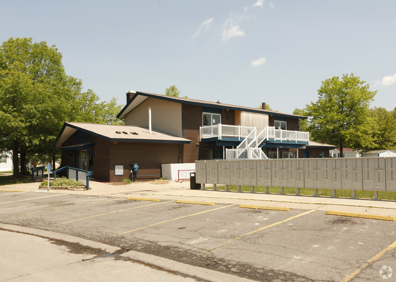
Property Record
515 Mason Rd, Howell, MI 48843
NEARBY LISTINGS FOR SALE OR LEASE
-
-
View all Howell listings for sale on LoopNet.com
Property Detail
515 Mason Rd
17-02-200-002
First Marion Add
Commercialnec
PRT OF N 1/2 OF NE FRAC 1/4 SEC. 2, T2N R4E. CITY OF HOWELL UNPLATTED LAND, BEG AT A PT ON S LINE MASON RD 96 FT WIDE, SD PT BEING S89*49'30"W ALNG N LN OF SEC 2 956.96 FT AND S 48 FT FROM NE COR OF SEC 2, TH S 1044.84 FT- TH E 740.48 FT TO W LN OF T
X
Livingston
26093C0302D
Michigan
2024
32.70 AC
2024
Outlying Livingston County
725101
Detroit
246 SF
Detroit-Warren-Dearborn, MI
DEMOGRAPHICS near 515 Mason Rd
1 Mile
3 Mile
5 Mile
2024 Total Population
6,218
26,723
43,710
2029 Population
6,375
27,493
44,990
Pop Growth 2024-2029
+ 2.52%
+ 2.88%
+ 2.93%
Average Age
39
41
42
2024 Total Households
2,565
10,948
17,330
HH Growth 2024-2029
+ 2.50%
+ 2.89%
+ 2.90%
Median Household Inc
$67,038
$76,946
$85,437
Avg Household Size
2.30
2.40
2.50
2024 Avg HH Vehicles
2.00
2.00
2.00
Median Home Value
$225,714
$258,669
$277,829
Median Year Built
1971
1992
1993
Nearby Places
- Restaurants
- Banks
- Shops
- Fitness
- Groceries
PUBLIC TRANSPORTATION
AIRPORT
Bishop International
DRIVE
WALK
Distance
Bishop International
58 min
36.8 mi
Freight Ports
Port of Toledo
DRIVE
WALK
Distance
Port of Toledo
108 min
89.0 mi
Nearby Properties
Address
Land Use
TOTAL SIZE
Lot Size
Zoning
Address
Land Use
TOTAL SIZE
Lot Size
Zoning
767,161 SF
127.33 AC
I-1
Address
Land Use
TOTAL SIZE
Lot Size
Zoning
89,443 SF
10.45 AC
R-M
Address
Land Use
TOTAL SIZE
Lot Size
Zoning
344,387 SF
27.72 AC
I-1
Address
Land Use
TOTAL SIZE
Lot Size
Zoning
171,564 SF
30.98 AC
O-1
Address
Land Use
TOTAL SIZE
Lot Size
Zoning
145,366 SF
13.60 AC
R-M
Address
Land Use
TOTAL SIZE
Lot Size
Zoning
95,252 SF
11.56 AC
R-M
Address
Land Use
TOTAL SIZE
Lot Size
Zoning
81,417 SF
13.10 AC
R-M
Address
Land Use
TOTAL SIZE
Lot Size
Zoning
37.65 AC
MFR
Address
Land Use
TOTAL SIZE
Lot Size
Zoning
161,366 SF
18.67 AC
HDR
Address
Land Use
TOTAL SIZE
Lot Size
Zoning
165,868 SF
27.80 AC
HDR
Address
Land Use
TOTAL SIZE
Lot Size
Zoning
80,330 SF
10 AC
MFR
Address
Land Use
TOTAL SIZE
Lot Size
Zoning
102,971 SF
11.95 AC
I-1
Address
Land Use
TOTAL SIZE
Lot Size
Zoning
152,606 SF
16 AC
R-M
Address
Land Use
TOTAL SIZE
Lot Size
Zoning
16.65 AC
MFR
Address
Land Use
TOTAL SIZE
Lot Size
Zoning
166,550 SF
20 AC
IND
Address
Land Use
TOTAL SIZE
Lot Size
Zoning
56,205 SF
3.68 AC
RSC
Address
Land Use
TOTAL SIZE
Lot Size
Zoning
106,170 SF
6.68 AC
I
Address
Land Use
TOTAL SIZE
Lot Size
Zoning
91,380 SF
11.55 AC
HDR
Address
Land Use
TOTAL SIZE
Lot Size
Zoning
35,546 SF
7.64 AC
R-M
Address
Land Use
TOTAL SIZE
Lot Size
Zoning
43,959 SF
33.51 AC
IFZ
Address
Land Use
TOTAL SIZE
Lot Size
Zoning
121,265 SF
15.10 AC
RCD
Address
Land Use
TOTAL SIZE
Lot Size
Zoning
79,801 SF
10.60 AC
B-2
Address
Land Use
TOTAL SIZE
Lot Size
Zoning
116,885 SF
13.78 AC
RCD
Address
Land Use
TOTAL SIZE
Lot Size
Zoning
93,620 SF
17.47 AC
MUPUD
Address
Land Use
TOTAL SIZE
Lot Size
Zoning
37,892 SF
5.40 AC
R-M
Address
Land Use
TOTAL SIZE
Lot Size
Zoning
75,407 SF
159.26 AC
R2
Address
Land Use
TOTAL SIZE
Lot Size
Zoning
121,850 SF
11.85 AC
I-1
Address
Land Use
TOTAL SIZE
Lot Size
Zoning
112,419 SF
9.31 AC
I
Address
Land Use
TOTAL SIZE
Lot Size
Zoning
57,736 SF
4.84 AC
R-M
The World's #1 Commercial Real Estate Marketplace
Connect with us
© 2025 CoStar Group
The information above has been obtained from sources believed reliable. While we do not doubt its accuracy we have not verified it and make no guarantee, warranty or representation about it. It is your responsibility to independently confirm its accuracy and completeness. Any projections, opinions, assumptions, or estimates used are for example only and do not represent the current or future performance of the property. The value of this transaction to you depends on tax and other factors which should be evaluated by your tax, financial, and legal advisors. You and your advisors should conduct a careful, independent investigation of the property to determine to your satisfaction the suitability of the property for your needs.