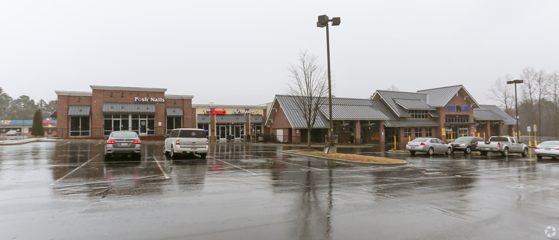
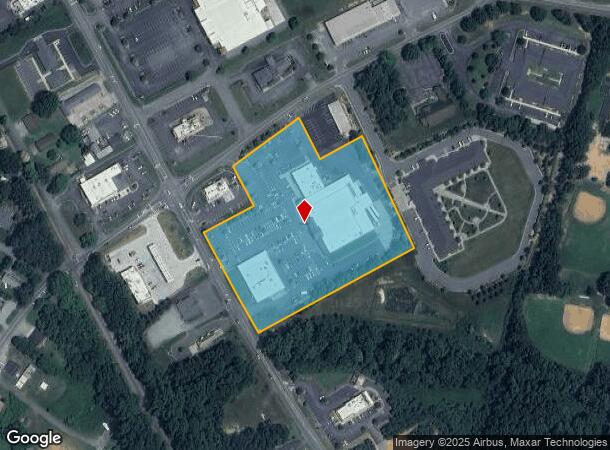
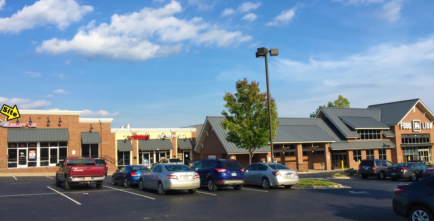
Property Record
515 S Highway 27, Stanley, NC 28164

NEARBY LISTINGS FOR SALE OR LEASE
-
-
View all Stanley listings for lease on LoopNet.com
Property Detail
515 S Highway 27
134082
08 007 020 02 000
Storebuilding
Gaston
X
North Carolina
3710357900J
5.90 AC
2024
Gaston County
2024
Charlotte
0302042009
Charlotte-Concord-Gastonia, NC-SC
12,000 SF
DEMOGRAPHICS near 515 S Highway 27
1 Mile
3 Mile
5 Mile
2024 Total Population
3,073
12,603
36,585
2029 Population
3,300
13,500
39,169
Pop Growth 2024-2029
+ 7.39%
+ 7.12%
+ 7.06%
Average Age
42
42
40
2024 Total Households
1,238
5,025
14,206
HH Growth 2024-2029
+ 7.75%
+ 7.38%
+ 7.30%
Median Household Inc
$64,757
$58,430
$58,584
Avg Household Size
2.40
2.50
2.50
2024 Avg HH Vehicles
2.00
2.00
2.00
Median Home Value
$218,043
$206,098
$208,225
Median Year Built
1978
1982
1986
Nearby Places
- Restaurants
- Banks
- Shops
- Fitness
- Groceries
PUBLIC TRANSPORTATION
COMMUTER RAIL
Gastonia Amtrak Station (Crescent - Amtrak)
DRIVE
WALK
Distance
Gastonia Amtrak Station (Crescent - Amtrak)
19 min
9.2 mi
AIRPORT
Charlotte/Douglas International
DRIVE
WALK
Distance
Charlotte/Douglas International
32 min
16.5 mi
Concord-Padgett Regional
DRIVE
WALK
Distance
Concord-Padgett Regional
37 min
26.1 mi
Freight Ports
North Charleston Terminal
DRIVE
WALK
Distance
North Charleston Terminal
243 min
212.4 mi
SALE & LEASE HISTORY
LISTING DATE
SALE/LEASE

Sep 25, 2016
For Lease
Aug 09, 2019
For Lease
Nearby Properties
Address
Land Use
TOTAL SIZE
Lot Size
Zoning
Address
Land Use
TOTAL SIZE
Lot Size
Zoning
100,470 SF
68.97 AC
ELDD R-SF
Address
Land Use
TOTAL SIZE
Lot Size
Zoning
6,720 SF
60.15 AC
PUB01
Address
Land Use
TOTAL SIZE
Lot Size
Zoning
135,468 SF
35.34 AC
PUB01
Address
Land Use
TOTAL SIZE
Lot Size
Zoning
426,374 SF
17.13 AC
INDS2
Address
Land Use
TOTAL SIZE
Lot Size
Zoning
76,455 SF
36.80 AC
Address
Land Use
TOTAL SIZE
Lot Size
Zoning
55,084 SF
19.93 AC
R-SF
Address
Land Use
TOTAL SIZE
Lot Size
Zoning
278,424 SF
25.32 AC
INDS2
Address
Land Use
TOTAL SIZE
Lot Size
Zoning
7,490 SF
10.10 AC
HCAR4
Address
Land Use
TOTAL SIZE
Lot Size
Zoning
138,105 SF
26.16 AC
INDS1
Address
Land Use
TOTAL SIZE
Lot Size
Zoning
30,272 SF
9.13 AC
R20
Address
Land Use
TOTAL SIZE
Lot Size
Zoning
76,602 SF
11.48 AC
PUB01
Address
Land Use
TOTAL SIZE
Lot Size
Zoning
59,315 SF
10.31 AC
CHUR2
Address
Land Use
TOTAL SIZE
Lot Size
Zoning
61,359 SF
12.30 AC
PUB01
Address
Land Use
TOTAL SIZE
Lot Size
Zoning
40,937 SF
4.44 AC
MRKT4
Address
Land Use
TOTAL SIZE
Lot Size
Zoning
142,850 SF
18.06 AC
STOR5
Address
Land Use
TOTAL SIZE
Lot Size
Zoning
2,387 SF
4.58 AC
Address
Land Use
TOTAL SIZE
Lot Size
Zoning
80,590 SF
9.89 AC
INDS2
Address
Land Use
TOTAL SIZE
Lot Size
Zoning
235.90 AC
I-G CU
Address
Land Use
TOTAL SIZE
Lot Size
Zoning
1,260 SF
3.80 AC
OFF01
Address
Land Use
TOTAL SIZE
Lot Size
Zoning
30,592 SF
4.03 AC
CHUR2
Address
Land Use
TOTAL SIZE
Lot Size
Zoning
8,980 SF
8.02 AC
CHUR2
Address
Land Use
TOTAL SIZE
Lot Size
Zoning
27,609 SF
3.89 AC
HCAR3
Address
Land Use
TOTAL SIZE
Lot Size
Zoning
73,956 SF
8.27 AC
INDS1
Address
Land Use
TOTAL SIZE
Lot Size
Zoning
1,935 SF
2.16 AC
APT02
Address
Land Use
TOTAL SIZE
Lot Size
Zoning
10,125 SF
1.18 AC
RET05
Address
Land Use
TOTAL SIZE
Lot Size
Zoning
8,222 SF
2.08 AC
CHUR5
Address
Land Use
TOTAL SIZE
Lot Size
Zoning
5,400 SF
6.19 AC
STOR4
Address
Land Use
TOTAL SIZE
Lot Size
Zoning
5,472 SF
1.40 AC
GARG1
Address
Land Use
TOTAL SIZE
Lot Size
Zoning
10,341 SF
5.28 AC
CHUR2
The World's #1 Commercial Real Estate Marketplace
Connect with us
© 2025 CoStar Group
The information above has been obtained from sources believed reliable. While we do not doubt its accuracy we have not verified it and make no guarantee, warranty or representation about it. It is your responsibility to independently confirm its accuracy and completeness. Any projections, opinions, assumptions, or estimates used are for example only and do not represent the current or future performance of the property. The value of this transaction to you depends on tax and other factors which should be evaluated by your tax, financial, and legal advisors. You and your advisors should conduct a careful, independent investigation of the property to determine to your satisfaction the suitability of the property for your needs.