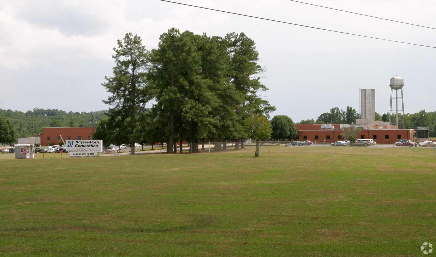
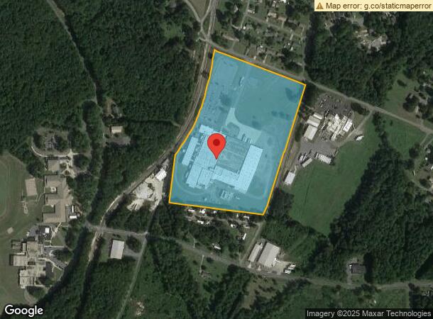
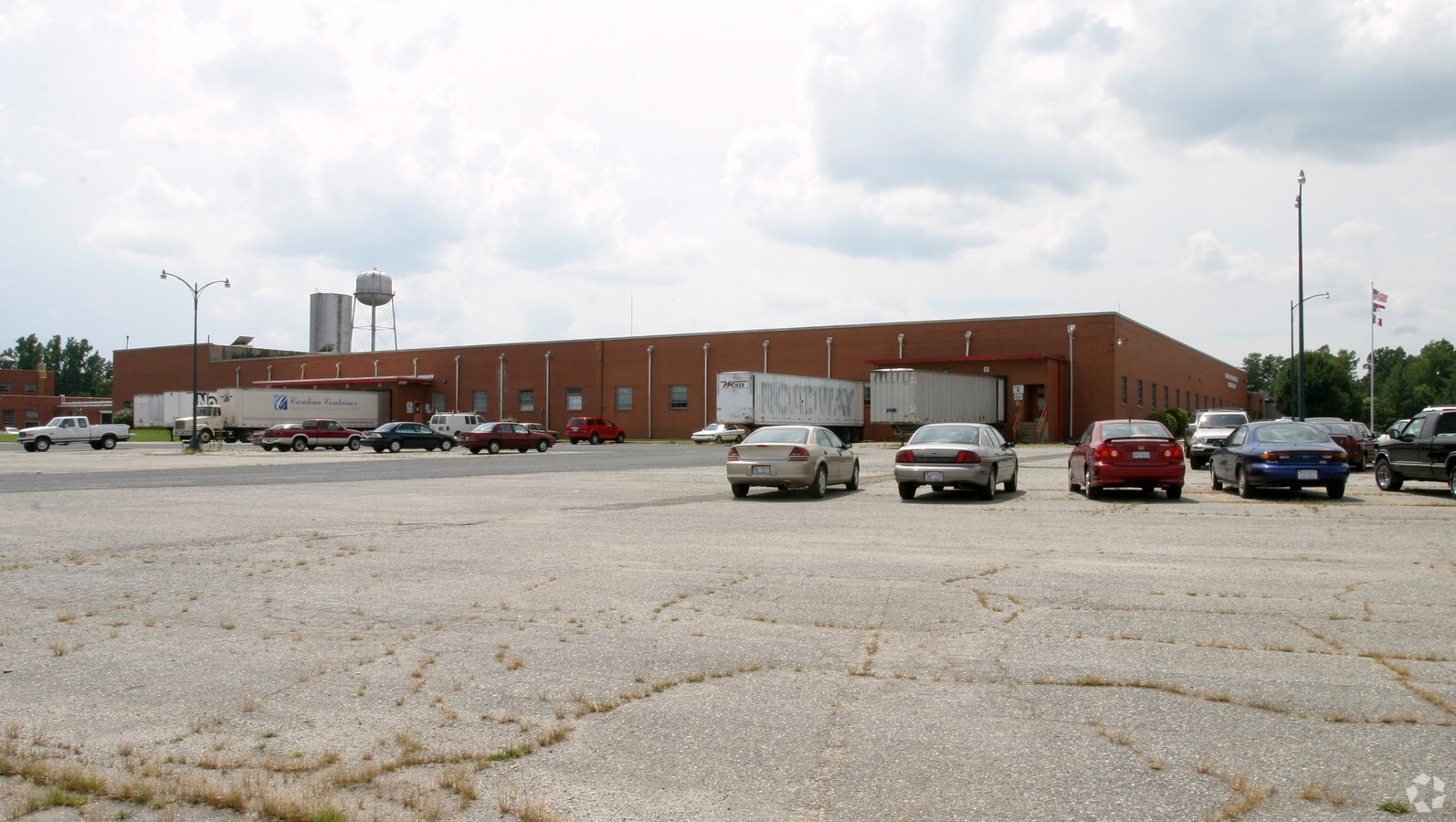
Property Record
515 W Balfour Ave, Asheboro, NC 27203
NEARBY LISTINGS FOR SALE OR LEASE
Property Detail
515 W Balfour Ave
7752-77-7921
Balfour Ave
Warehouse
BALFOUR AVE;S
X
Randolph
3710775200J
North Carolina
2024
25.99 AC
2024
North Asheboro
030400
Greensboro/Winston-Salem
159,217 SF
Greensboro-High Point, NC
DEMOGRAPHICS near 515 W Balfour Ave
1 Mile
3 Mile
5 Mile
2024 Total Population
2,774
22,220
42,640
2029 Population
2,867
23,115
44,337
Pop Growth 2024-2029
+ 3.35%
+ 4.03%
+ 3.98%
Average Age
37
38
40
2024 Total Households
1,067
8,655
16,953
HH Growth 2024-2029
+ 3.19%
+ 4.02%
+ 3.96%
Median Household Inc
$55,889
$50,371
$49,711
Avg Household Size
2.50
2.50
2.40
2024 Avg HH Vehicles
2.00
2.00
2.00
Median Home Value
$138,688
$139,822
$144,510
Median Year Built
1985
1981
1978
Nearby Places
- Restaurants
- Banks
- Shops
- Fitness
- Groceries
PUBLIC TRANSPORTATION
AIRPORT
Piedmont Triad International
DRIVE
WALK
Distance
Piedmont Triad International
41 min
30.2 mi
Freight Ports
Port of Wilmington
DRIVE
WALK
Distance
Port of Wilmington
229 min
193.3 mi
Nearby Properties
Address
Land Use
TOTAL SIZE
Lot Size
Zoning
Address
Land Use
TOTAL SIZE
Lot Size
Zoning
31,320 SF
46.13 AC
I2
Address
Land Use
TOTAL SIZE
Lot Size
Zoning
7,782 SF
62.37 AC
I1
Address
Land Use
TOTAL SIZE
Lot Size
Zoning
312,205 SF
6.83 AC
B2
Address
Land Use
TOTAL SIZE
Lot Size
Zoning
36,106 SF
28.62 AC
I2 (CZ)
Address
Land Use
TOTAL SIZE
Lot Size
Zoning
283,127 SF
95.67 AC
I2
Address
Land Use
TOTAL SIZE
Lot Size
Zoning
5.24 AC
B3
Address
Land Use
TOTAL SIZE
Lot Size
Zoning
238 SF
30.24 AC
I3
Address
Land Use
TOTAL SIZE
Lot Size
Zoning
4,800 SF
24.07 AC
RA6
Address
Land Use
TOTAL SIZE
Lot Size
Zoning
26.07 AC
B2
Address
Land Use
TOTAL SIZE
Lot Size
Zoning
84,857 SF
8.31 AC
B2
Address
Land Use
TOTAL SIZE
Lot Size
Zoning
143,671 SF
11.48 AC
I2
Address
Land Use
TOTAL SIZE
Lot Size
Zoning
172,096 SF
11.84 AC
I2
Address
Land Use
TOTAL SIZE
Lot Size
Zoning
4,224 SF
13.69 AC
OA6 (CZ)
Address
Land Use
TOTAL SIZE
Lot Size
Zoning
7,168 SF
13.75 AC
RA6
Address
Land Use
TOTAL SIZE
Lot Size
Zoning
138,047 SF
31.10 AC
I2
Address
Land Use
TOTAL SIZE
Lot Size
Zoning
1,948 SF
71.18 AC
I3
Address
Land Use
TOTAL SIZE
Lot Size
Zoning
4,800 SF
6.64 AC
RA6
Address
Land Use
TOTAL SIZE
Lot Size
Zoning
125,738 SF
27.16 AC
I2
Address
Land Use
TOTAL SIZE
Lot Size
Zoning
25,184 SF
8.23 AC
RA6
Address
Land Use
TOTAL SIZE
Lot Size
Zoning
2,592 SF
15.50 AC
RA6
Address
Land Use
TOTAL SIZE
Lot Size
Zoning
179,650 SF
10.04 AC
I2
Address
Land Use
TOTAL SIZE
Lot Size
Zoning
36,798 SF
25.95 AC
I3
Address
Land Use
TOTAL SIZE
Lot Size
Zoning
39,512 SF
2.91 AC
B2
Address
Land Use
TOTAL SIZE
Lot Size
Zoning
5.58 AC
B2
Address
Land Use
TOTAL SIZE
Lot Size
Zoning
59,830 SF
0.85 AC
RA6
Address
Land Use
TOTAL SIZE
Lot Size
Zoning
66,585 SF
7.34 AC
OA6
Address
Land Use
TOTAL SIZE
Lot Size
Zoning
1,595 SF
53.92 AC
R10 (CZ)
Address
Land Use
TOTAL SIZE
Lot Size
Zoning
24,840 SF
3.43 AC
B1 (CZ)
Address
Land Use
TOTAL SIZE
Lot Size
Zoning
16,540 SF
11.38 AC
I2
The World's #1 Commercial Real Estate Marketplace
Connect with us
© 2025 CoStar Group
The information above has been obtained from sources believed reliable. While we do not doubt its accuracy we have not verified it and make no guarantee, warranty or representation about it. It is your responsibility to independently confirm its accuracy and completeness. Any projections, opinions, assumptions, or estimates used are for example only and do not represent the current or future performance of the property. The value of this transaction to you depends on tax and other factors which should be evaluated by your tax, financial, and legal advisors. You and your advisors should conduct a careful, independent investigation of the property to determine to your satisfaction the suitability of the property for your needs.