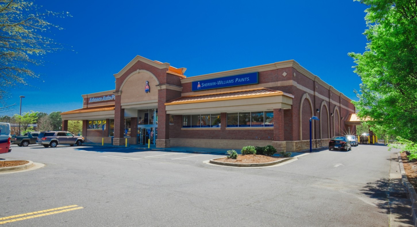
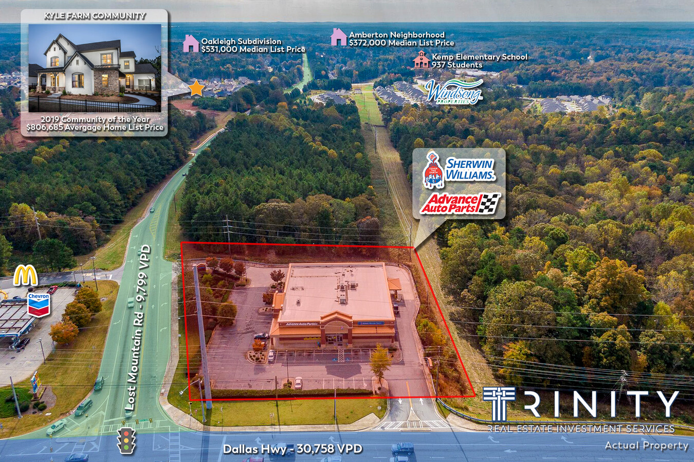
Property Record
5155 Dallas Hwy, Powder Springs, GA 30127

NEARBY LISTINGS FOR SALE OR LEASE
Property Detail
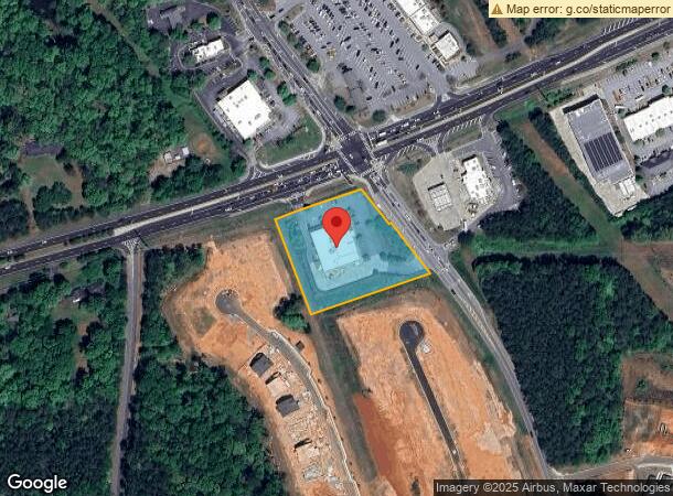
5155 Dallas Hwy
Atlanta-Sandy Springs-Roswell, GA
Not Shown
19-0066-0-005-0
LL66&83
Storebuilding
Cobb
X
Georgia
13067C0079G
66
2024
2.12 AC
2024
Powder Spring/Austell
030268
Atlanta
14,616 SF
DEMOGRAPHICS near 5155 Dallas Hwy
1 Mile
3 Mile
5 Mile
2024 Total Population
3,471
35,445
114,345
2029 Population
3,569
36,973
120,023
Pop Growth 2024-2029
+ 2.82%
+ 4.31%
+ 4.97%
Average Age
41
41
40
2024 Total Households
1,124
11,743
38,516
HH Growth 2024-2029
+ 2.85%
+ 4.49%
+ 5.22%
Median Household Inc
$147,695
$122,317
$116,634
Avg Household Size
3.00
3.00
2.90
2024 Avg HH Vehicles
3.00
3.00
2.00
Median Home Value
$444,387
$379,210
$362,501
Median Year Built
1996
1995
1996
Nearby Places
- Restaurants
- Banks
- Shops
- Fitness
- Groceries
PUBLIC TRANSPORTATION
AIRPORT
Hartsfield-Jackson Atlanta International
DRIVE
WALK
Distance
Hartsfield-Jackson Atlanta International
47 min
36.1 mi
Freight Ports
Georgia Ports - Savannah
DRIVE
WALK
Distance
Georgia Ports - Savannah
1 min
241.1 mi
SALE & LEASE HISTORY
LISTING DATE
SALE/LEASE

Nov 22, 2021
For Sale
Apr 25, 2018
For Sale
Nearby Properties
Address
Land Use
TOTAL SIZE
Lot Size
Zoning
Address
Land Use
TOTAL SIZE
Lot Size
Zoning
46.05 AC
Address
Land Use
TOTAL SIZE
Lot Size
Zoning
264,394 SF
27.59 AC
NRC
Address
Land Use
TOTAL SIZE
Lot Size
Zoning
37.28 AC
Address
Land Use
TOTAL SIZE
Lot Size
Zoning
81,639 SF
15.82 AC
NRC
Address
Land Use
TOTAL SIZE
Lot Size
Zoning
174,472 SF
60.63 AC
Address
Land Use
TOTAL SIZE
Lot Size
Zoning
108,435 SF
13.69 AC
NRC
Address
Land Use
TOTAL SIZE
Lot Size
Zoning
223,686 SF
30.20 AC
B2
Address
Land Use
TOTAL SIZE
Lot Size
Zoning
138,725 SF
11.66 AC
B2
Address
Land Use
TOTAL SIZE
Lot Size
Zoning
83,054 SF
11.06 AC
NRC/WS
Address
Land Use
TOTAL SIZE
Lot Size
Zoning
44,972 SF
7.81 AC
B2
Address
Land Use
TOTAL SIZE
Lot Size
Zoning
71,301 SF
3.88 AC
B1
Address
Land Use
TOTAL SIZE
Lot Size
Zoning
202,176 SF
24.10 AC
R-30
Address
Land Use
TOTAL SIZE
Lot Size
Zoning
19,059 SF
28.20 AC
R80
Address
Land Use
TOTAL SIZE
Lot Size
Zoning
78,312 SF
6.37 AC
NRC
Address
Land Use
TOTAL SIZE
Lot Size
Zoning
99,972 SF
3.18 AC
NRC/O&I
Address
Land Use
TOTAL SIZE
Lot Size
Zoning
28,886 SF
18 AC
Address
Land Use
TOTAL SIZE
Lot Size
Zoning
18,577 SF
1.95 AC
NRC
Address
Land Use
TOTAL SIZE
Lot Size
Zoning
75,856 SF
10.06 AC
B2
Address
Land Use
TOTAL SIZE
Lot Size
Zoning
1,524 SF
51.95 AC
R30
Address
Land Use
TOTAL SIZE
Lot Size
Zoning
16,240 SF
1.73 AC
NRC
Address
Land Use
TOTAL SIZE
Lot Size
Zoning
52,413 SF
7.57 AC
B2
Address
Land Use
TOTAL SIZE
Lot Size
Zoning
38,674 SF
3.08 AC
NRC
Address
Land Use
TOTAL SIZE
Lot Size
Zoning
16,776 SF
2.65 AC
GC
Address
Land Use
TOTAL SIZE
Lot Size
Zoning
16,288 SF
1.96 AC
B2
Address
Land Use
TOTAL SIZE
Lot Size
Zoning
16,405 SF
1.91 AC
NRC
Address
Land Use
TOTAL SIZE
Lot Size
Zoning
21,460 SF
2.87 AC
B2
Address
Land Use
TOTAL SIZE
Lot Size
Zoning
15,035 SF
2.40 AC
CRC
Address
Land Use
TOTAL SIZE
Lot Size
Zoning
29,234 SF
4.90 AC
B1
Address
Land Use
TOTAL SIZE
Lot Size
Zoning
9.83 AC
R30
The World's #1 Commercial Real Estate Marketplace
Connect with us
© 2025 CoStar Group
The information above has been obtained from sources believed reliable. While we do not doubt its accuracy we have not verified it and make no guarantee, warranty or representation about it. It is your responsibility to independently confirm its accuracy and completeness. Any projections, opinions, assumptions, or estimates used are for example only and do not represent the current or future performance of the property. The value of this transaction to you depends on tax and other factors which should be evaluated by your tax, financial, and legal advisors. You and your advisors should conduct a careful, independent investigation of the property to determine to your satisfaction the suitability of the property for your needs.