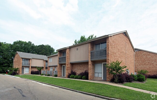
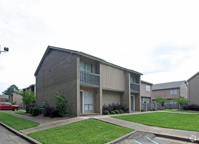
Property Record
5155 Keele St, Jackson, MS 39206

NEARBY LISTINGS FOR SALE OR LEASE
Property Detail
5155 Keele St
0507-0401-000
Nw4s13t6nr1e
Apartment
BEG INT S/L BOUNDS ST & W/L GALAXIE DR S 510 FT W 350 FT TO POB S 914.02 FT W/LY 418.34 FT N 481.7 FT SW 34 FT N 470.85 FT E 436.69 FT TO POB PT NW 1/4 SEC 13 T6N R1E & 41 FT X 436.69 FT N/S LESS 9 FT X 128.7 FT MID PT N/S TO WHITLEY & TAYLOR LESS 0.
AE
Hinds
28049C0307H
Mississippi
2024
7 AC
2025
North Jackson
000302
Jackson
124,290 SF
Jackson, MS
DEMOGRAPHICS near 5155 Keele St
1 Mile
3 Mile
5 Mile
2024 Total Population
10,081
50,379
99,621
2029 Population
9,518
47,761
97,262
Pop Growth 2024-2029
(5.58%)
(5.20%)
(2.37%)
Average Age
36
39
39
2024 Total Households
4,585
21,996
44,053
HH Growth 2024-2029
(5.74%)
(5.32%)
(2.47%)
Median Household Inc
$50,760
$46,636
$44,370
Avg Household Size
2.20
2.20
2.10
2024 Avg HH Vehicles
2.00
2.00
2.00
Median Home Value
$139,812
$156,838
$151,610
Median Year Built
1969
1970
1974
Nearby Places
Map Layers
Map Styles
 Street
 Aerial
- Restaurants
- Banks
- Shops
- Fitness
- Groceries
PUBLIC TRANSPORTATION
COMMUTER RAIL
Jackson (City of New Orleans - Amtrak)
DRIVE
WALK
Distance
Jackson (City of New Orleans - Amtrak)
13 min
7.2 mi
AIRPORT
Jackson-Medgar Wiley Evers International
DRIVE
WALK
Distance
Jackson-Medgar Wiley Evers International
24 min
12.9 mi
Freight Ports
Port of Greater Baton Rouge
DRIVE
WALK
Distance
Port of Greater Baton Rouge
206 min
182.8 mi
Nearby Properties
Address
Land Use
TOTAL SIZE
Lot Size
Zoning
Address
Land Use
TOTAL SIZE
Lot Size
Zoning
7,561 SF
153.82 AC
Address
Land Use
TOTAL SIZE
Lot Size
Zoning
416,776 SF
18.77 AC
Address
Land Use
TOTAL SIZE
Lot Size
Zoning
40,445 SF
3 AC
Address
Land Use
TOTAL SIZE
Lot Size
Zoning
51,260 SF
1.58 AC
Address
Land Use
TOTAL SIZE
Lot Size
Zoning
236.80 AC
Address
Land Use
TOTAL SIZE
Lot Size
Zoning
33,960 SF
19,602 AC
Address
Land Use
TOTAL SIZE
Lot Size
Zoning
59,840 SF
2.72 AC
Address
Land Use
TOTAL SIZE
Lot Size
Zoning
55,160 SF
3 AC
Address
Land Use
TOTAL SIZE
Lot Size
Zoning
49,949 SF
10 AC
Address
Land Use
TOTAL SIZE
Lot Size
Zoning
108,198 SF
15.40 AC
Address
Land Use
TOTAL SIZE
Lot Size
Zoning
105,600 SF
13 AC
Address
Land Use
TOTAL SIZE
Lot Size
Zoning
64,949 SF
3 AC
Address
Land Use
TOTAL SIZE
Lot Size
Zoning
54,291 SF
6.99 AC
Address
Land Use
TOTAL SIZE
Lot Size
Zoning
15,374 SF
0.64 AC
Address
Land Use
TOTAL SIZE
Lot Size
Zoning
102,249 SF
14.38 AC
Address
Land Use
TOTAL SIZE
Lot Size
Zoning
67,575 SF
3 AC
Address
Land Use
TOTAL SIZE
Lot Size
Zoning
10,620 SF
2.81 AC
Address
Land Use
TOTAL SIZE
Lot Size
Zoning
230,401 SF
643,381.54 AC
Address
Land Use
TOTAL SIZE
Lot Size
Zoning
4.38 AC
Address
Land Use
TOTAL SIZE
Lot Size
Zoning
20.54 AC
Address
Land Use
TOTAL SIZE
Lot Size
Zoning
310,650 SF
17 AC
Address
Land Use
TOTAL SIZE
Lot Size
Zoning
23,589 SF
110,808.08 AC
Address
Land Use
TOTAL SIZE
Lot Size
Zoning
93.67 AC
Address
Land Use
TOTAL SIZE
Lot Size
Zoning
78,239 SF
4 AC
Address
Land Use
TOTAL SIZE
Lot Size
Zoning
9,003 SF
1.80 AC
Address
Land Use
TOTAL SIZE
Lot Size
Zoning
139,497 SF
12 AC
Address
Land Use
TOTAL SIZE
Lot Size
Zoning
148,195 SF
11.66 AC
Address
Land Use
TOTAL SIZE
Lot Size
Zoning
223,203 SF
625,957.30 AC
Address
Land Use
TOTAL SIZE
Lot Size
Zoning
81,911 SF
15.53 AC
Address
Land Use
TOTAL SIZE
Lot Size
Zoning
26,875 SF
3 AC
The World's #1 Commercial Real Estate Marketplace
Connect with us
© 2025 CoStar Group
The information above has been obtained from sources believed reliable. While we do not doubt its accuracy we have not verified it and make no guarantee, warranty or representation about it. It is your responsibility to independently confirm its accuracy and completeness. Any projections, opinions, assumptions, or estimates used are for example only and do not represent the current or future performance of the property. The value of this transaction to you depends on tax and other factors which should be evaluated by your tax, financial, and legal advisors. You and your advisors should conduct a careful, independent investigation of the property to determine to your satisfaction the suitability of the property for your needs.